
This article is a part of the Ogunquit in September Guide I am writing, for the model aeronautically-inclined. It is the main and the last installment in the series. Together with the modern beach equipment installment, it details everything you will ever need, before you head out to fly a drone or two in this beautiful beach town.
My main interest in this trip was to fly RC planes by the ocean. To that end, I booked a suite at the Norsemen Resort, and for the second half of the trip a room at the Cliff House. This allowed me to fly my planes on a whim, at the Ogunquit Beach and later on a perilous rock formation at the Bald Head Cliff, without needing to plan for these activities. One moment I would be drinking my morning coffee on the balcony just after sunrise, and two minutes later I would be out there flying my micro sailplanes.
During the day I walked or drove to nearby oceanfront locations, to sample what this place had to offer. These day trips took me to popular tourist attractions such as the Marginal Way. They took me north to Wells Beach, Drakes Island Beach, and then farther to Gooch’s Beach, right next to president Bush’s compound. They took me south to Cape Neddick where I visited both the Long and the Short Sands Beach, plus the famous Cape Neddick Light.
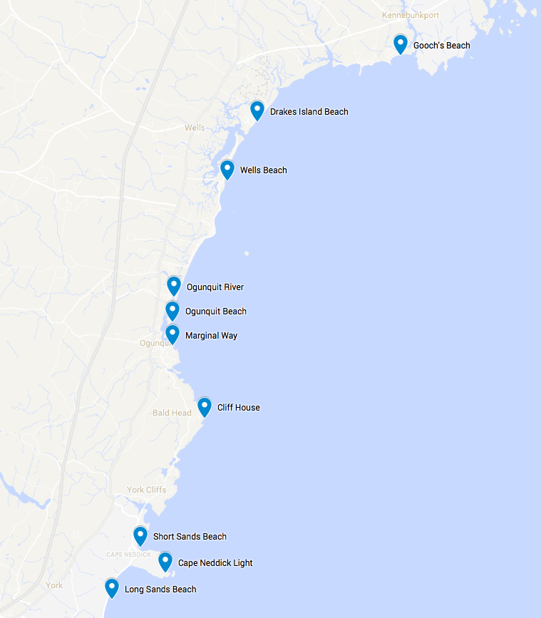
Points of interests around Ogunquit
I marked these locations of aeronautical interests on Google Maps.
As usual, Elisha Huang took most of pictures and videos found on this article. This article continues my Wiki Vacation tradition where I upload pictures useful for Wikipedia to Wikimedia. Wherever appropriate, I link from this article to full-resolution images hosted on Wikimedia.
Safety first
If you are reading this article, you probably fly a model plane or a multicopter. These flying machines come in all sizes. Except for micro planes and small quadcopters, most will require that you register with the FAA, as they often weigh more than half a pound. In May 2017, however, the federal court nullified this registration requirement temporarily. By the time you read this article, things may have changed. Check with the FAA.
I recommend that everyone flying a model aircraft become a member of the Academy of Model Aeronautics (AMA). The main purpose of the membership is to provide insurance in case your flying activities result in damages to properties. Besides, you can’t fly at most model airplane fields without showing your current AMA membership card.
Flying a plane at a popular tourist venue such as the Ogunquit Beach and the Marginal Way poses serious safety issues. The AMA guidelines state, “Excluding takeoff and landing, no powered model may be flown outdoors closer than 25 feet to any individual, except for the pilot…”. The town of Ogunquit has in fact posted explicit drone-flying guidelines on its website. It allows drones up to 55 pounds, but it also states, “Small unmanned aircraft may not operate over any people.” In addition, so as not to scare the endangered Piping Plover, “Drones are prohibited from being within 400 feet of any Piping Plover nesting areas.”
These restrictions make sense if one were flying a 3-pound DJI quadcopter with motors and blades that can seriously injure a person. If also makes sense if one were flying a plane with a 3-foot wingspan which can look like a raptor to a Piping Plover.
But I chose to fly a lightweight and severely-underpowered sailplane instead.
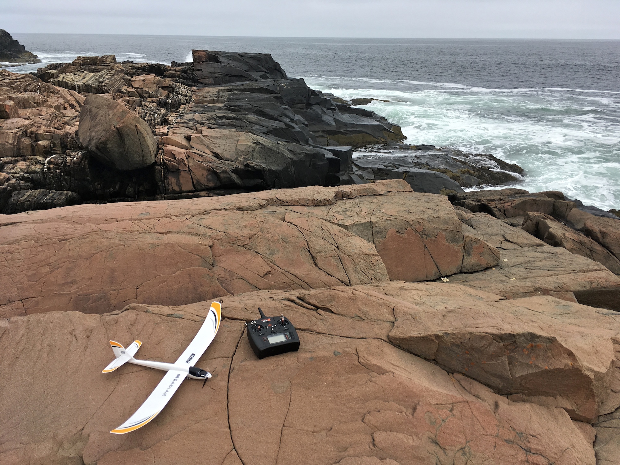
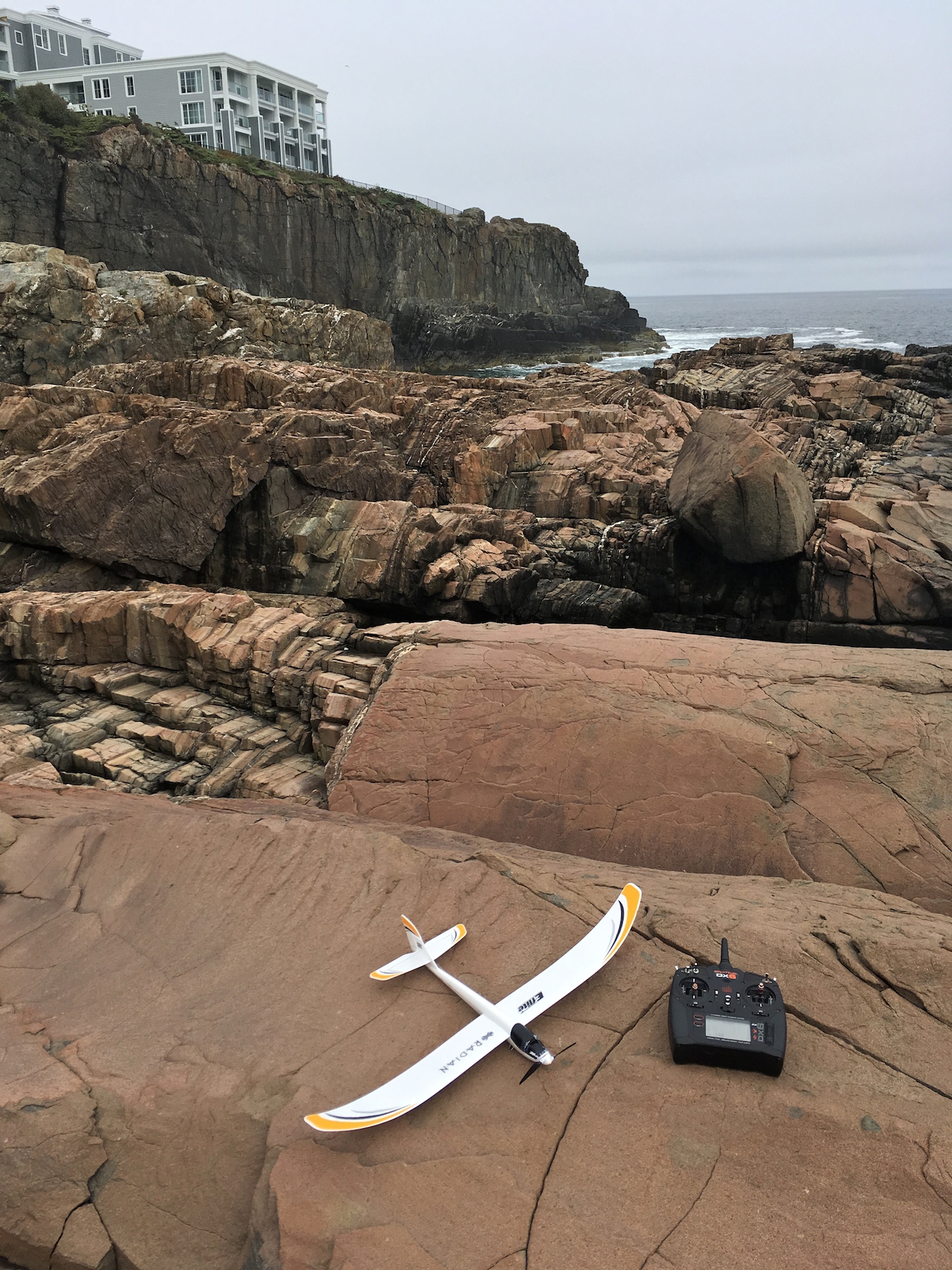
UMX Radian – lightweight and severely underpowered on a rock formation
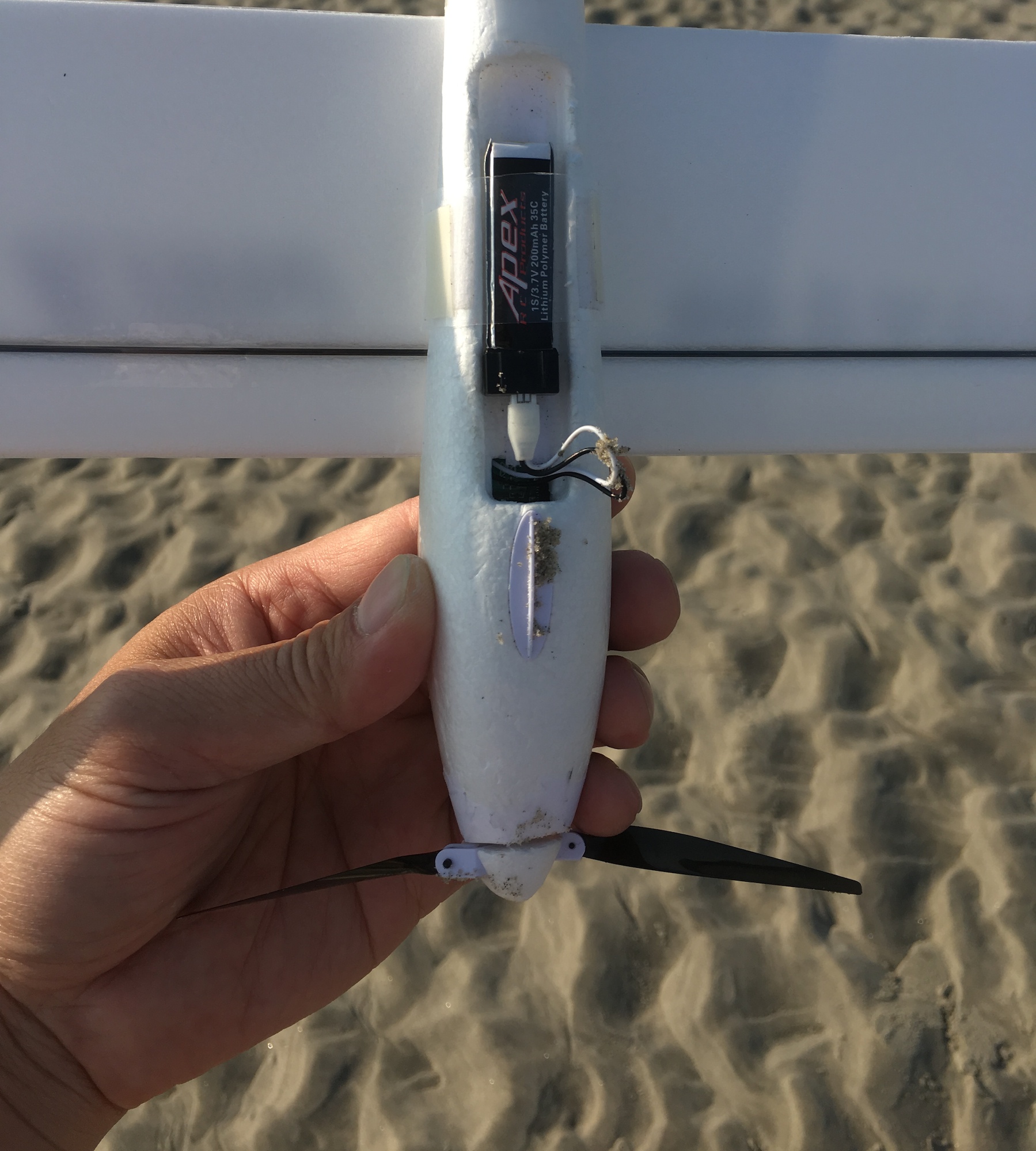
The UMX Radian is a micro sailplane made from foam, and weighs a mere 1.5 oz. It is lighter by several times compared to a baseball cap. The folding prop is powered by a tiny motor reminiscent of those vibration motors found in ancient cell phones. See how someone pulled such a tiny motor out of a phone, and put a prop on it to make a fan. Any battery-powered mini fan is many times more powerful than this humble sailplane.
I concluded that with the UMX Radian, I could invoke the waiver clause in the town’s drone guidelines: “Most of the restrictions discussed above are waivable if the applicant demonstrates that his or her operation can safely be conducted.”
Sand is not your friend
I’ve never flown a model plane at a beach before. But how difficult could it be? Naturally I headed to the beach to begin demonstrating my flying skills, as soon as I checked into the Tidal Suites at the Norseman Resort. I did not even bother to unpack my luggage.
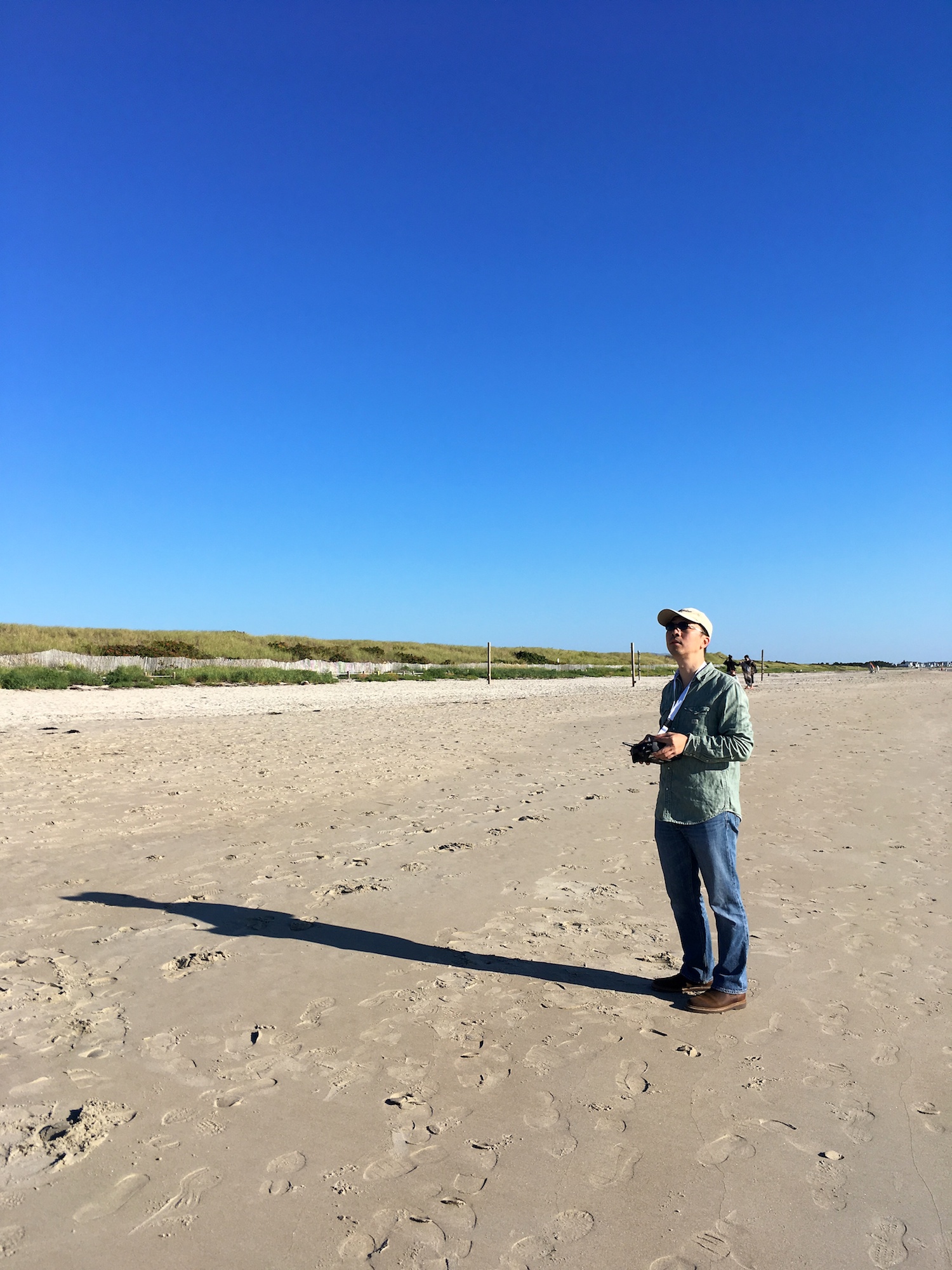
Flying an UMX Radian (sailplane) at Ogunquit Beach
Any experienced beach flyer will be shaking her head right now, after seeing how I stood so far from the water in the picture above. But I was not an experienced beach flyer. I thought it would be best if I stayed as far away from the water as possible. I thought landing the plane away from waves would be safer.
So I landed the plane on dry and soft sand that had not met the Ocean since the last hurricane. The landing sent sand flying in each and every direction, and the nose of the plane dug into the sand. That first flight of the day was also my last flight of the day. The moment the first grain of sand seeped into the plane and got between meshing gears was the moment the prop stopped moving. A whole spoonful of sand drained into the plane from the gap between the spinner and the fuselage.
Even the most skillful landing will result in sand-between-gears
This was how I spend that first afternoon: I sat on the deck of my room, cut open the nose, and got every last grain of sand out of the gearbox. Fortunately I did bring a few tools with me.
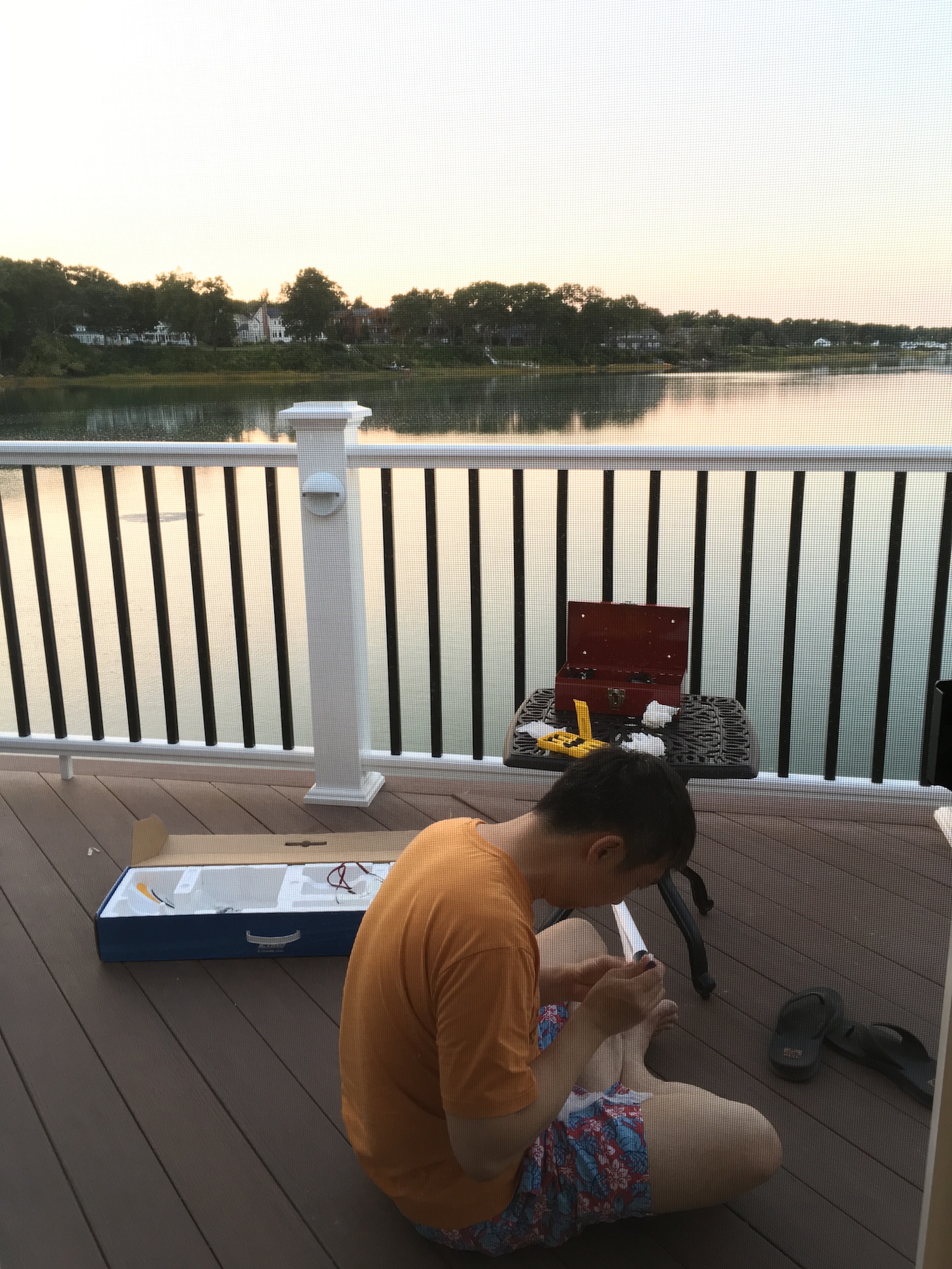
Repairing the plane – brushing off sand from gears
Makeshift landing strip
Still clueless about beach flying, I figured I would make a landing strip, so the plane would never make contact with sand. My cunning plan was to use the Pacific Breeze Beach Lounger as my landing strip. See Modern beach equipment for the model aeronautically-inclined, if you haven’t learned to ditch your traditional beach chairs.
I gleefully headed out to the beach the next morning, with these lounger pads in my beach wagon. Never mind my fashionable beach shorts. Enough people have commented on my shorts. I simply wear whatever Elisha gives me.
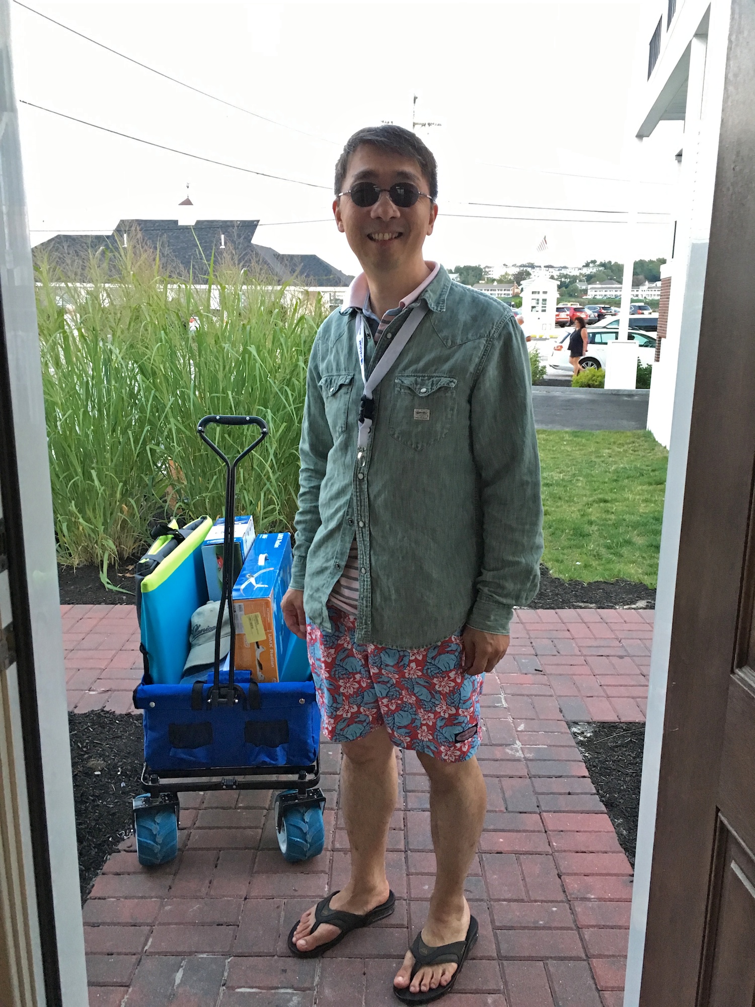
Surely my landing pads will save me this time
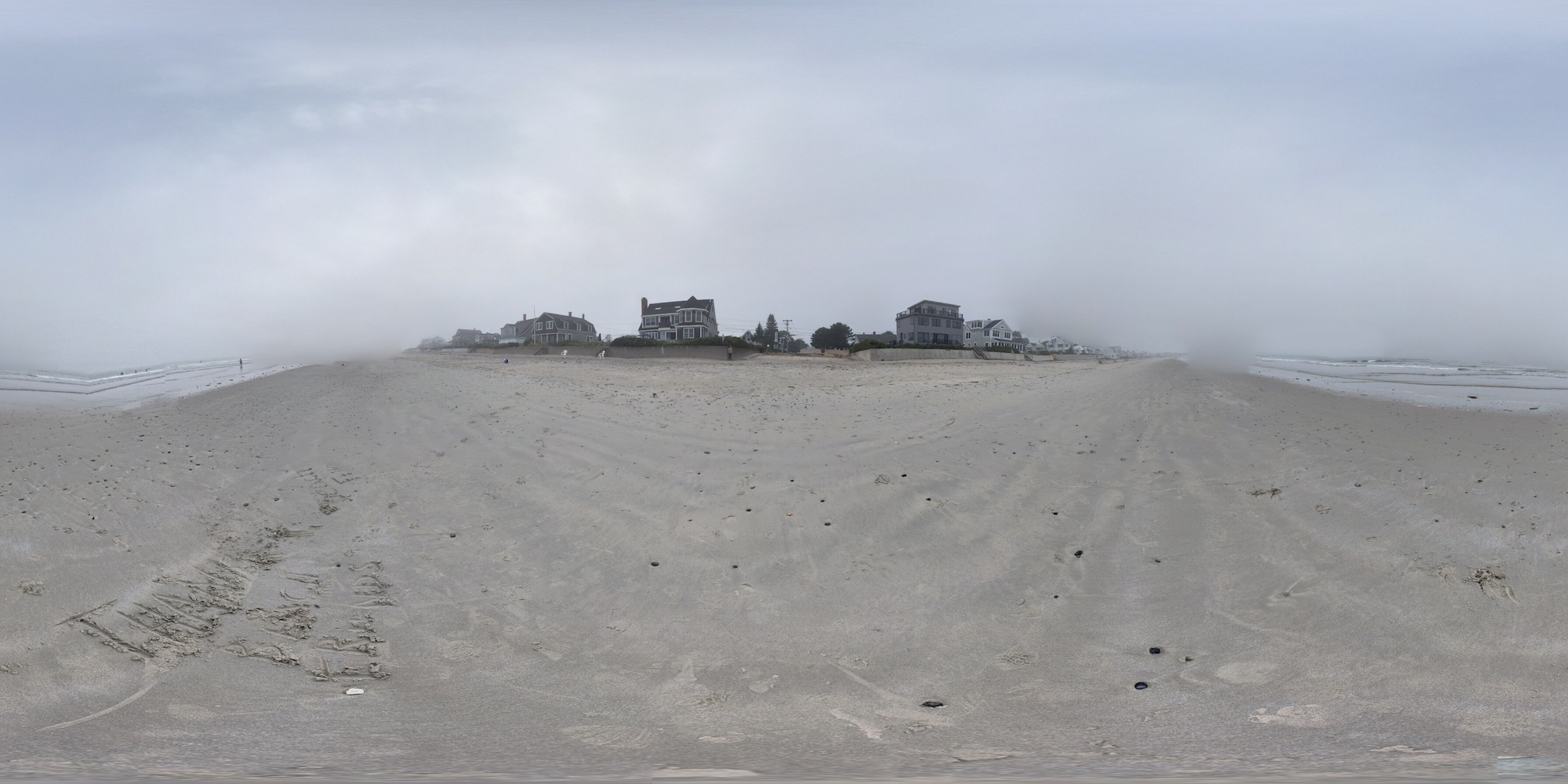
The 360° equirectangular panorama below shows this glorious beach wagon carrying all my RC gears. The wagon sits by itself on the Ogunquit Beach at low tide, before other beachgoers came and trampled all over the pristine wet sand. The view is deceiving. This beach is large, but not as expansive as the equirectangular image would make you believe. Click on the image to see what the beach actually looks like, interactively on Google Street View. Click here to see a larger version of the equirectangular picture in 2D.
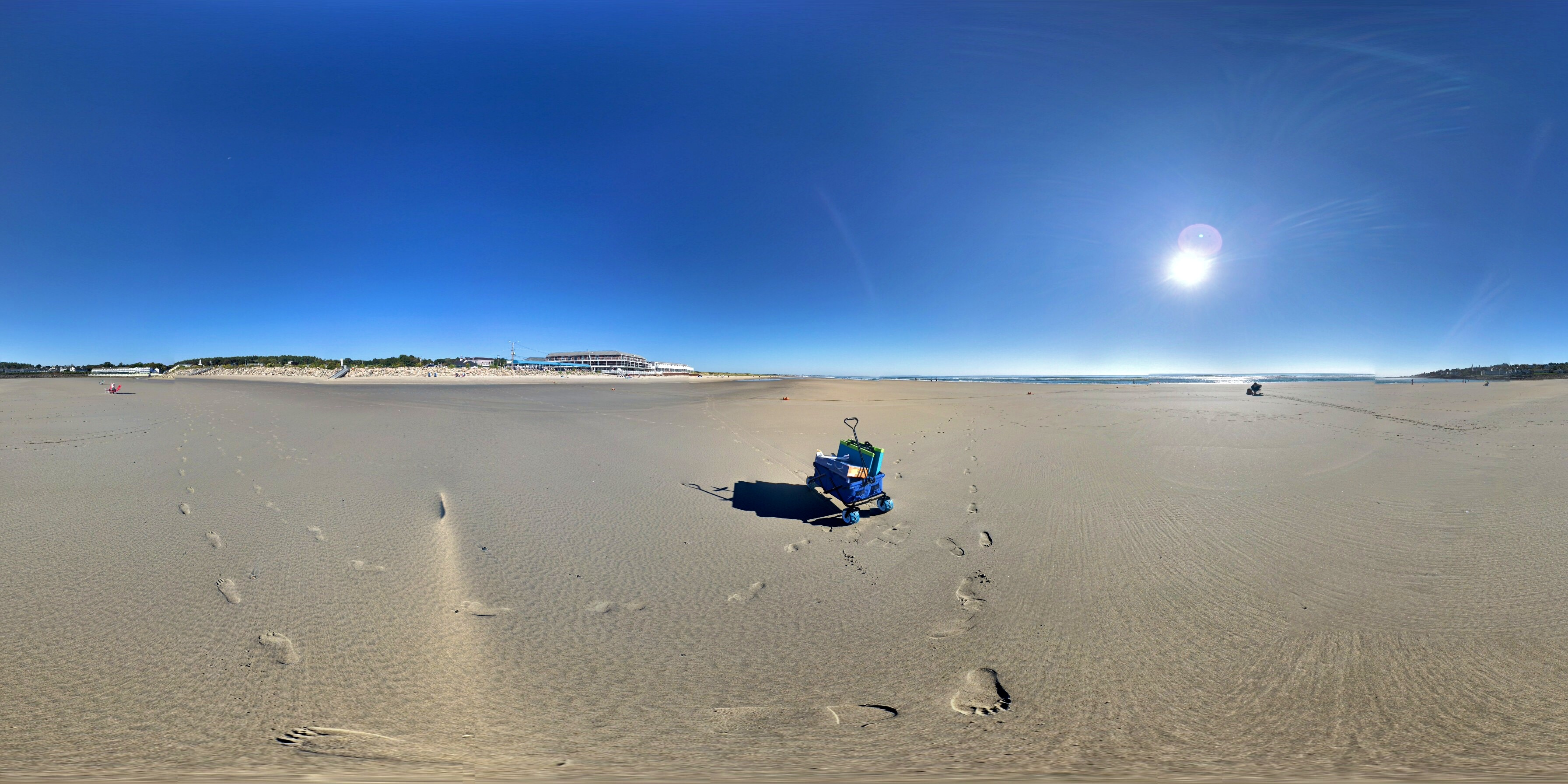
360° panorama of the lone wagon on the Ogunquit Beach
So this was how the landing pads was supposed to have worked. The pads were not laid down completely flat. Instead I propped up the end pieces as these loungers were meant to be used by people. The end pieces would brake the plane as it landed on the pad, or I thought.
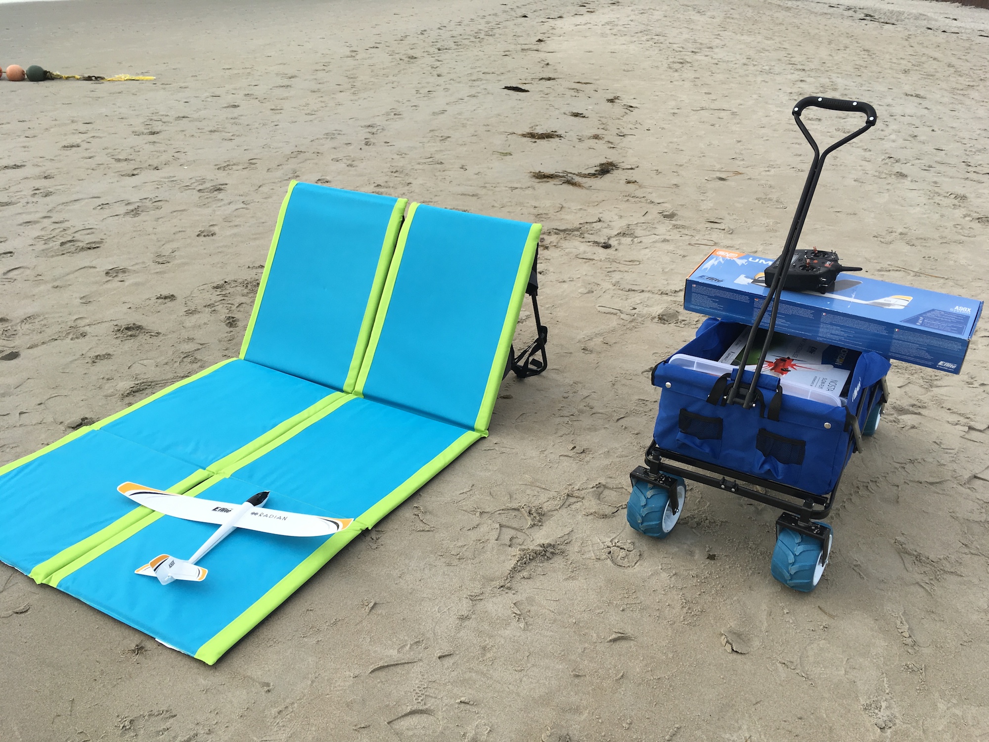
Idealized landing configuration
In practice, the “runway” was too short. And the propped-up back didn’t always stop the plane the way I imagined. More often that not, the plane bounced off it in random directions. Soon I got sand into the gearbox again.
How to land a plane on the beach
Two things saved my droning trip. After opening up the nose and brushing sand away for the second time, I realized that I could just cover up that big hole in the nose where sand poured in. I used clear tapes to create a makeshift cover, making sure to leave enough gap for the prop shaft to freely spin. A few grains of sand could still get in, if I touch down hot with the nose down, however. But you know, they tell you to flare right before touchdown for a good reason.
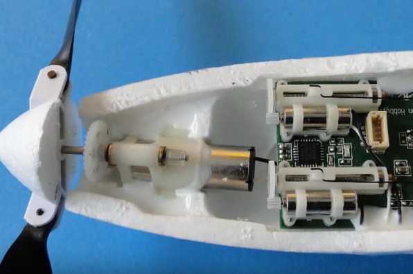
UMX Radian Gearbox
After dragging that beach wagon on dry and soft sand on the first day, I learned to stop this foolish struggle. I now walked the wagon on sand that was newly licked by waves from an incoming tide, or on newly exposed sand from a receding tide. Wet sand was compact and smooth. Tiny sand grains clung to one another. You could pull a heavy wagon without much effort on wet sand.
It dawned on me that the same was true for a no-mess landing. I started to land the plane close to the water, on wet sand. The plane no longer dug into the sand on landing. It now glided gracefully to a stop without artificial landing pads, and without splashing dry sand everywhere. This worked even on an uneven riverbed exposed by a receding tide, as the picture below shows.
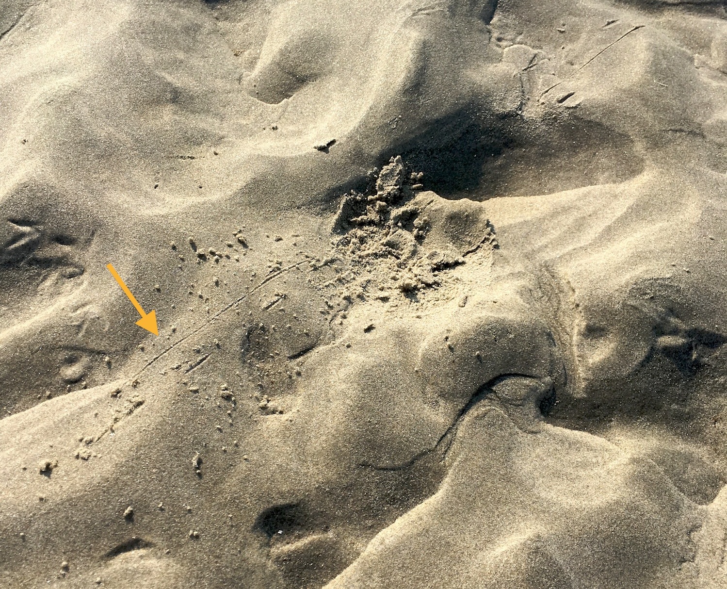
Minimum amount of sand disturbed by landing
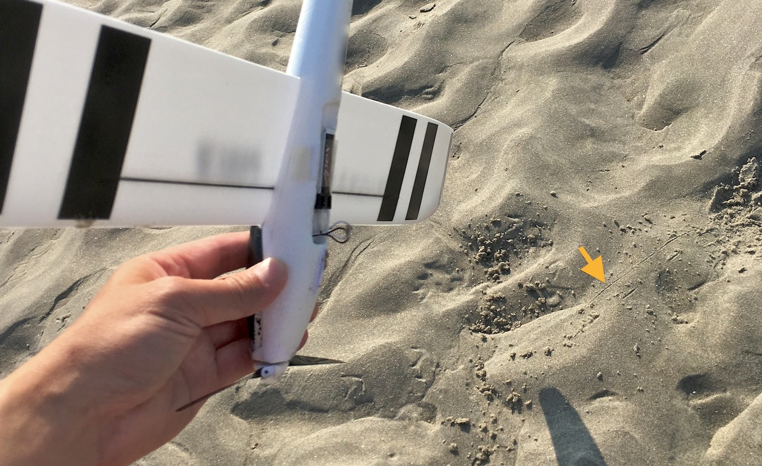
Flying from an exposed riverbed
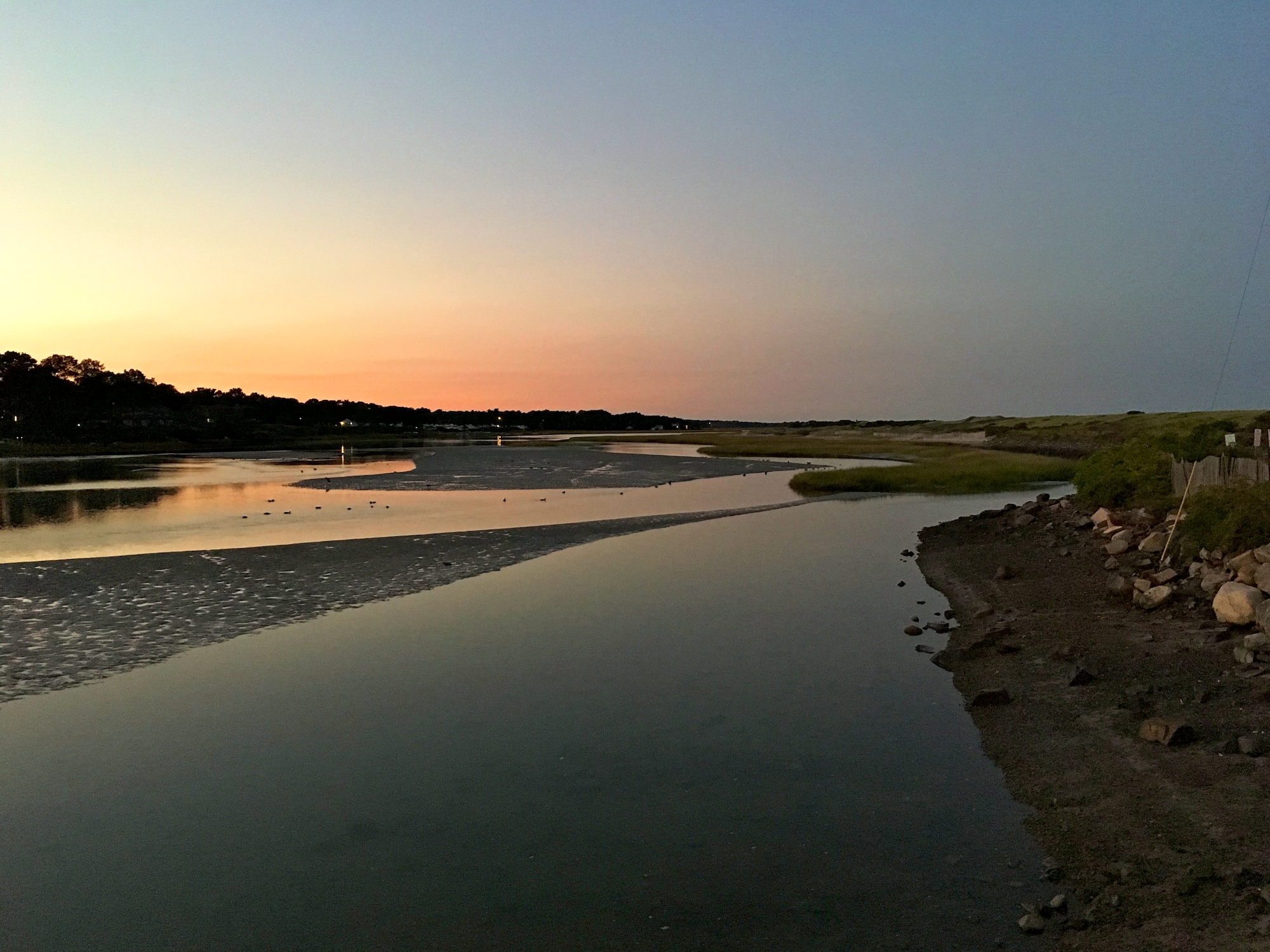
The Ogunquit river is a tidal river. At high tide it looks like a normal river. At mid tide the riverbed starts to emerge. And finally at low tide, the riverbed is completely exposed, turning into an expanse suitable for flying drones.
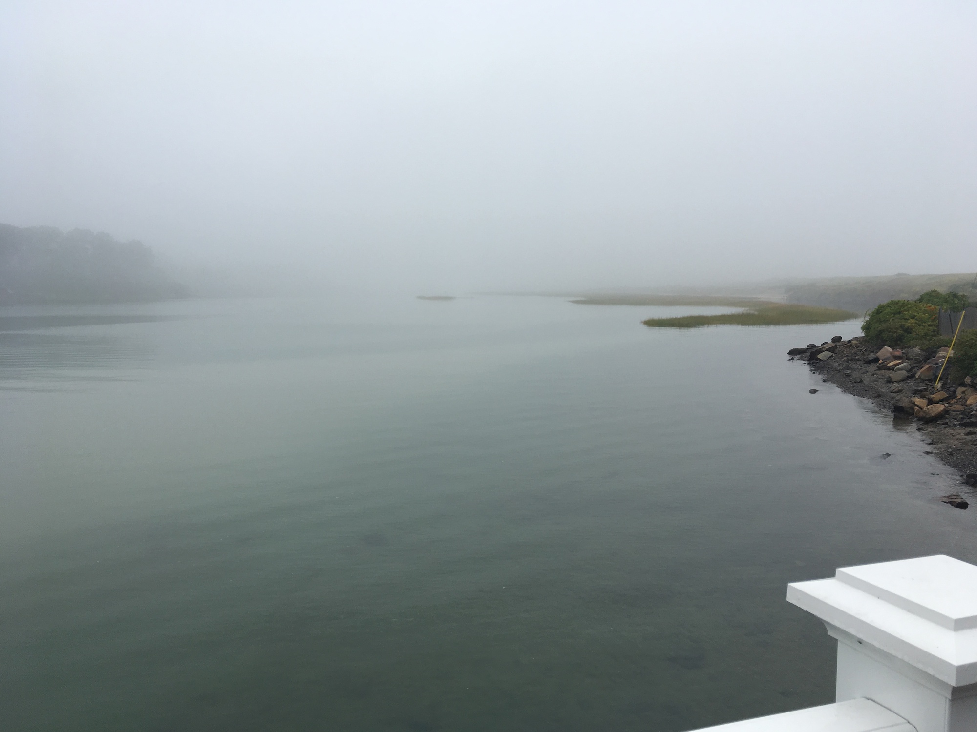
Tidal Suites at the Norseman Resort – view of the Ogunquit River at high tide
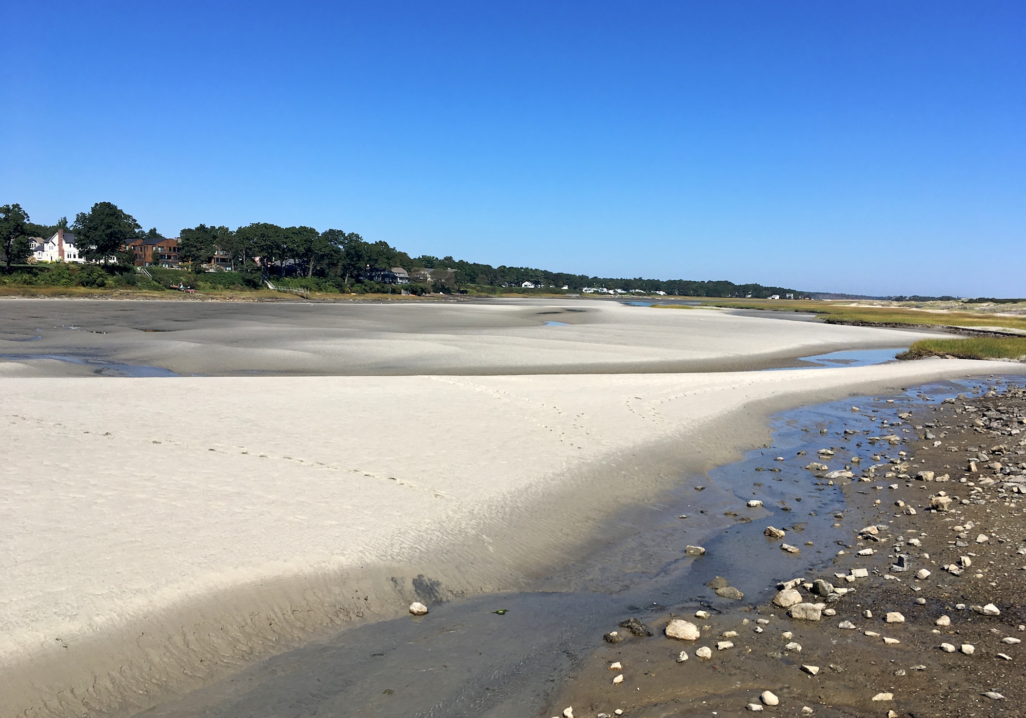
At mid tide
At low tide
The riverbed at the mouth of the river was, however, not the ideal place to fly sailplanes. The prevailing wind during my stay was from the south mostly. Sometimes it flew from the southwest. Coincidentally, that was also how the sun tracked from the late morning to sunset. So I was looking at the sun all the time as I flew the plane upwind. Making matters worse, the wind broke into thousand eddies as it passed between and over odd-shaped buildings such as the restaurant and other resort buildings. Flying my sailplane from the beach with the wind blowing over uniformly-shaped sand dunes yielded more pleasant experiences.
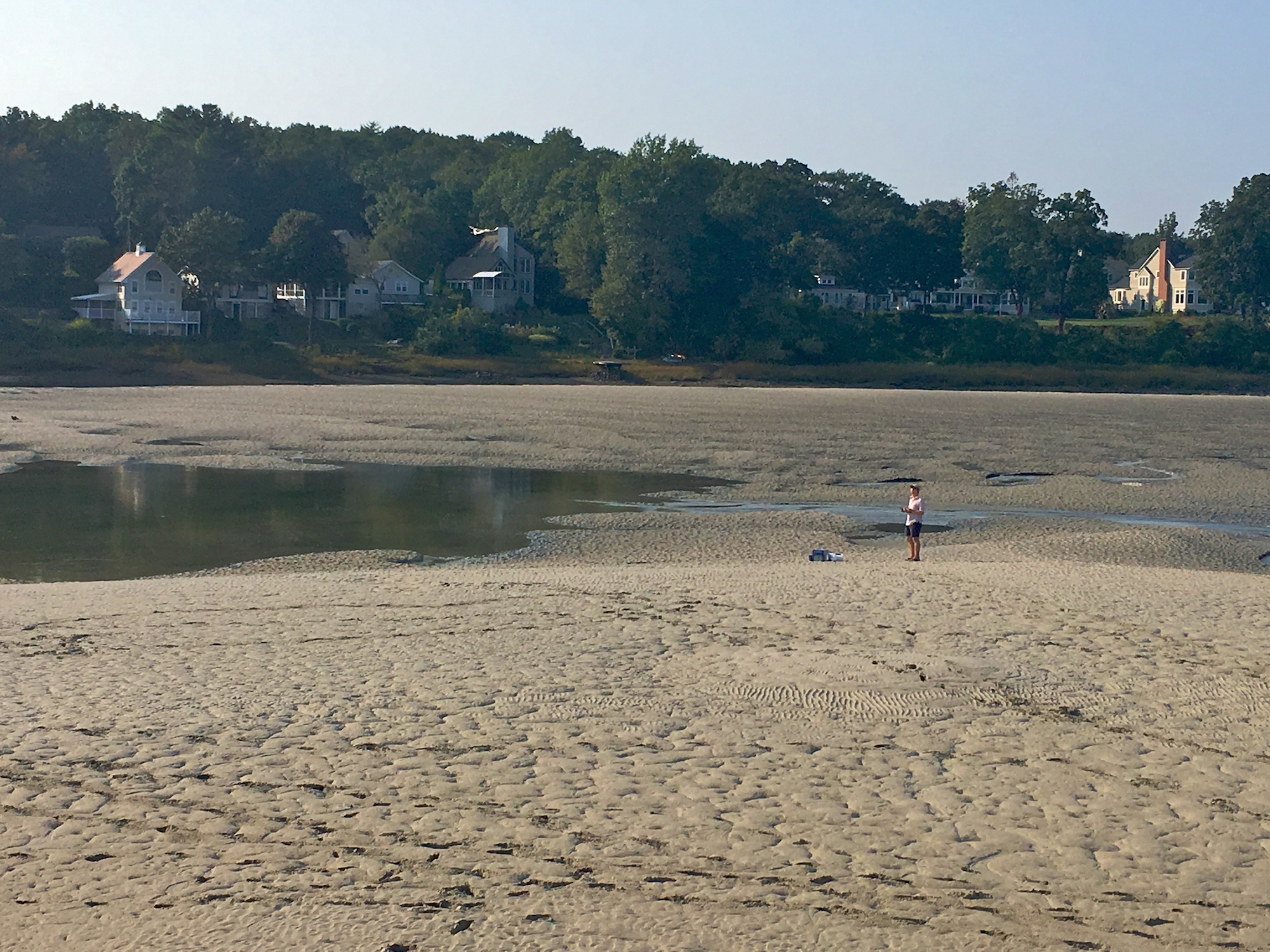
Flying my sailplane on exposed riverbed at low tide
Marginal Way
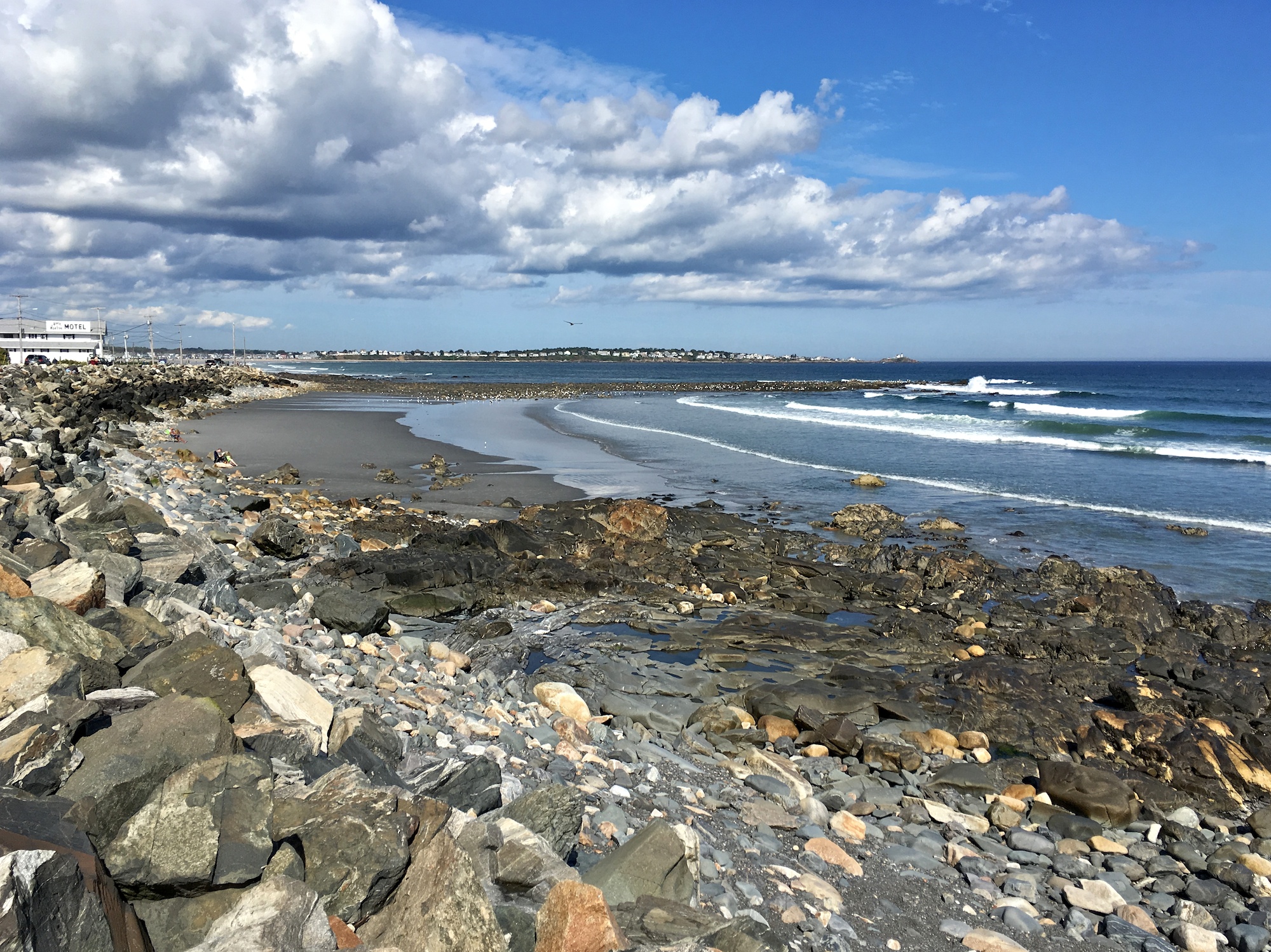
The Marginal Way is a mile-long walk along a cliff overlooking the Atlantic Ocean. At the beginning of the walk starting from the center of the town, it offers one of the most spectacular views of the Main Beach at Ogunquit Beach.

Main Beach as seen from Marginal Way at low tide
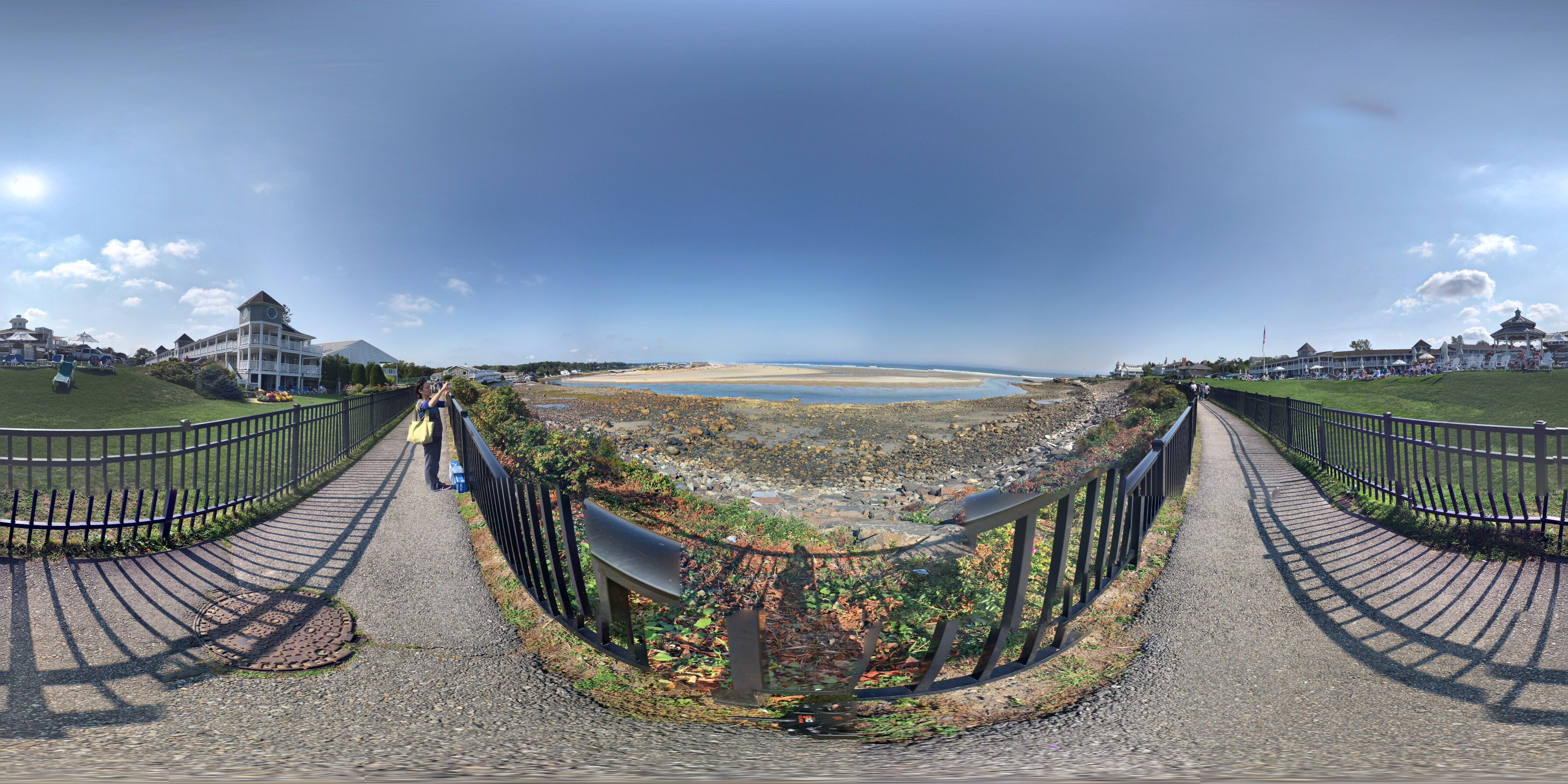
360° panorama from the Marginal Way
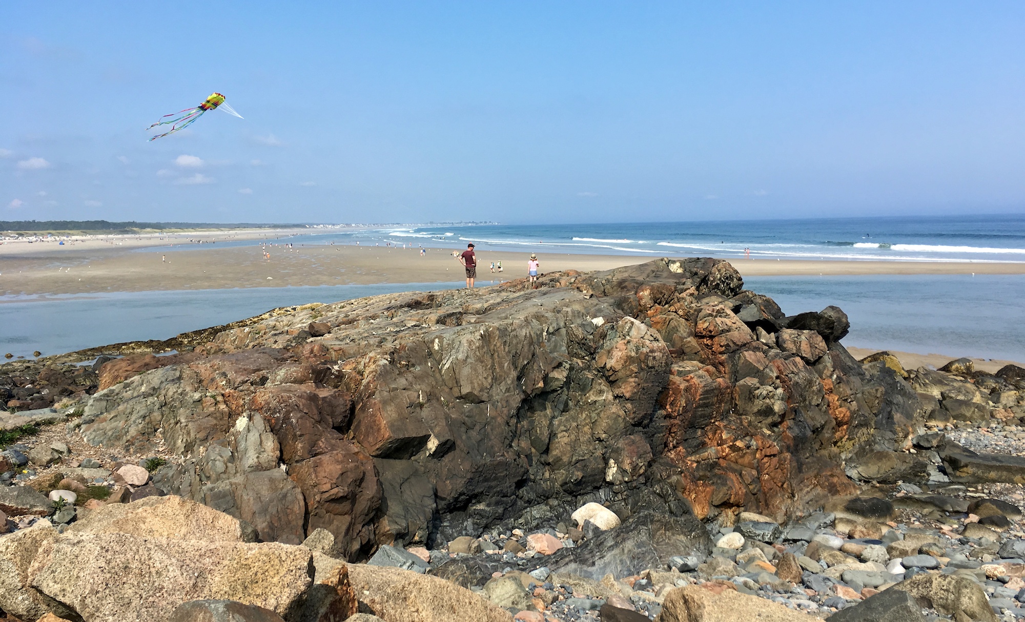
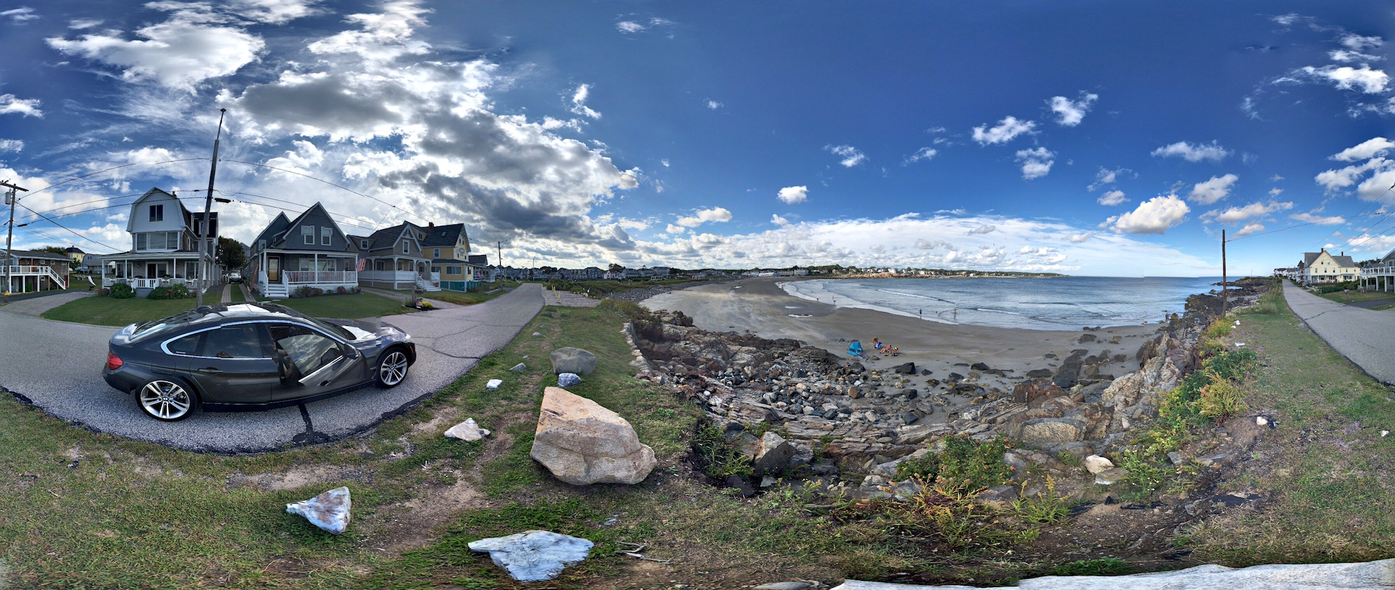
There is a famous rock formation by the Marginal Way. Standing on it offers a great view of the Ogunquit Beach, the Marginal Way, and various resorts along the “Way”.

Rock formation overlooking Ogunquit Beach
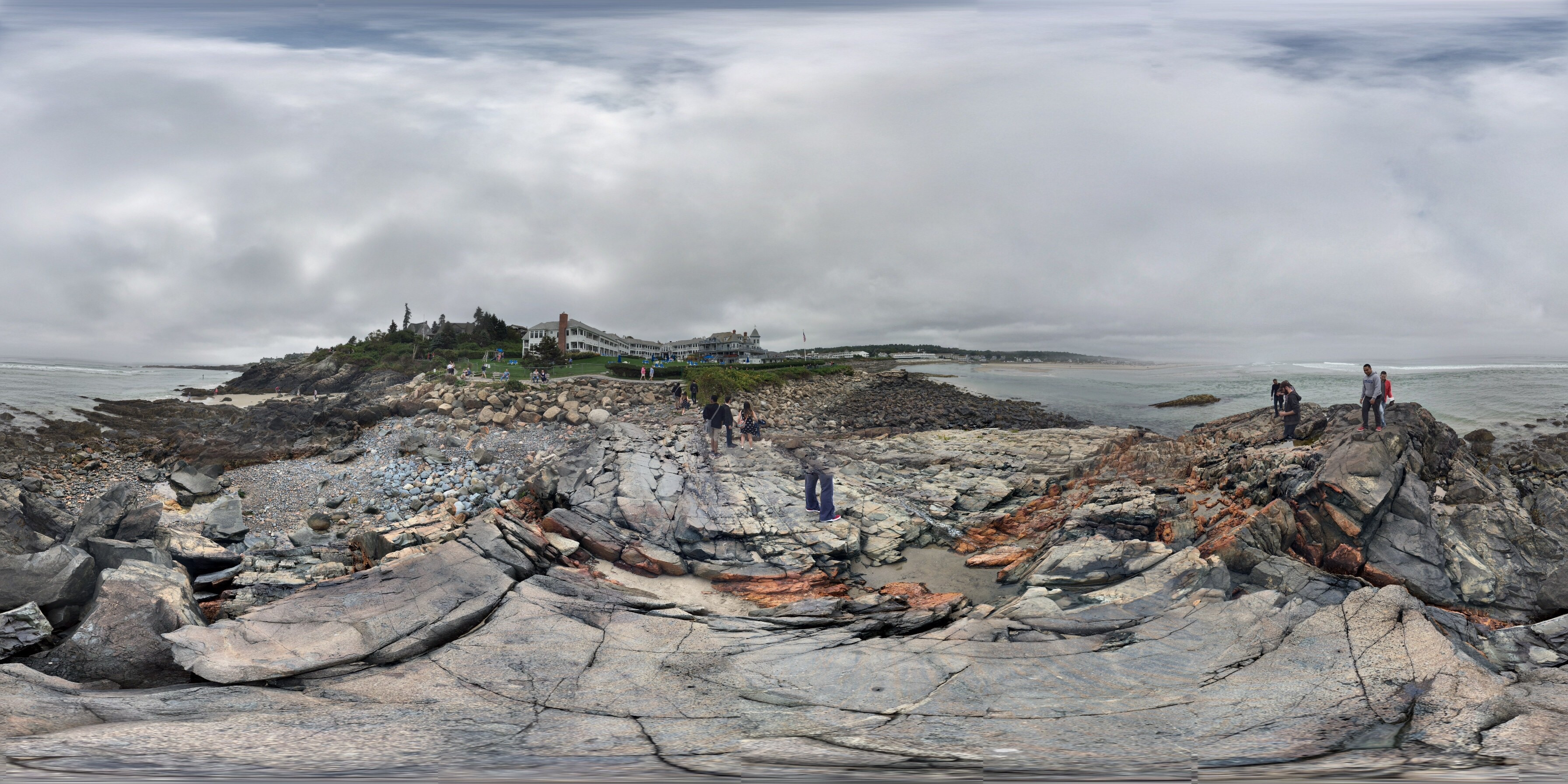
360° panorama standing on the rock formation
Flying a sailplane on the rock formation was a lot of fun. The ocean, the rock and the cliff conspire to create interesting air dynamics. I had a blast.
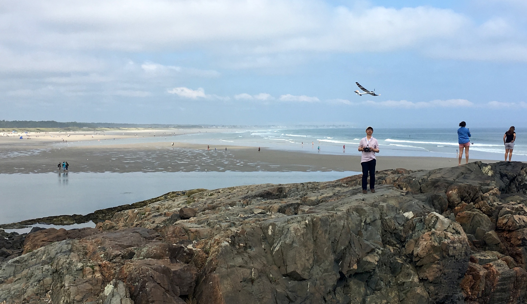
Flying the Radian on the famous rock formation
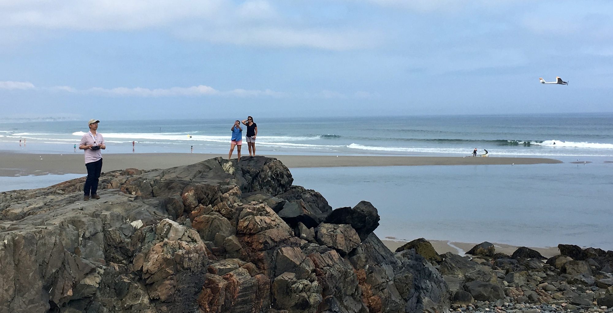
The video below captured the excitement of this experience. Even though the plane was nearly harmless, I verbally communicated with everyone standing on the rock as I flew the plane. I made sure to call out all landing attempts, so that no one got startled by an approaching plane, and jumped off the rock formation.
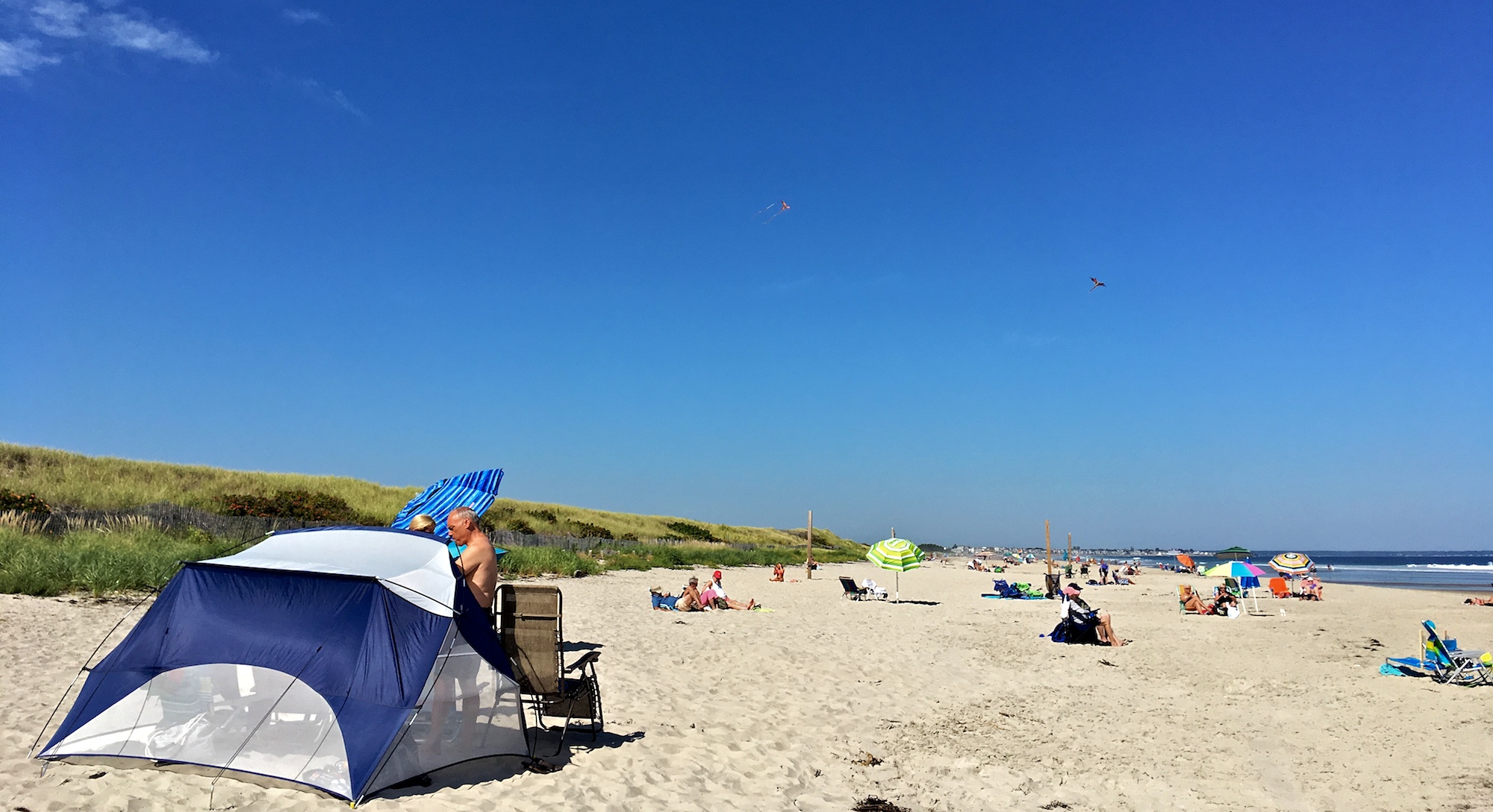
Flying kites at the beach
I missed the annual kite festival at the Ogunquit Beach by just a few days. We were the only ones flying kites that day. Sigh. Here is someone’s picture of the 2011 event on TripAdvisor. I can’t find a single picture from the 2017 event. Perhaps it is no longer as festive as it was.

This photo of Ogunquit Beach is courtesy of TripAdvisor
Certain member of my two-person household flew a rainbow delta kite to “test the water”.

Flying a delta kite
I then flew the WindnSun 74″ 3D Macaw Kite, and the WindnSun 76″ 3D Dragon Kite. The macaw and the dragon were tied to their own beach volleyball poles, in two separate courts further down the beach.
Two kites tied to beach volleyball poles
I also flew a Giant 3D parafoil Octopus Kite, and tied it to the handle of the beach wagon.
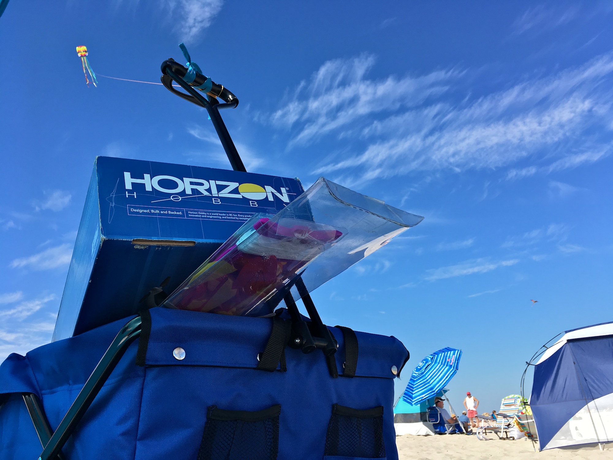
Octopus kite tied to the beach wagon
I also flew the octopus kite on the rock formation by Marginal Way. It looked majestic, with the expansive Ogunquit Beach in the background.
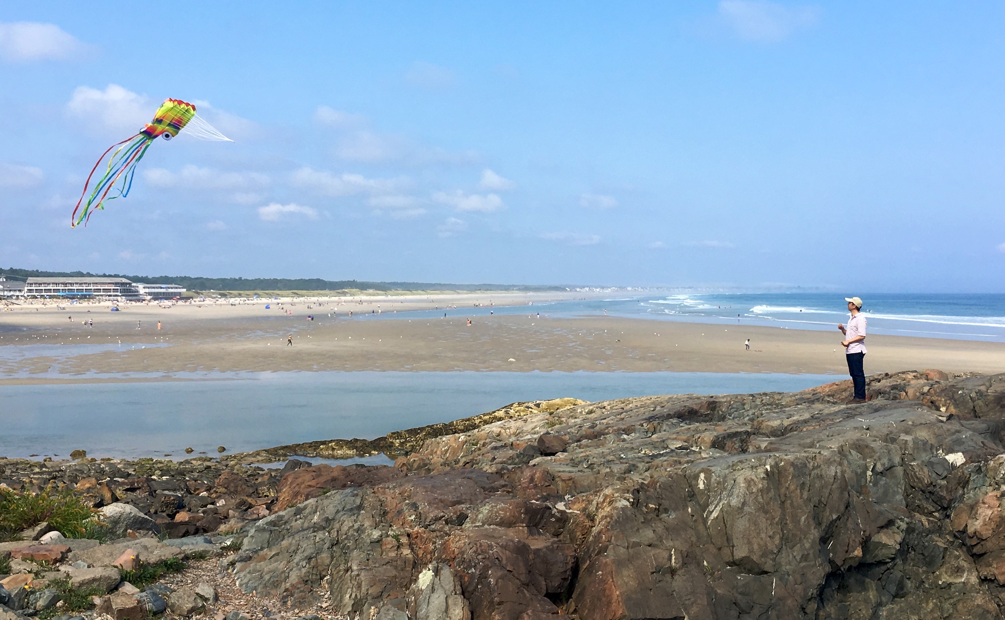
The kite flew itself once it went above the turbulence caused by the rock
Flying the UMX Radian at the Cliff House
We stayed at Cliff House during the second leg of our trip. The resort is build next to a cliff. Premium guest rooms overlook the main center piece of the resort landscape, a set of rock formations.

Cliff to the left and the rock formations to the right
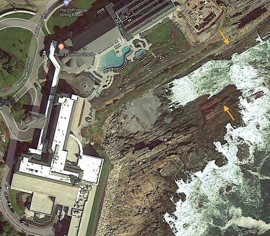
Arrows showing the cliff and the main rock formation
The resort landscape was painstakingly manicured. Staff can be seen throughout the day working on the garden and polishing handrails.
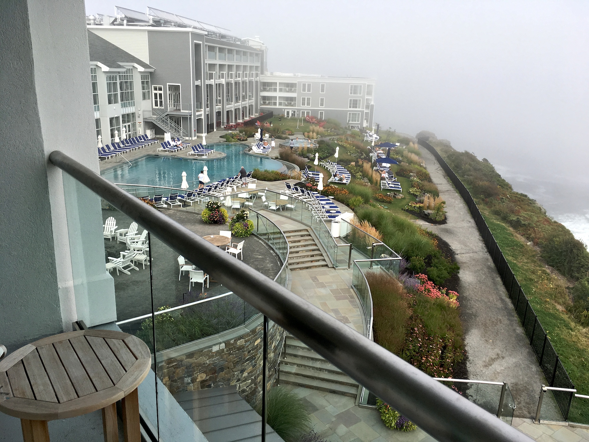
A view of the resort landscape from a guest room
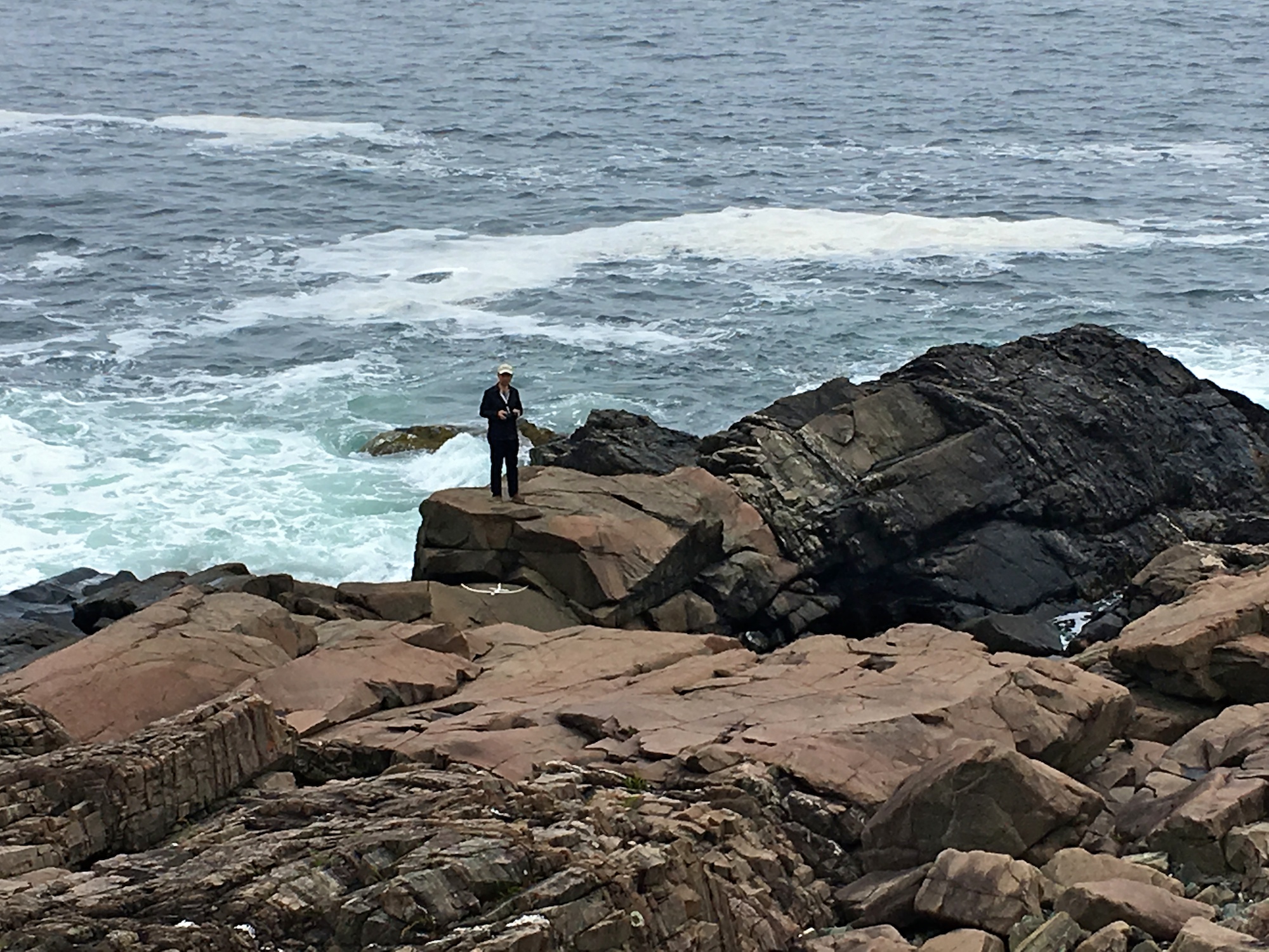
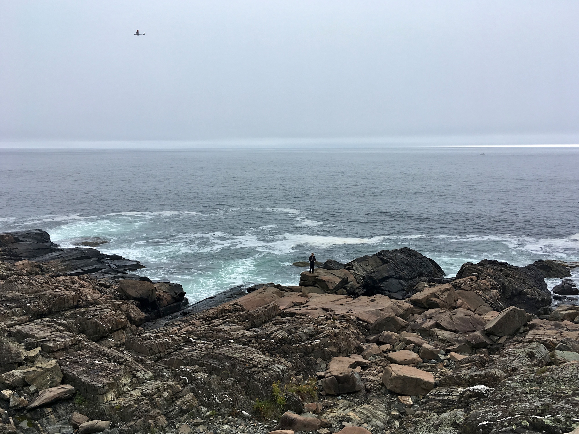
I had a good time flying the UMX Radian, while standing on perilous rocks, with multi-person-tall waves pounding on these same rocks.
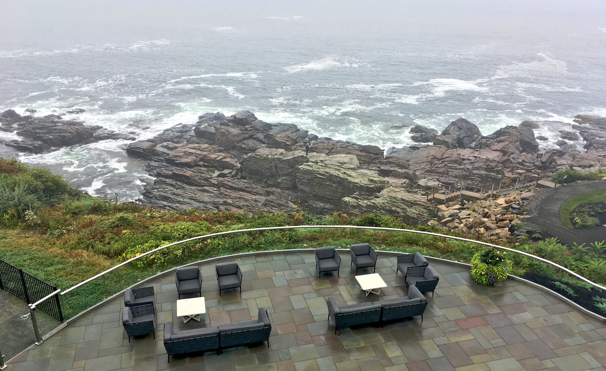
Flying a sailplane standing on rocks, as seen from my room
There is a staircase leading down to the main rock formation. Most guests are unable to resist the urge to climb down and tempt fate.
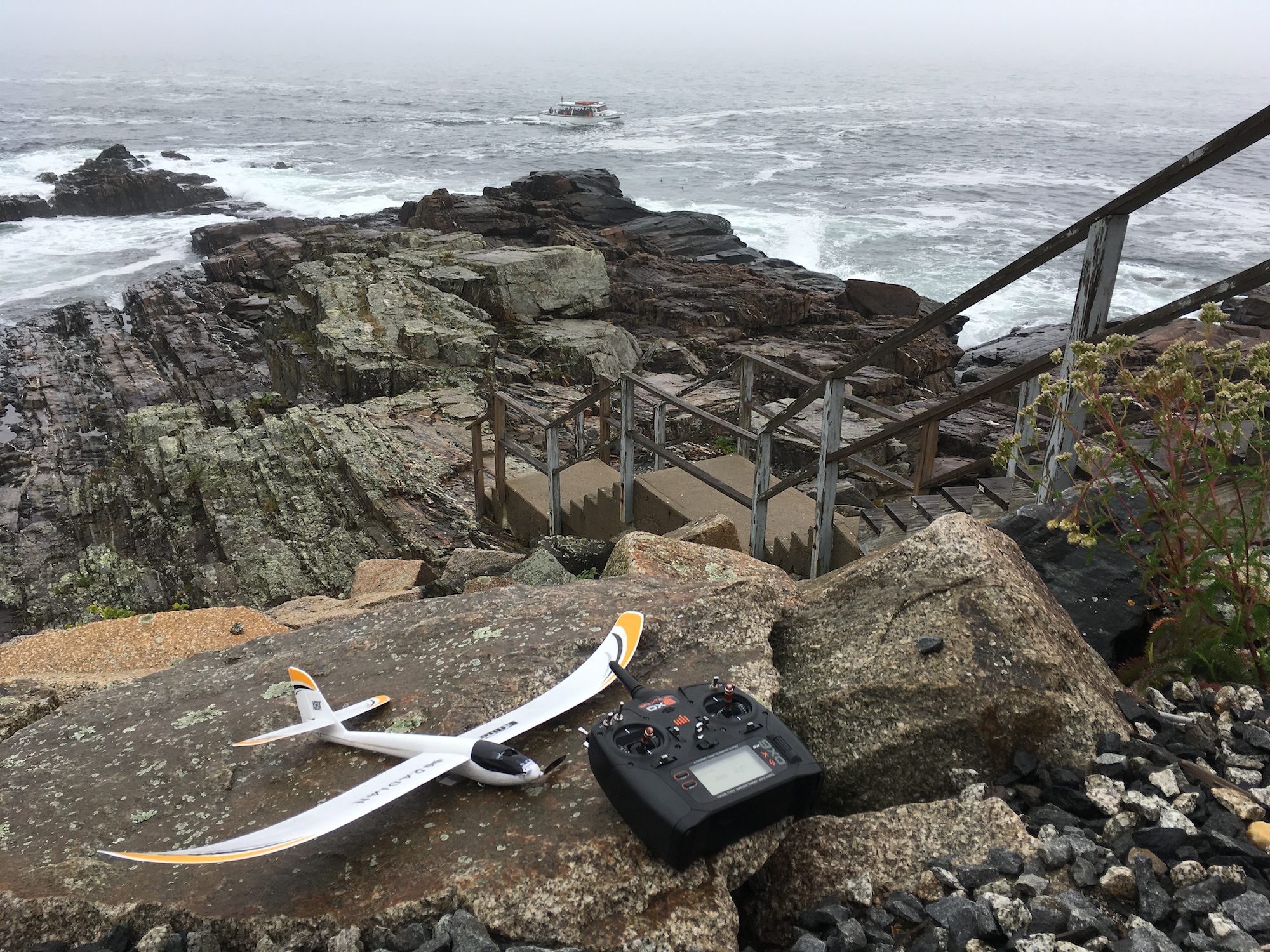
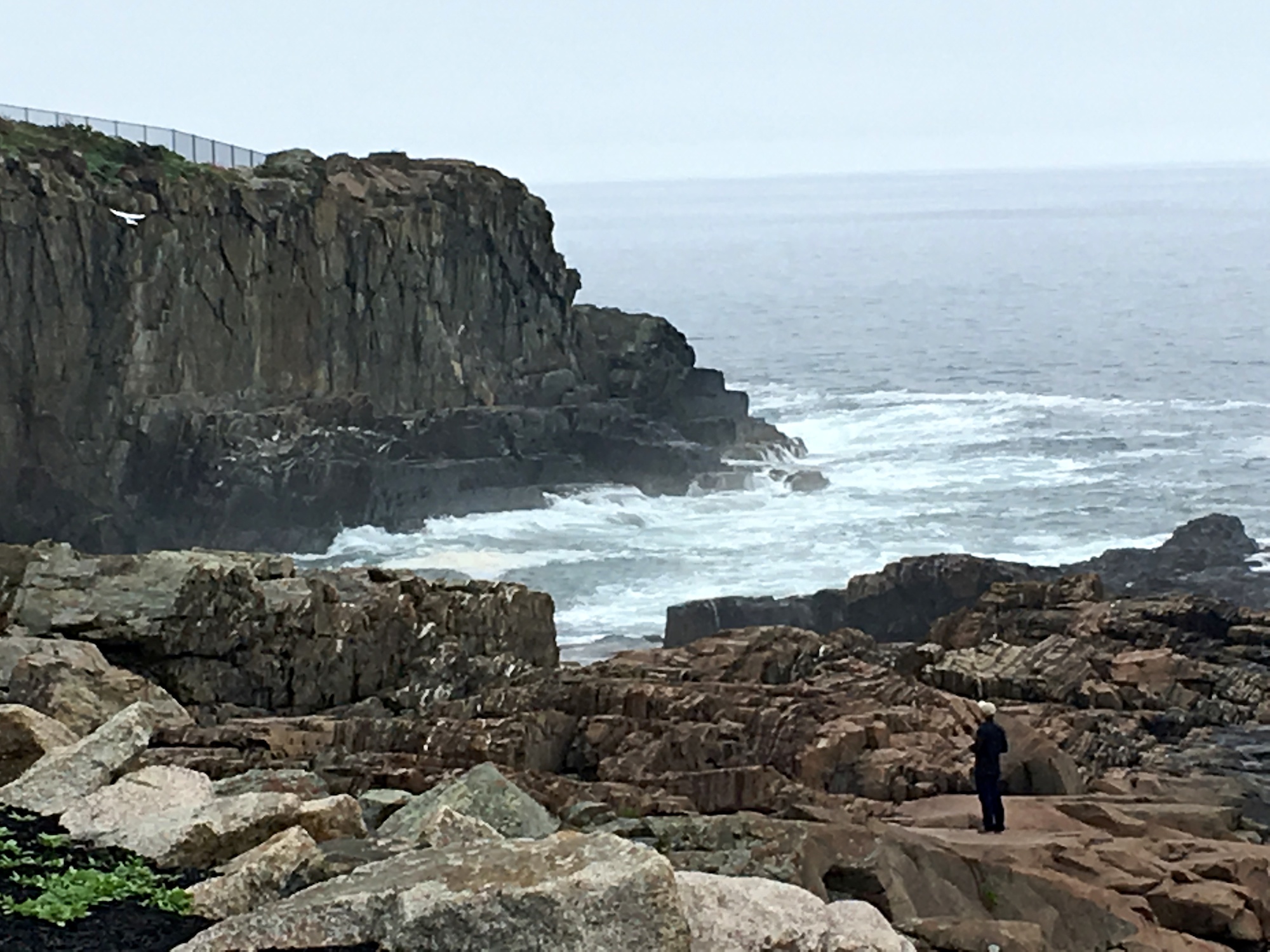
Flying a sailplane on the rock formation against the cliff
At one point I stood foolishly and dangerously close to the pounding waves. Don’t try this at home.
Waves poured in
Flying next to pounding waves was an exhilarating experience
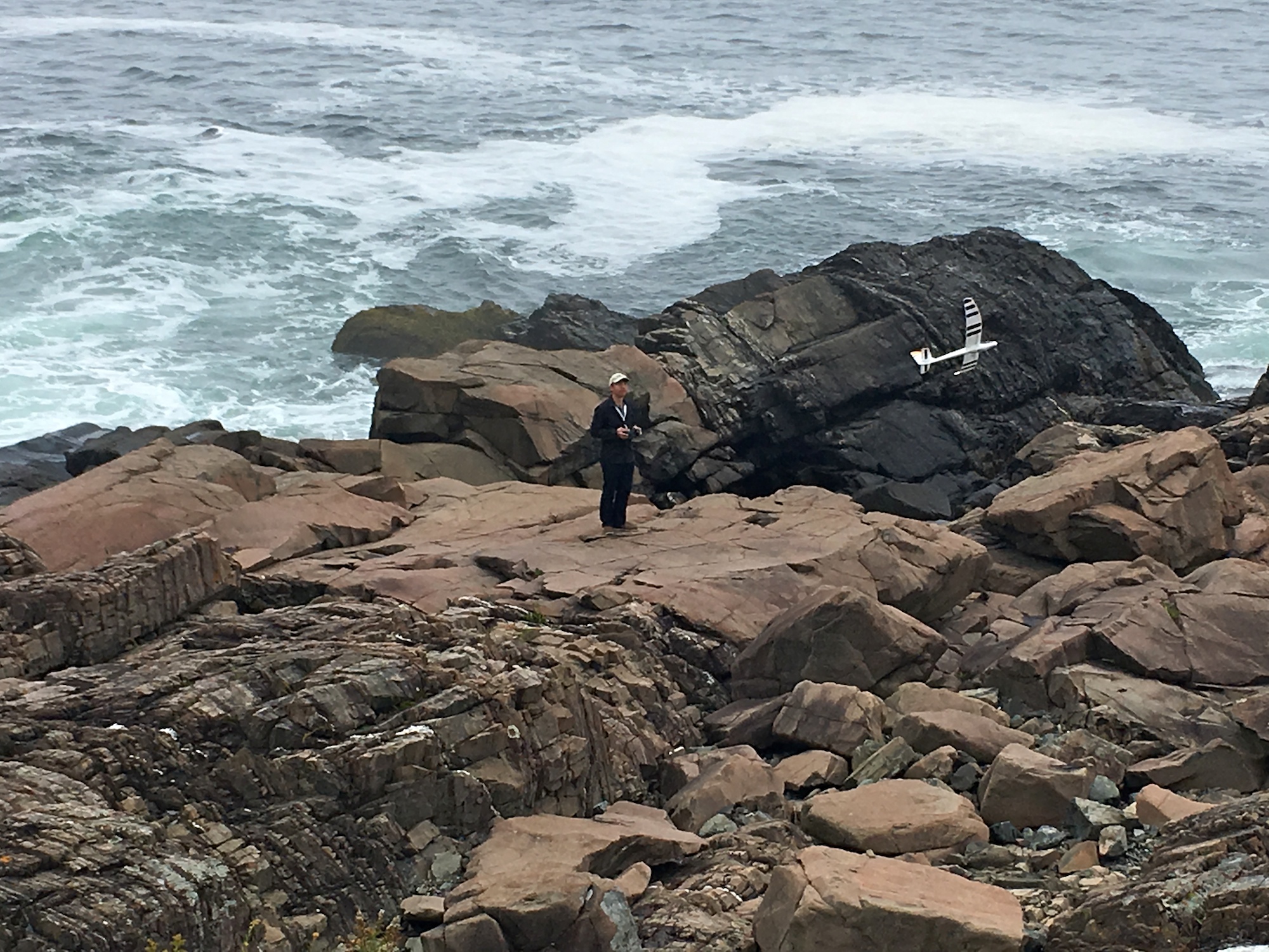
By now I’ve learned to catch the plane with my bare hand upon landing, so I didn’t have to rely on hard and uneven rocks to stop my plane. Clearly one would not do this with a regular RC plane. It was only safe to do here, because this plane is severely underpowered, but I repeat myself. The video below captured some of these landings.
The Ogunquit Beach
The Ogunquit Beach is two miles long. Parts of this long beach are given informal names which you will not find on Google Maps. The southern-most tip of the peninsula is called the Main Beach. On this beach you will find the only beachfront hotel on the entire peninsula, the Norsemen. See the Tidal Suites at the Norsemen article for details. From the bottom up, the rest of the peninsula are known as Footbridge Beach, North Beach and Moody Beach.
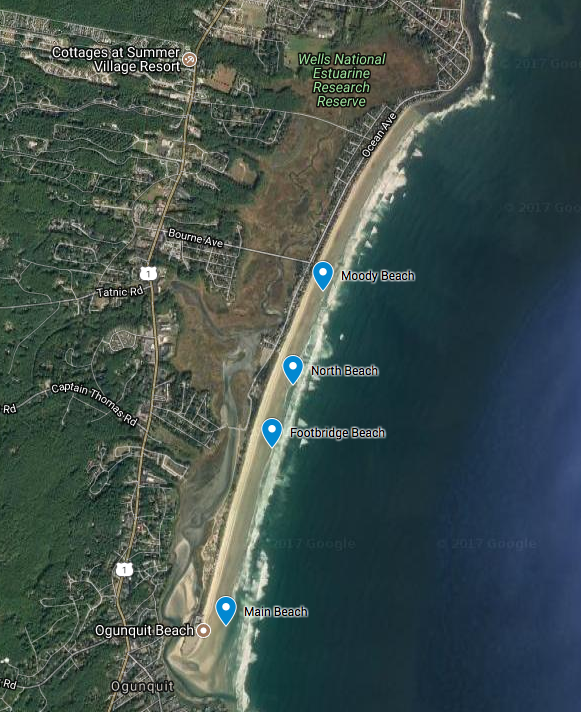
Sections of the Ogunquit Beach
Explore this two-mile long Ogunquit Beach on Google Maps below.
The Main Beach is located at the mouth of the tidal Ogunquit River. It completely disappears at high tide. And it reemerges as a flat expanse at low tide. This is a popular stretch of the Ogunquit Beach even in chilly September, past the Labor Day. So I flew mostly at sunrise and sunset to avoid the crowd, despite the fact that I was flying a harmless and lightweight sailplane.

Looking north standing on the Main Beach
If you walk north, you’ll soon find yourself keeping company with only seagulls. Not the entire two-mile beach is crowded. This is mostly because of lack of access. The southern 3/4 mile of the beach is only accessible from two places: the river mouth and the Footbridge. This would be a good place to fly planes. But on the other hand, you’ll need to contend with angry birds.
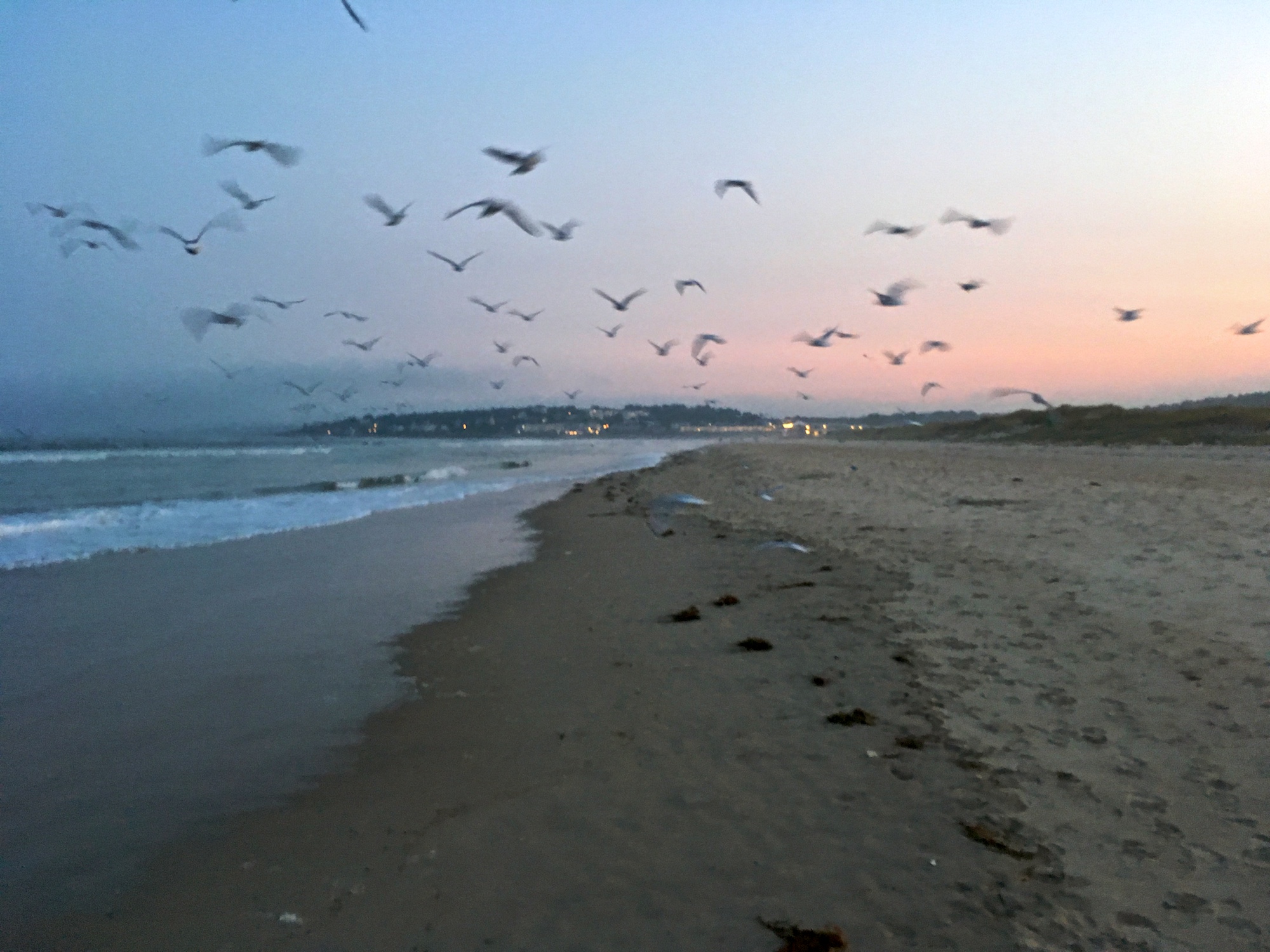
Between the river mouth and the Footbridge, looking south
Continue north and you may pick up a pet or two in the form of a seagull. We walked alongside a juvenile Great Black-backed Gull for 15 minutes.
The Footbridge Beach is named after the bridge connecting the mainland to this stretch of sand. Walk past the Footbridge and you’ll be at the North Beach. There is a public parking lot by this beach.
North Beach Parking Lot
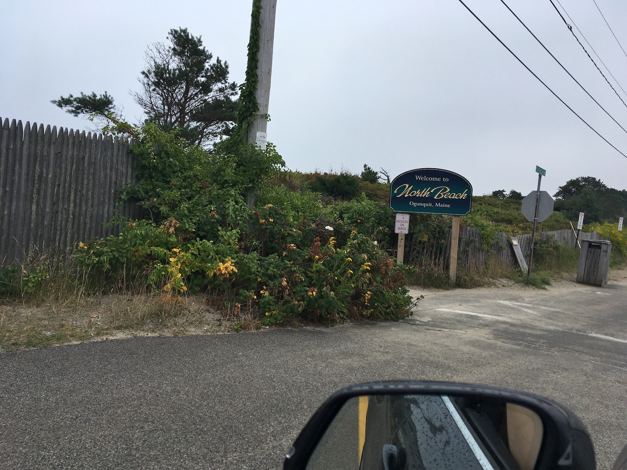
North Beach and Moody Beach is sometimes said to be the same beach. But for the purpose of this article, it is best to draw a line between these two at the public access point by the public parking lot. In 1989 the court decided that the hundred houses on Moody Beach had private property rights to the low-water mark or low tide area. This sounded at first glance as if the order left some room for the public on the beach. But it actually means that every grain of sand between a private property and the ocean belongs to the property owner. In practice, tourists can stroll past these houses, as long as they don’t linger on Moody Beach. The North Beach, on the other hand, is a public beach.
Boundary between North Beach and Moody Beach
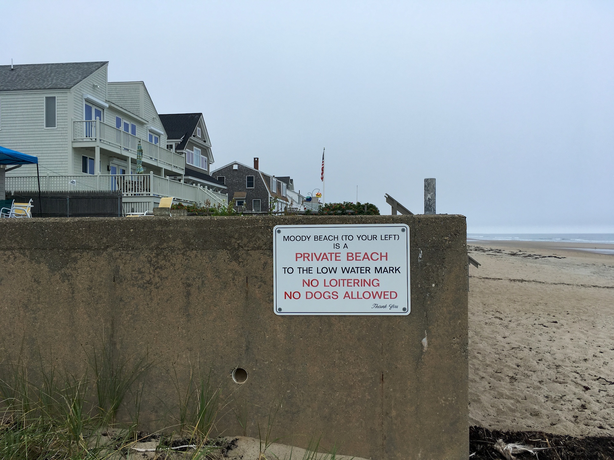
It appears that residents of beachfront houses erected these humorous street signs in an attempt to sugarcoat their monopoly of the Moody Beach.
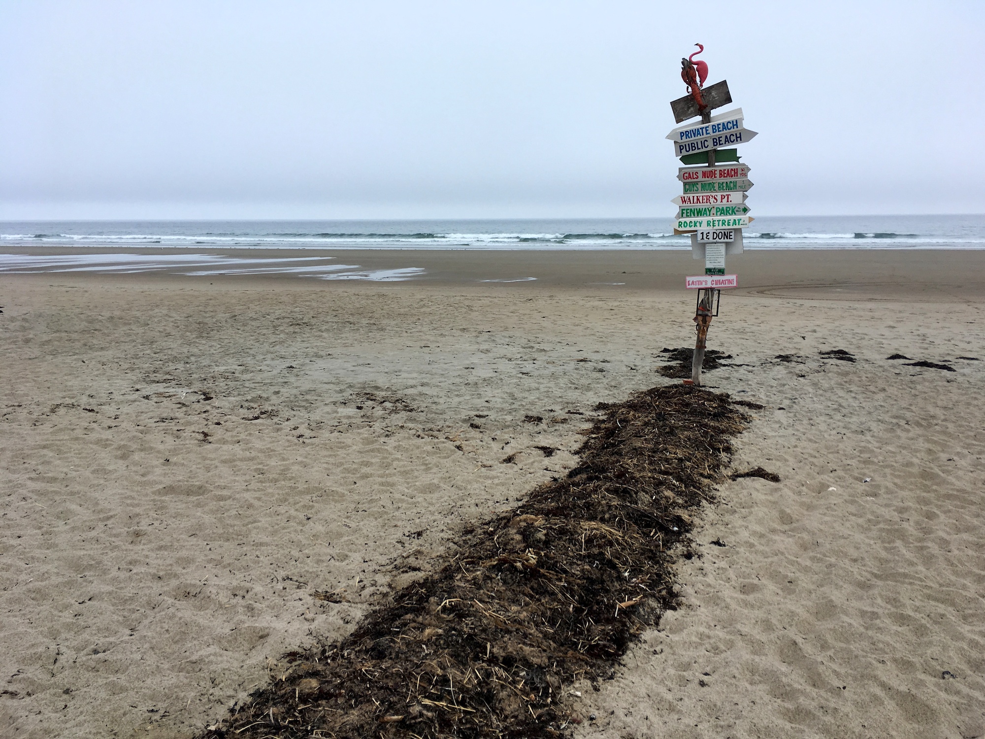
Humorous street signs at the boundary between North Beach and Moody Beach

Turn right for public North Beach
Moody Beach marks the end of pristine and expansive beach space without private homes. From here on northward no beach can be found without private properties overlooking them. But Moody Beach is the only one that prohibits free public access to the beach.

Turn left for private Moody Beach
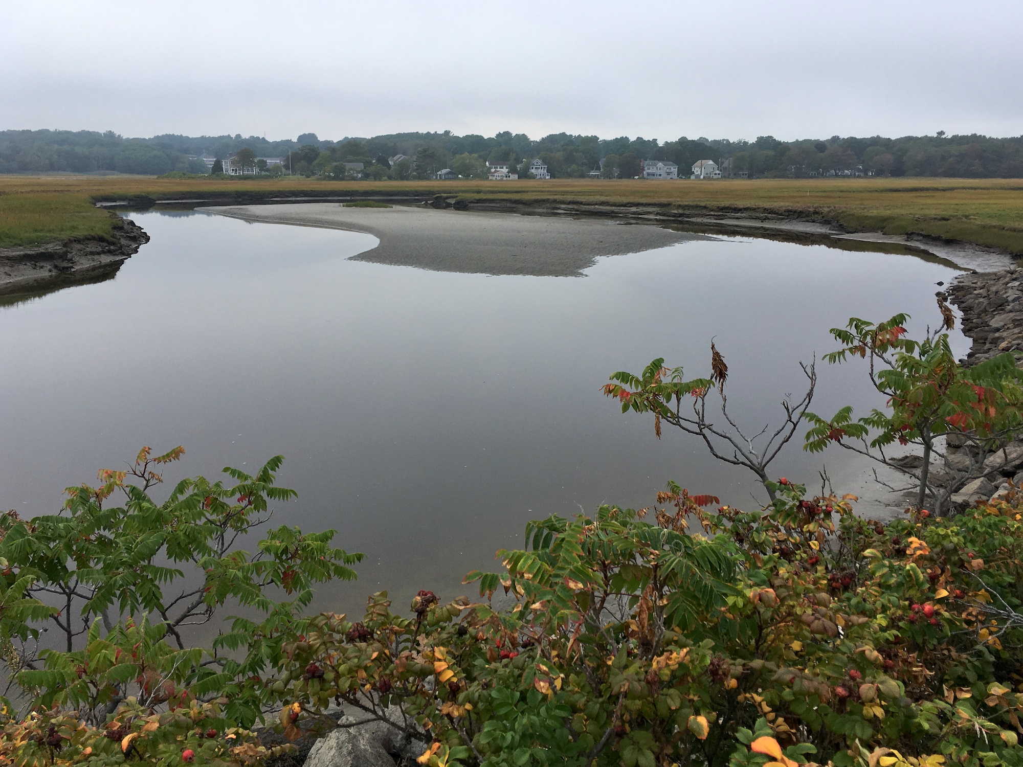
Ogunquit River runs to the left of the peninsula. I didn’t try to get onto the expansive marshland and fly my plane from there. But I imagine it is doable.
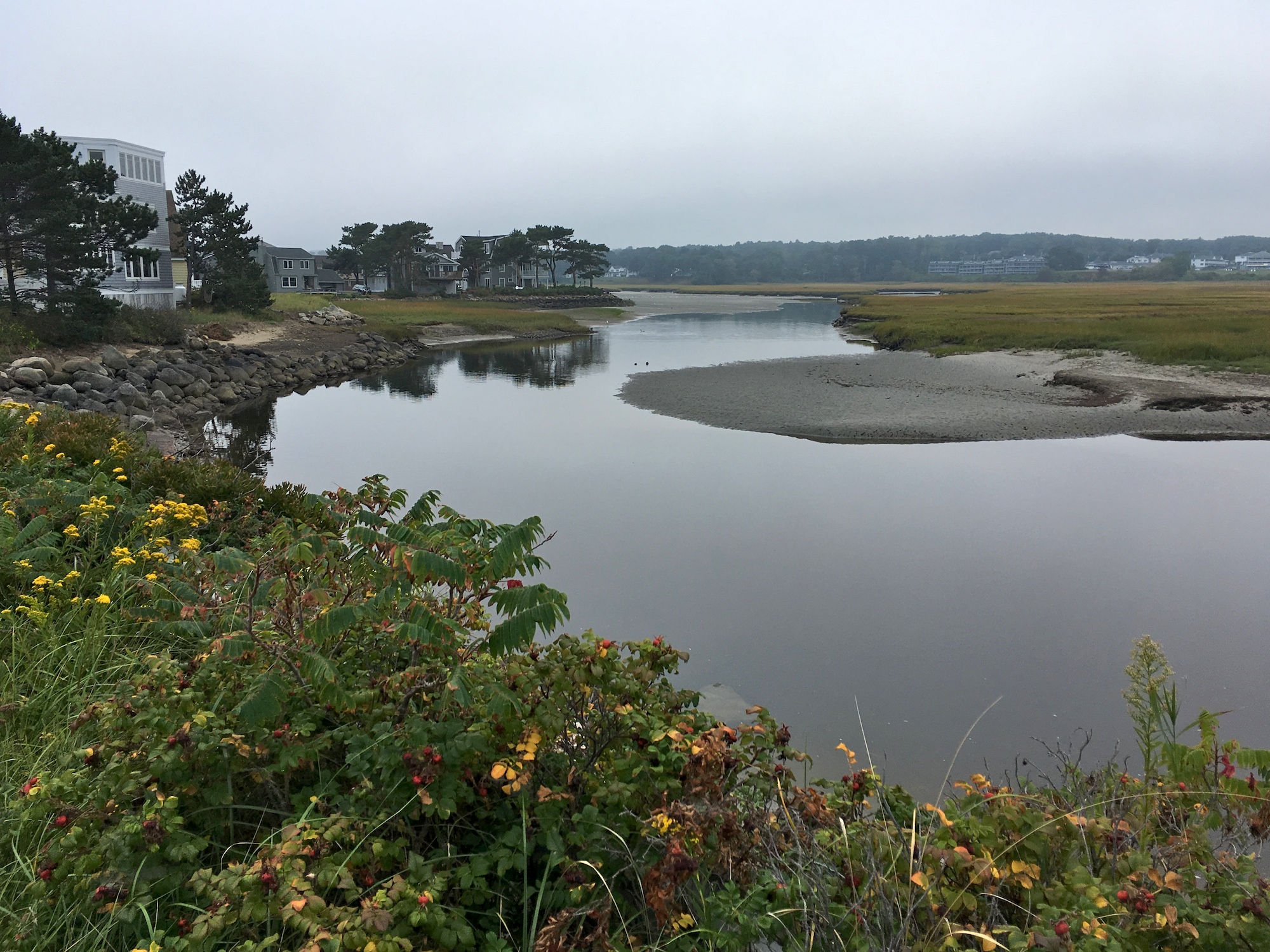
Ogunquit River at mid tide
Wells Beach
Unlike Moody Beach, Wells Beach is open to the public. It is more than one and a half miles long. This is another great location for drone flying, as long as you keep regulations and safety in mind.
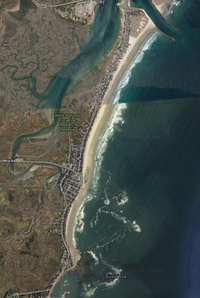
Map of Wells Beach
The Mile Road connects the mainland to Wells Beach. There are a few public access points to the beach from the road.
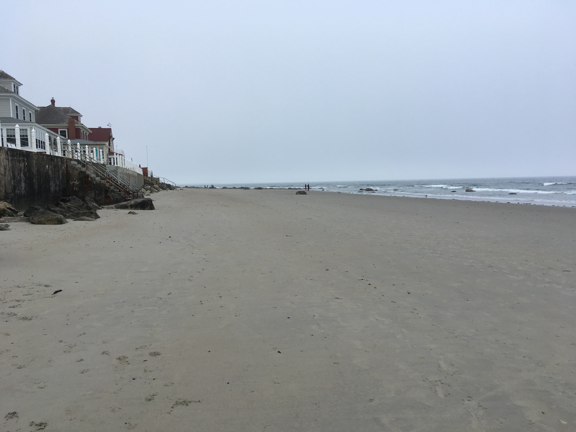
Wells Beach, looking north
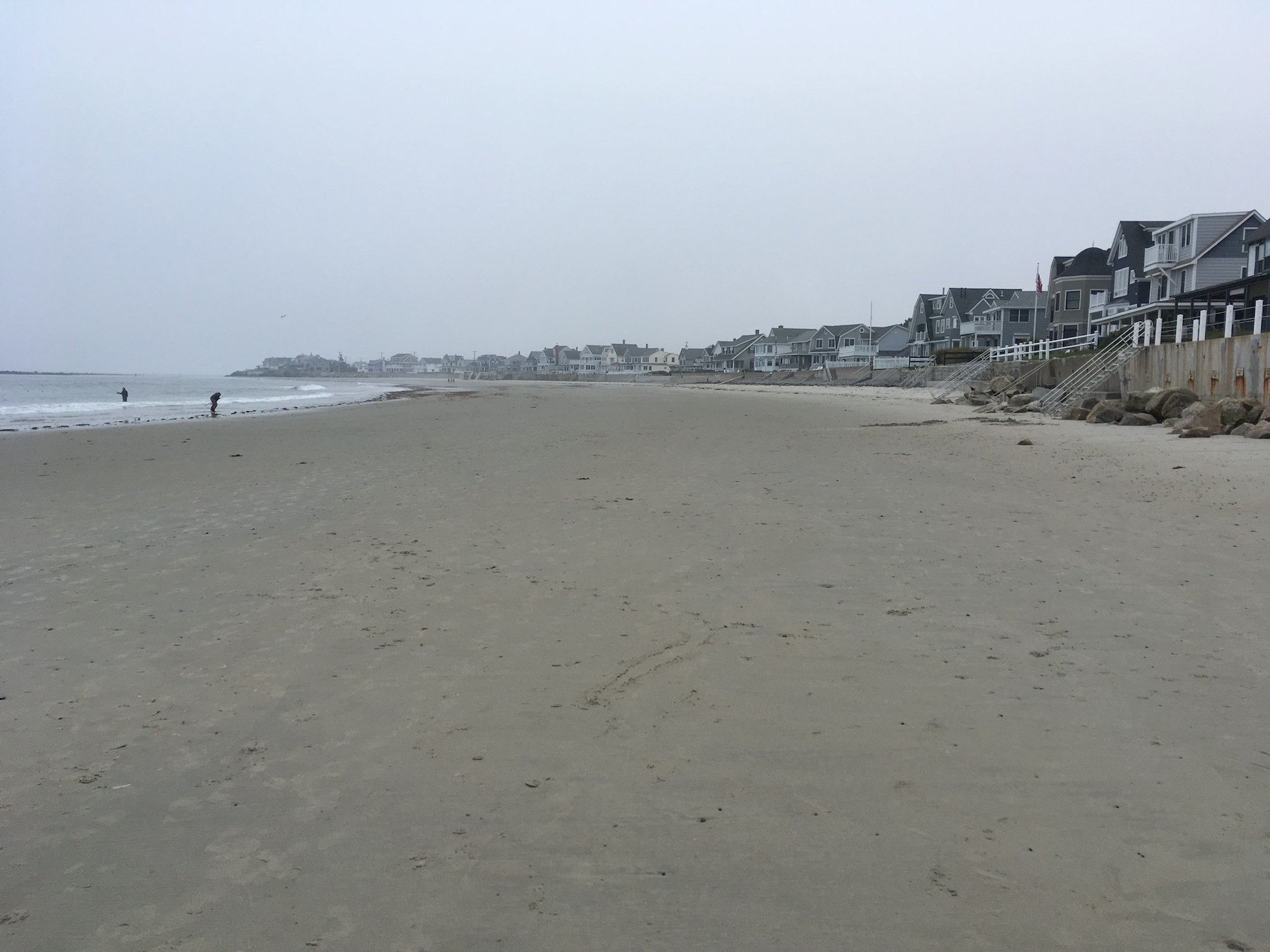
Looking south
Drakes Island Beach
Immediately to the north of Wells Beach, separate by two enormous jetties alongside the entrance to Wells Harbor, is Drakes Island Beach.
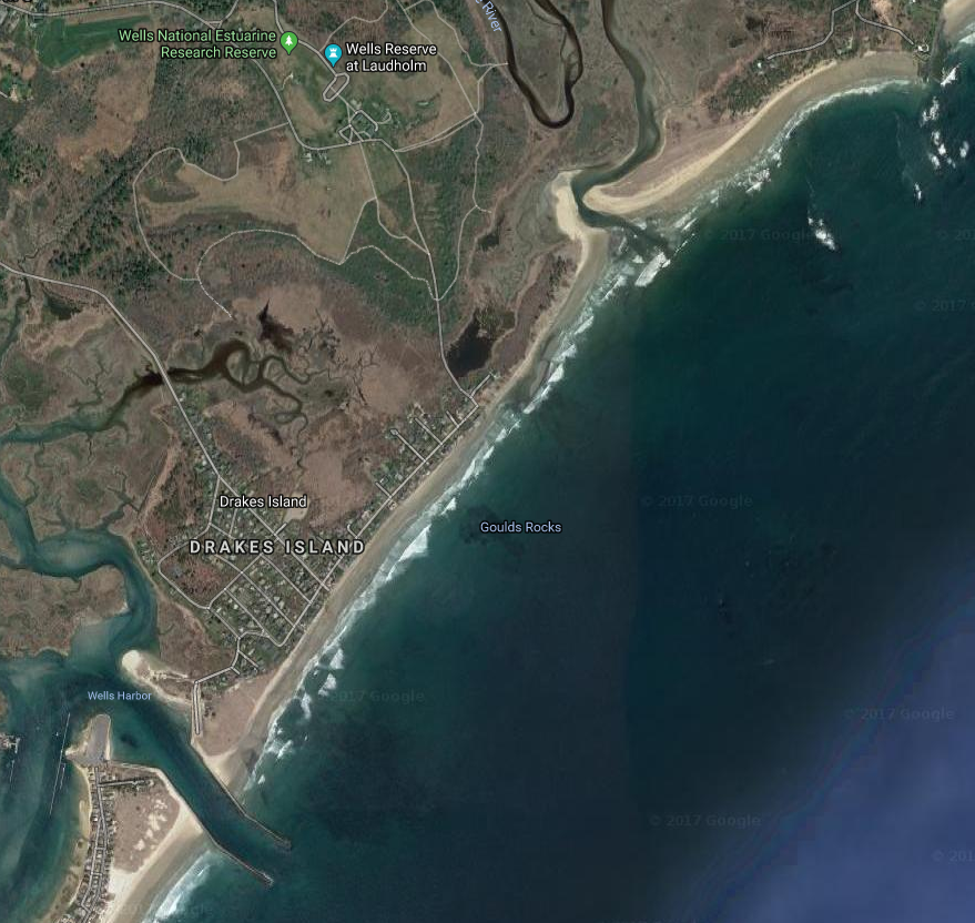
Google Maps Drakes Island Beach
There are two public access points to the beach. One is found at the end of Drakes Island Road, and the other by the jetty at the southern tip. I wasn’t aware of the enormous jetty until after the trip. It would have been a great place to fly planes from.
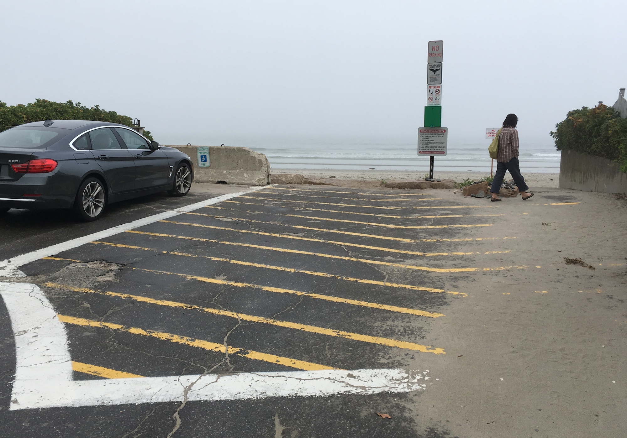
One public access point to Drakes Island Beach
360° panorama of a small section of the Drakes Island Beach
Gooch’s Beach
Gooch’s Beach is the longest beach in Kennebunkport. You can’t chat up a local at this beach without the local telling you about the Bush compound at Walker’s Point. The point is named Walker, after the great-grandfather of President George H. W. Bush. Locals will stand on the beach and point in the general direction of the Bush compound, as if one could see the compound behind the Kennebunk jetty, the Old Fort Point, and the Blowing Cave Park.
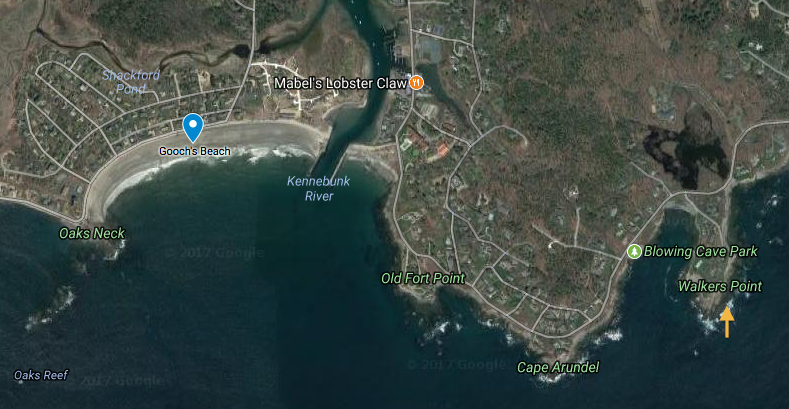
Gooch’s Beach and the Bush compound
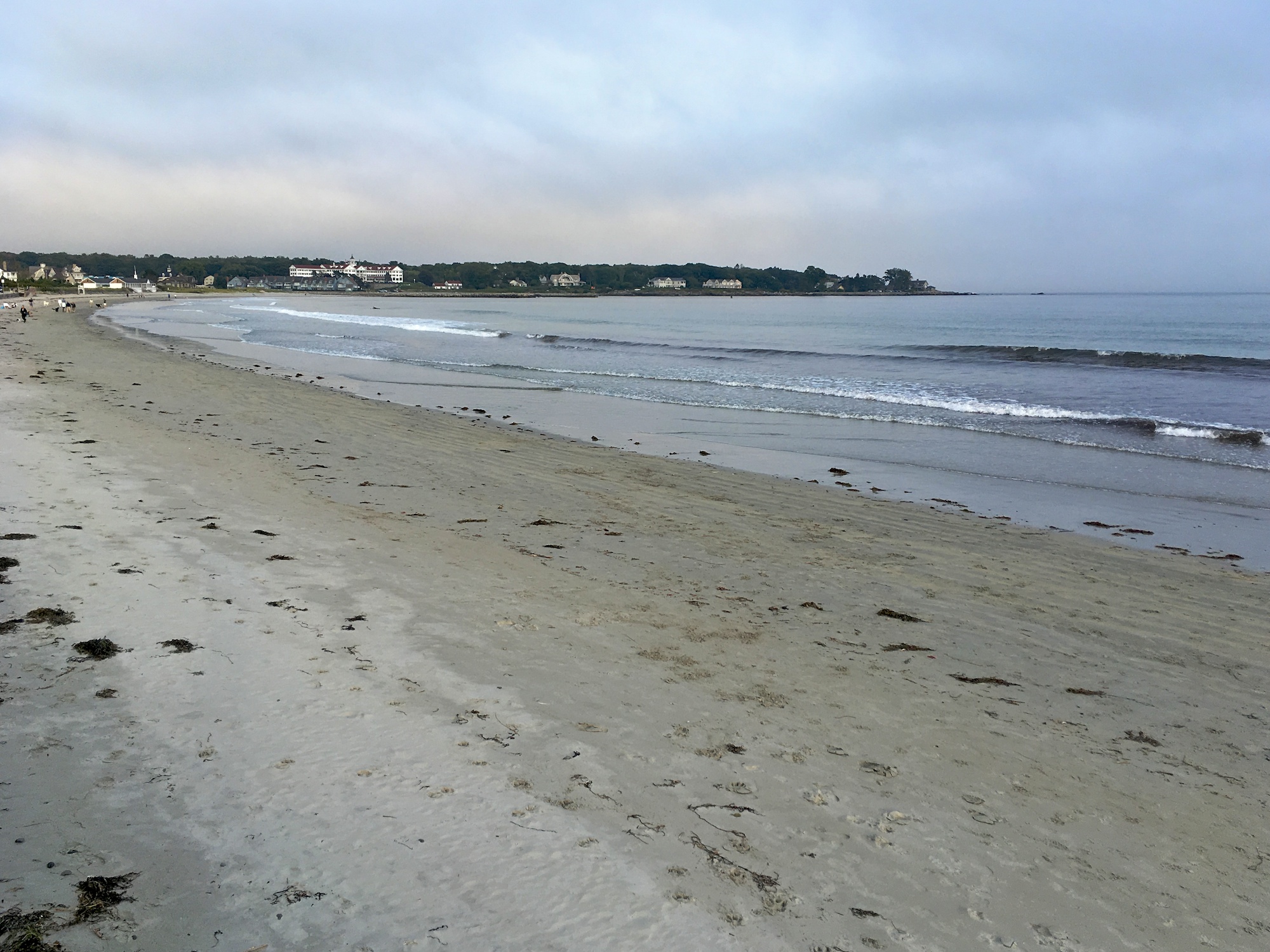
Gooch’s Beach, Kennebunkport
360° panorama of Gooch’s Beach
Cape Neddick and York Beach
York Beach is a strange place. It is not one beach. According to Wikipedia it consists of two beaches, Long Sands Beach and Short Sands Beach, separated by Cape Neddick. But Cape Neddick is, at the same time, a census-designated place (CDP) in the town of York which includes the two beaches in York Beach. This sounds like a conundrum. But I suspect it is a result of one label being used to name a geographical area, as well as a political boundary, just like the age-old dilemma, “Queens is on Long Island, but Long Island does not include Queens“.
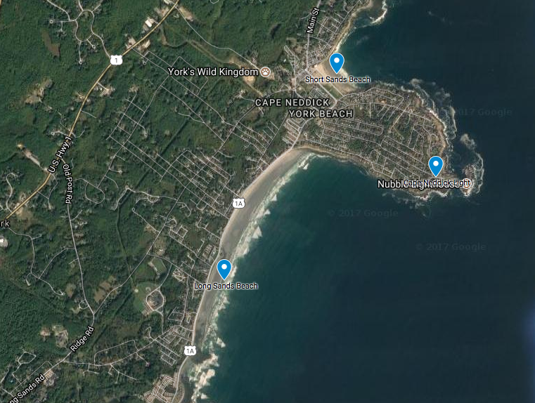
Map of Cape Neddick and York Beach
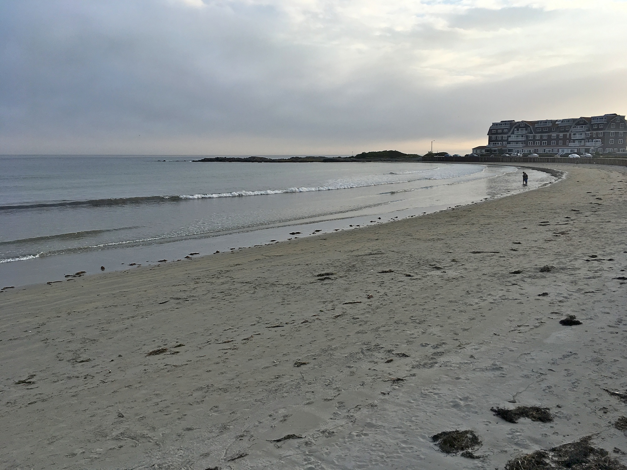
We start with the Short Sands Beach. This is a modestly-sized beach. Unlike its segregated sibling to the south, this beach is surrounded by a heavily-commercialized neighborhood.
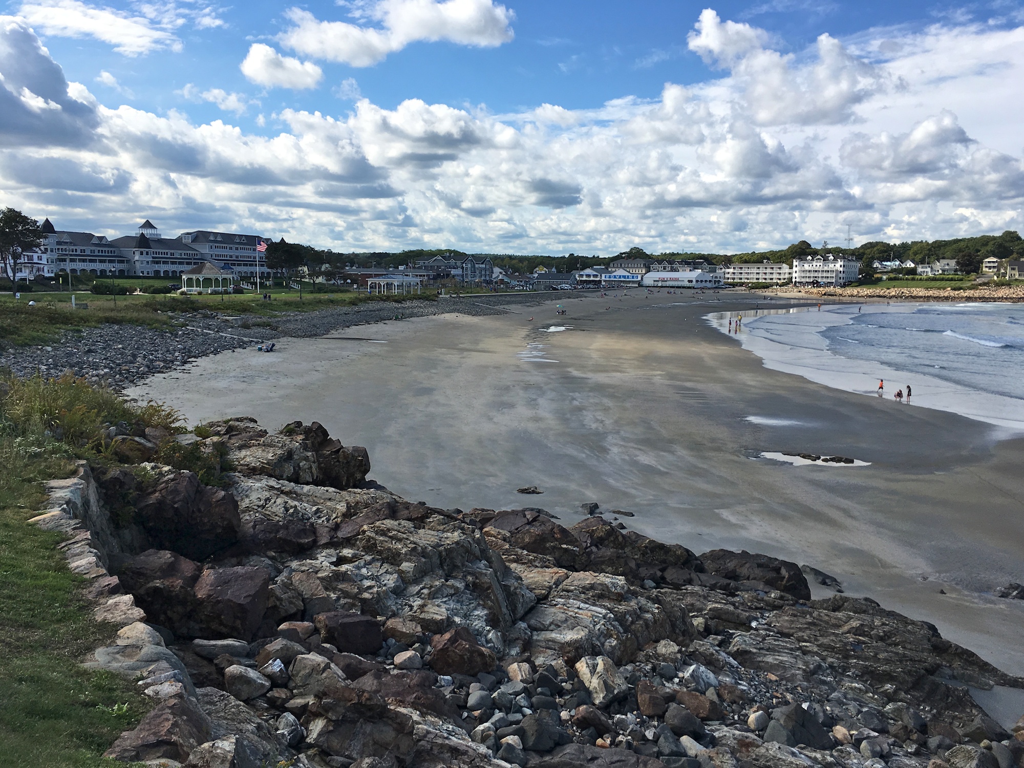
Short Sands Beach at York Beach
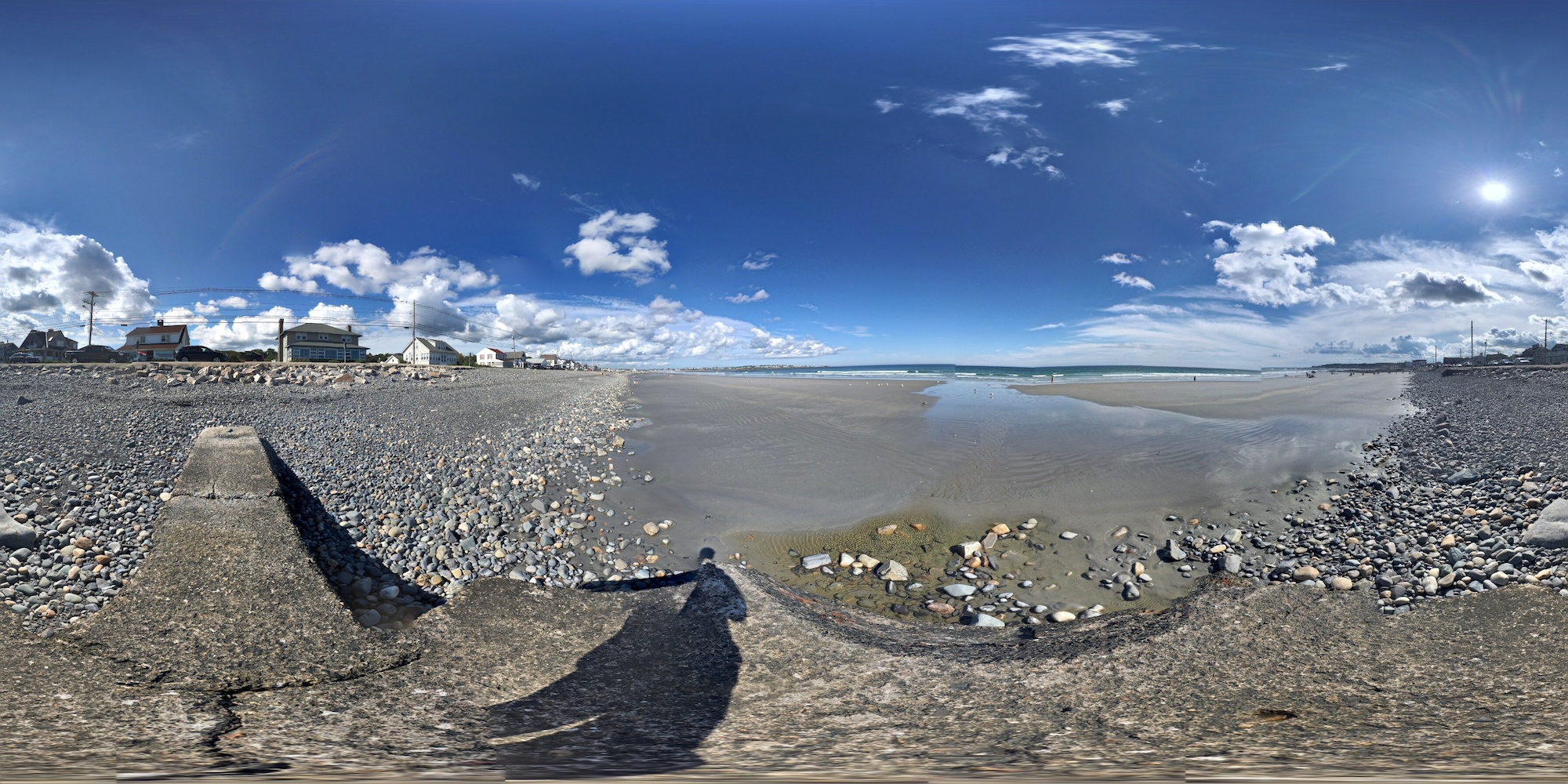
360° panorama of Short Sands Beach
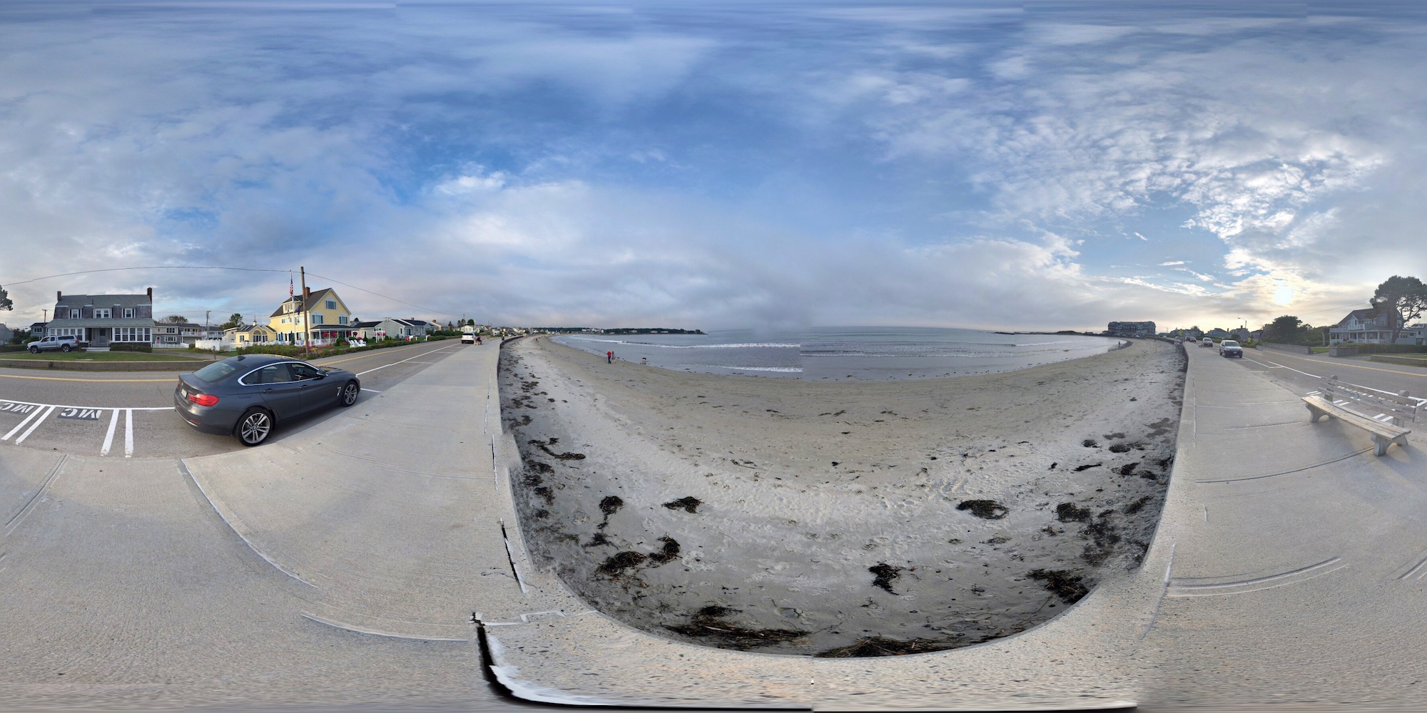
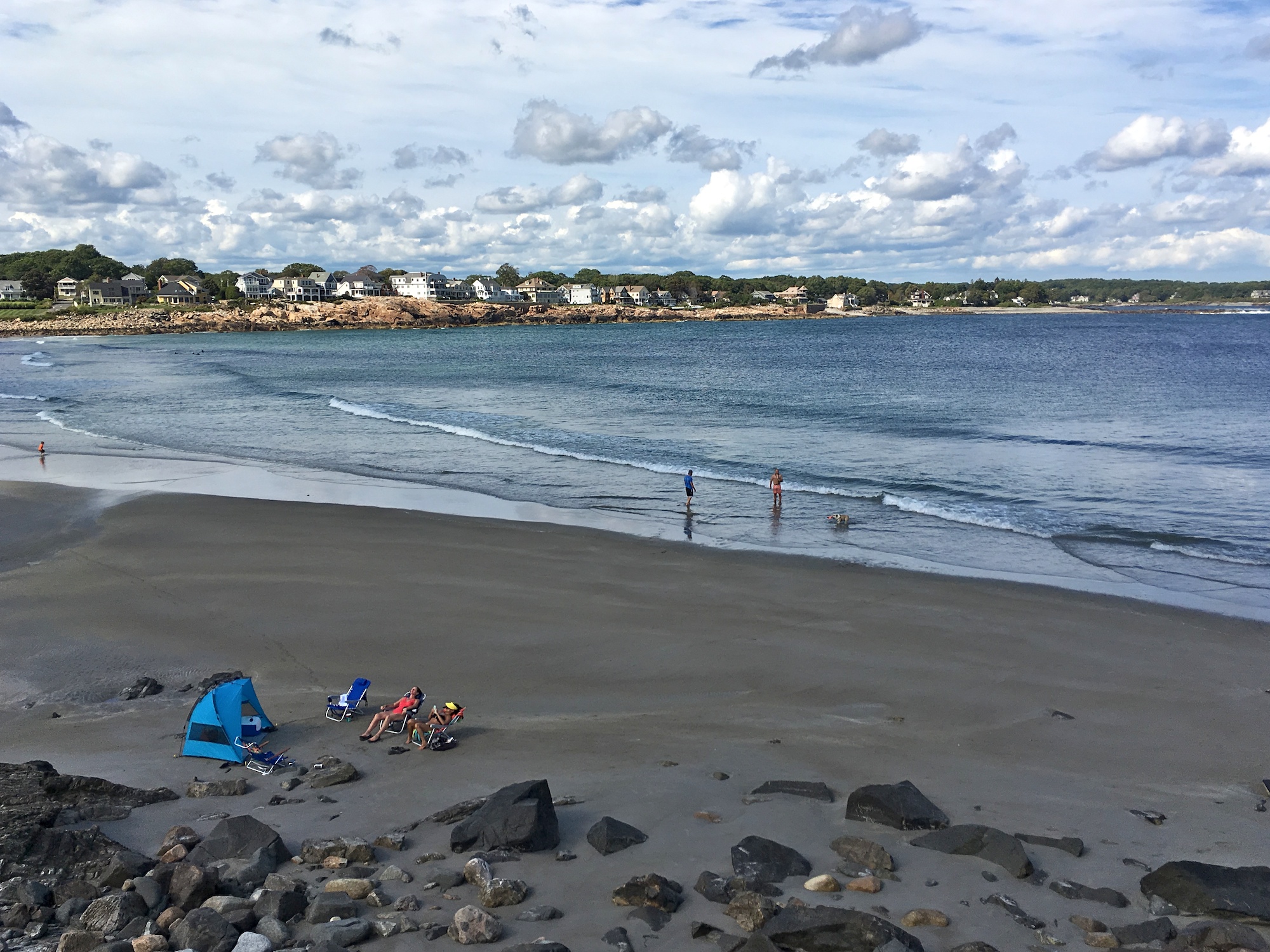
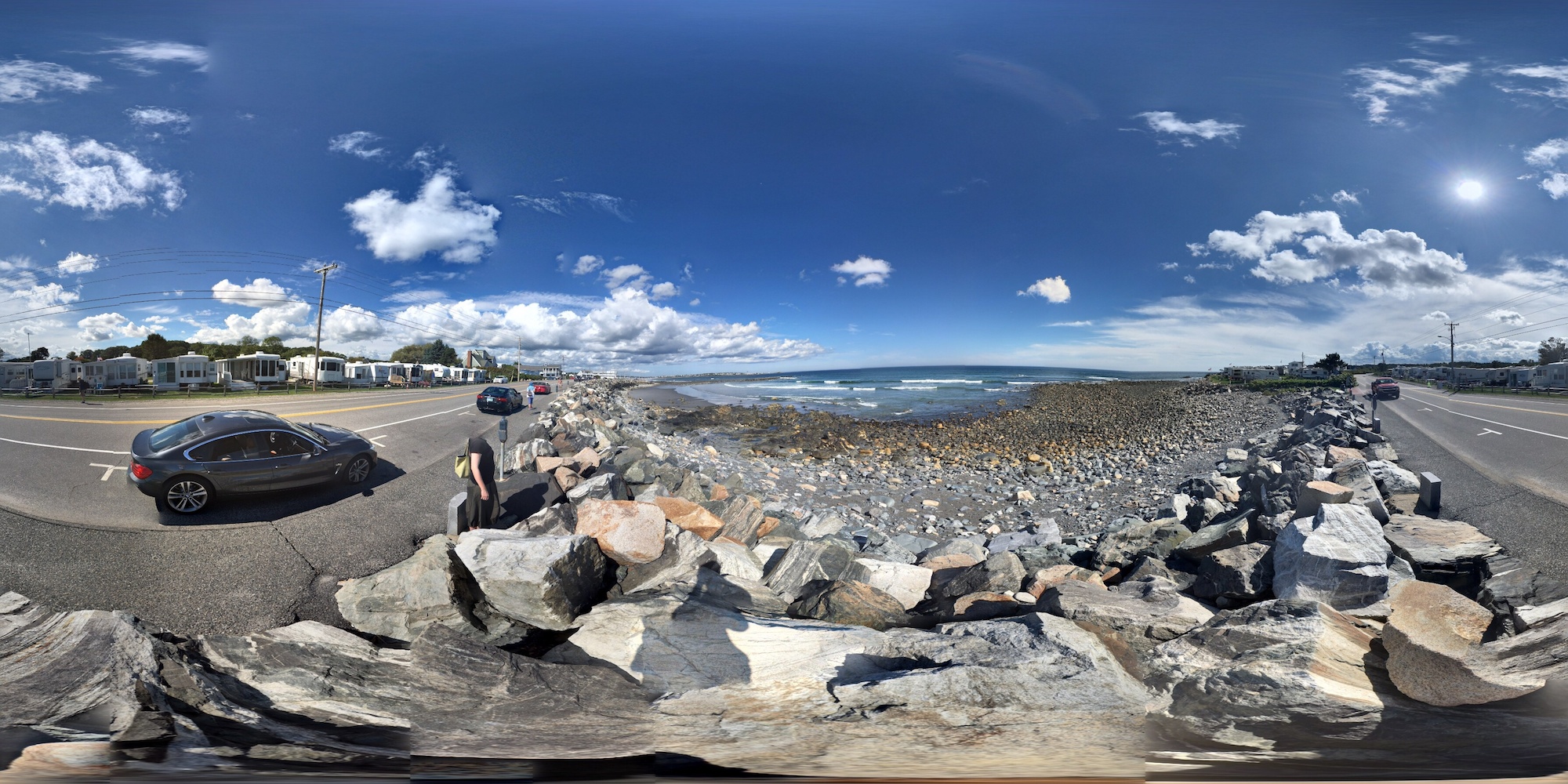
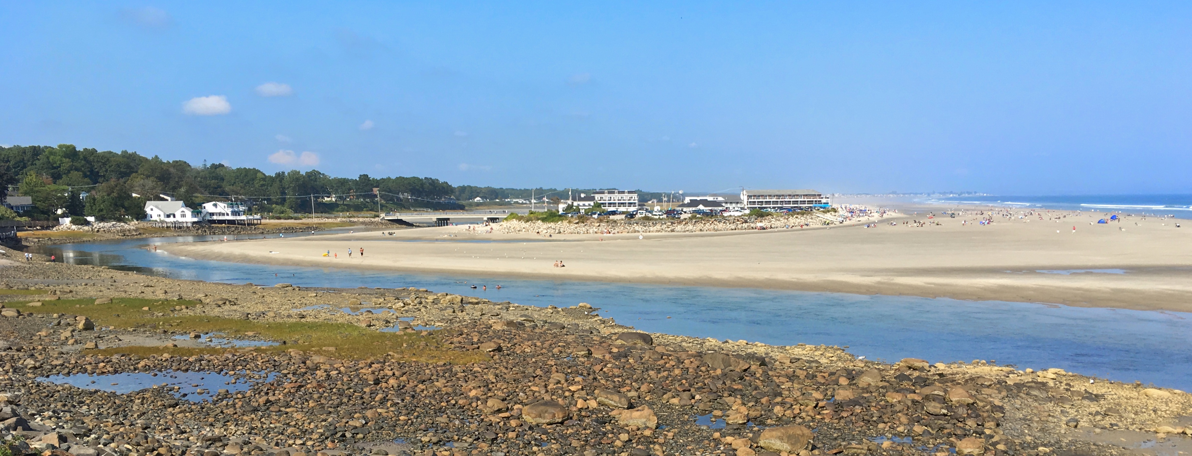
The Long Sands Beach is, er, much longer than the Short Sands Beach.

Long Sands Beach at York Beach
360° panorama of Long Sands Beach
Another section of the Long Sands Beach
Cape Neddick Light is also known as Nubble Light. This is probably not a good place for drone flying. Enjoy the scenery though.
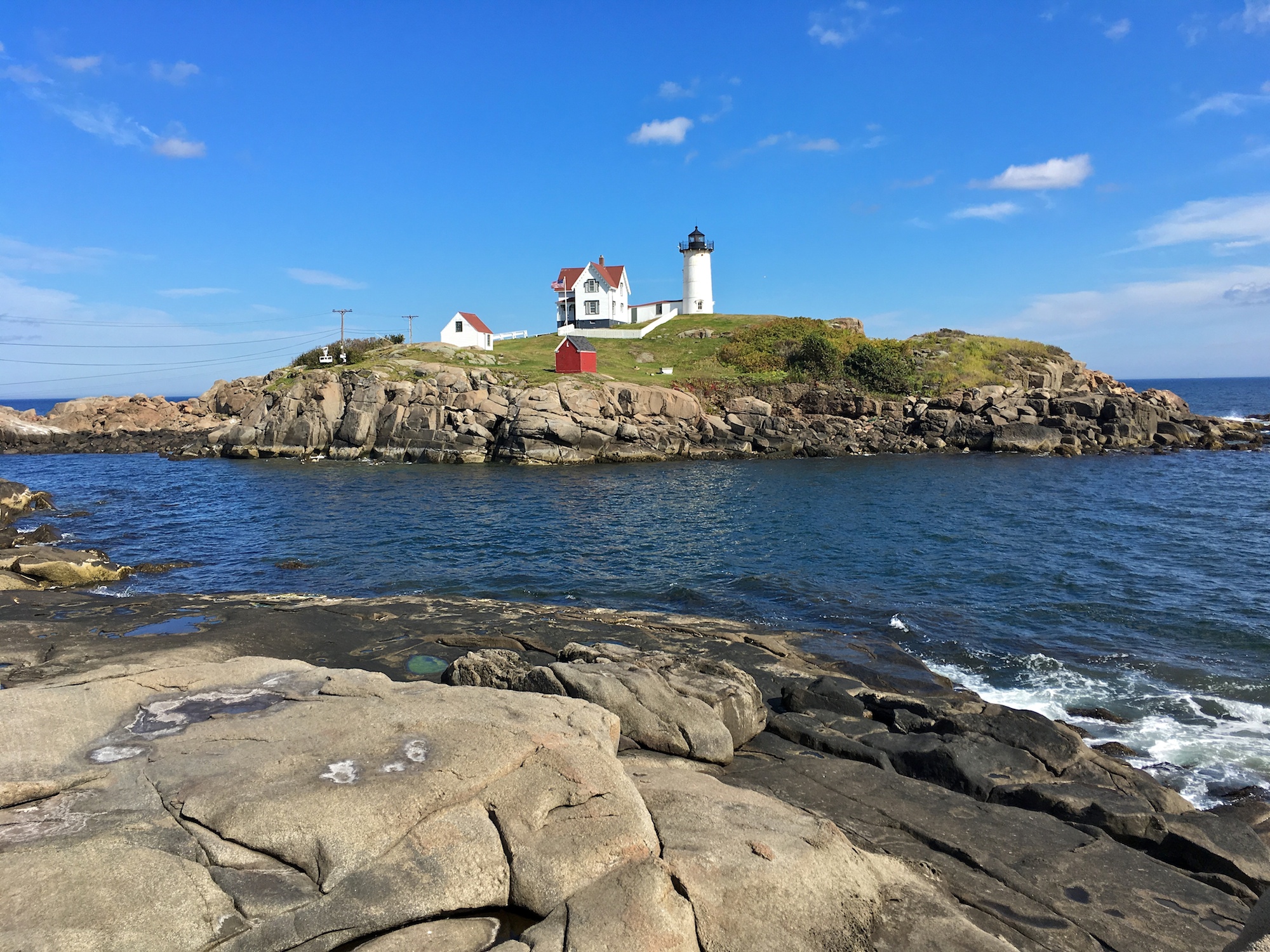
Cape Neddick Light – Nubble Lighthouse

Cape Neddick Light – Nubble Lighthouse
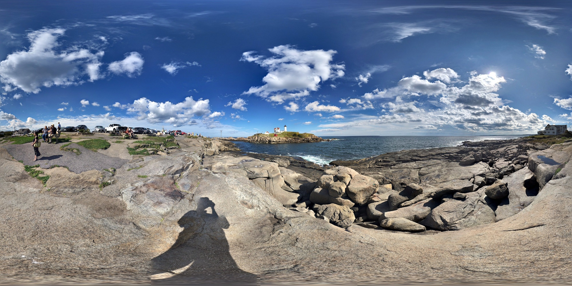
360° panorama of Cape Neddick Light – Nubble Lighthouse
The end
Remember that this is the last and the most useful part of the Ogunquit in September Guide, for the model aeronautically-inclined. The previous installment can be found at Ocean Terrace Rooms at Cliff House.
I hope you find the guide useful. Go forth and fly responsibly. Also, try not to make garbage.


Hi! I love how informative and great your articles are. Can you recommend any other blogs that share recipes of Indian Curries or authentic Indian cuisine? Thanks a lot!