
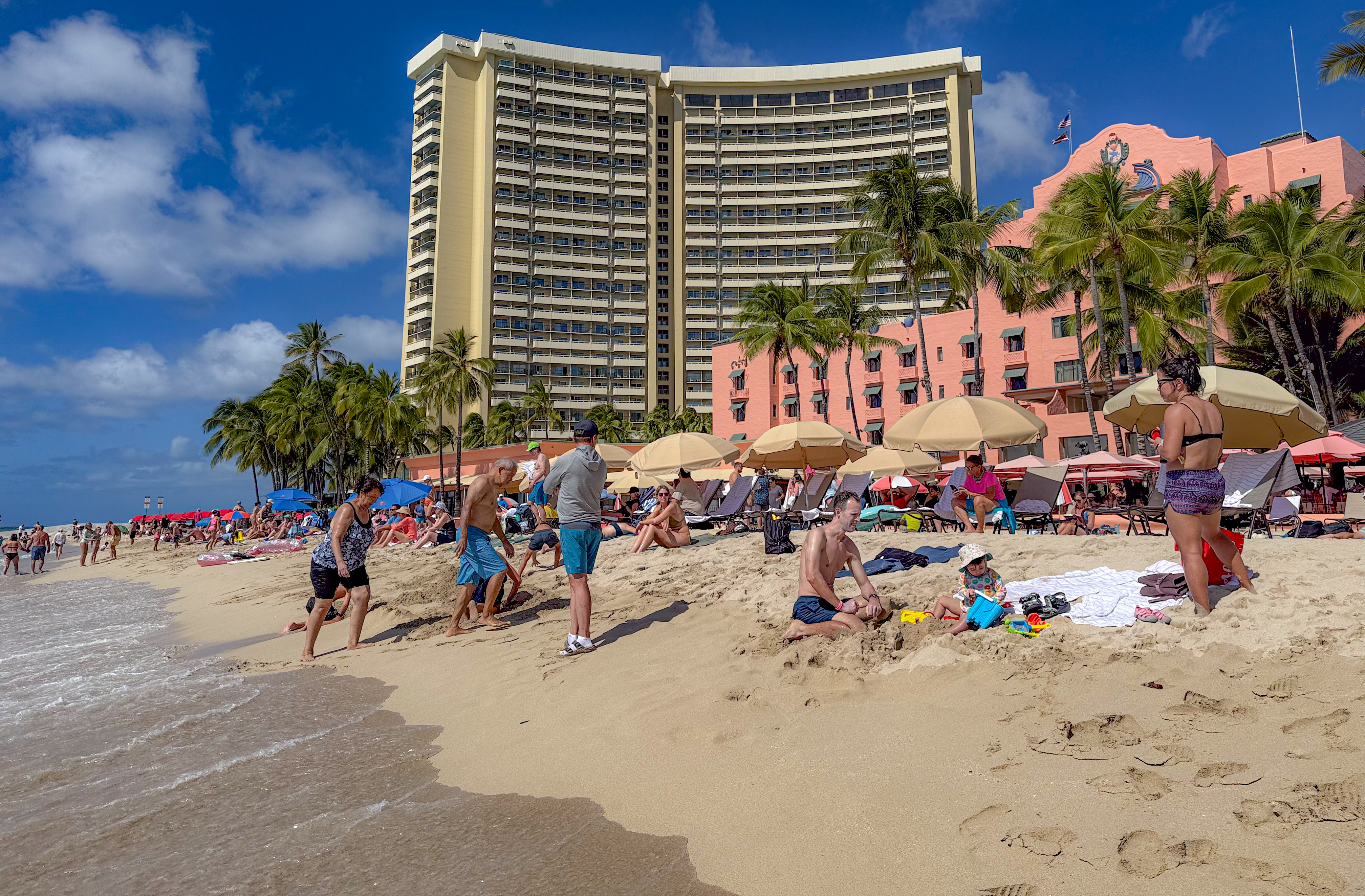
Kūhiō Beach at Waikīkī, along with its two walled ponds, is often misunderstood. It is frequently lumped together with the rest of Waikiki beaches and dismissed as eternally crowded – “like a zoo”, as they say. In reality, each beach along Waikiki Bay has its own distinct vibe, shaped by differences in location, reef structure, parking access, and proximity to oceanfront resorts.
Surfers begin gathering at Kuhio Beach well before sunrise, paddling out to Canoes, arguably the most popular surf break along all of Waikiki beaches. Long before swimmers arrive at the walled ponds, surfers are already catching waves on the reef just outside the west pond. Even after sunset, silhouettes of surfers can still be seen braving the break, moving against an ocean painted with the fading afterglow of dusk.


I don’t know what Kuhio Beach looks like in summer or during the holiday season, but I can describe what it feels like to stay beside it for a week in November. The experience was noticeably different from influencer videos that highlight midday crowds during peak months. It also felt less touristy than portrayed by websites written by people who have something to sell to you.
- Where is Kuhio Beach
- What is Kuhio Beach
- Your first day begins at sunset
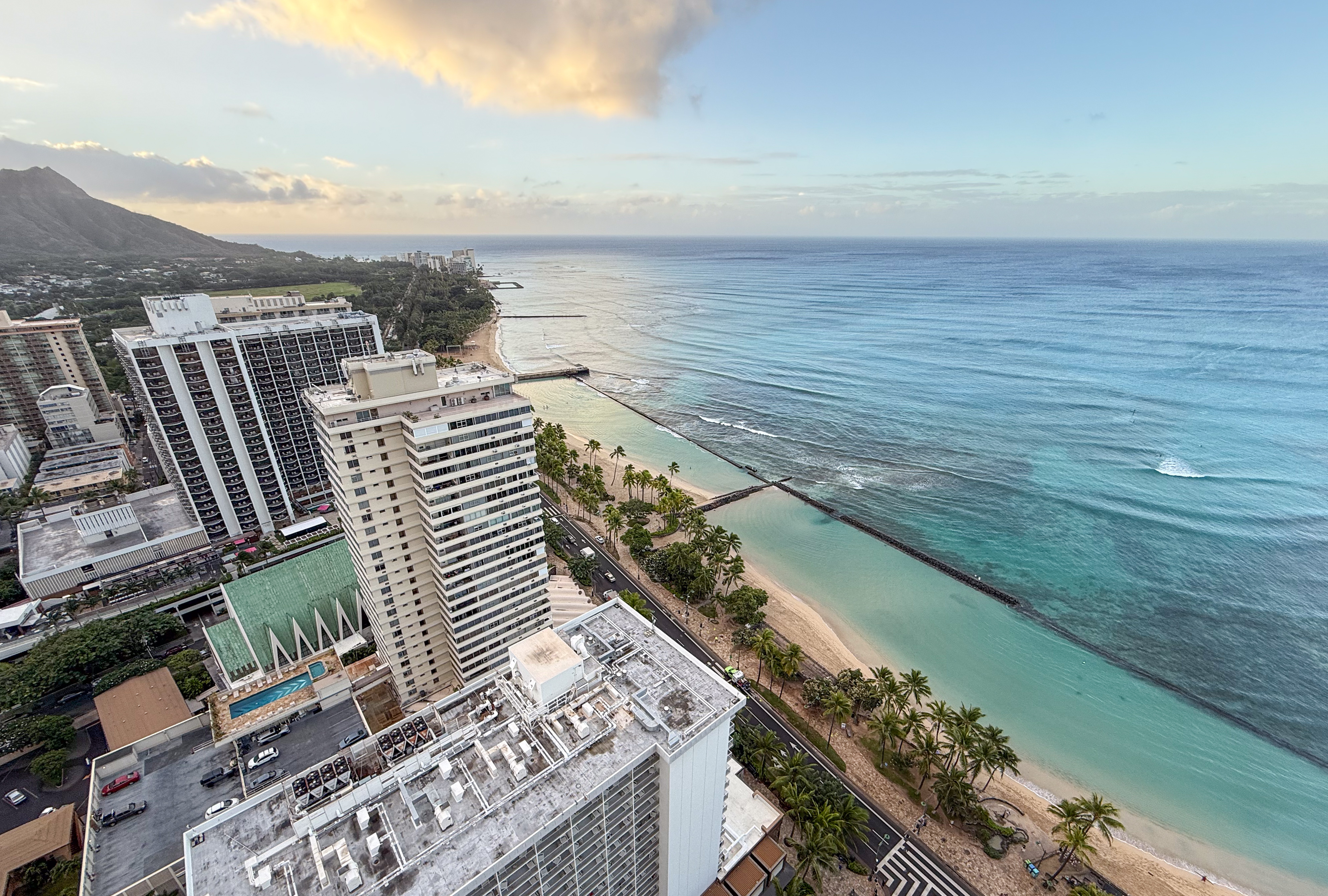
- Kuhio Beach at sunrise
- Taking a morning swim at Kuhio Beach
- Noon crowd at Kuhio Beach
- Waikiki Beach Center
- Waikiki Beach or Royal-Moana Beach
- Boat traffic through Canoes break
- Snorkeling at Kuhio Beach
- Around Kuhio Beach
- The Waikiki skyline
- Rainy and shoulder seasons at Oahu
- Rainbows at Oahu
Where is Kuhio Beach
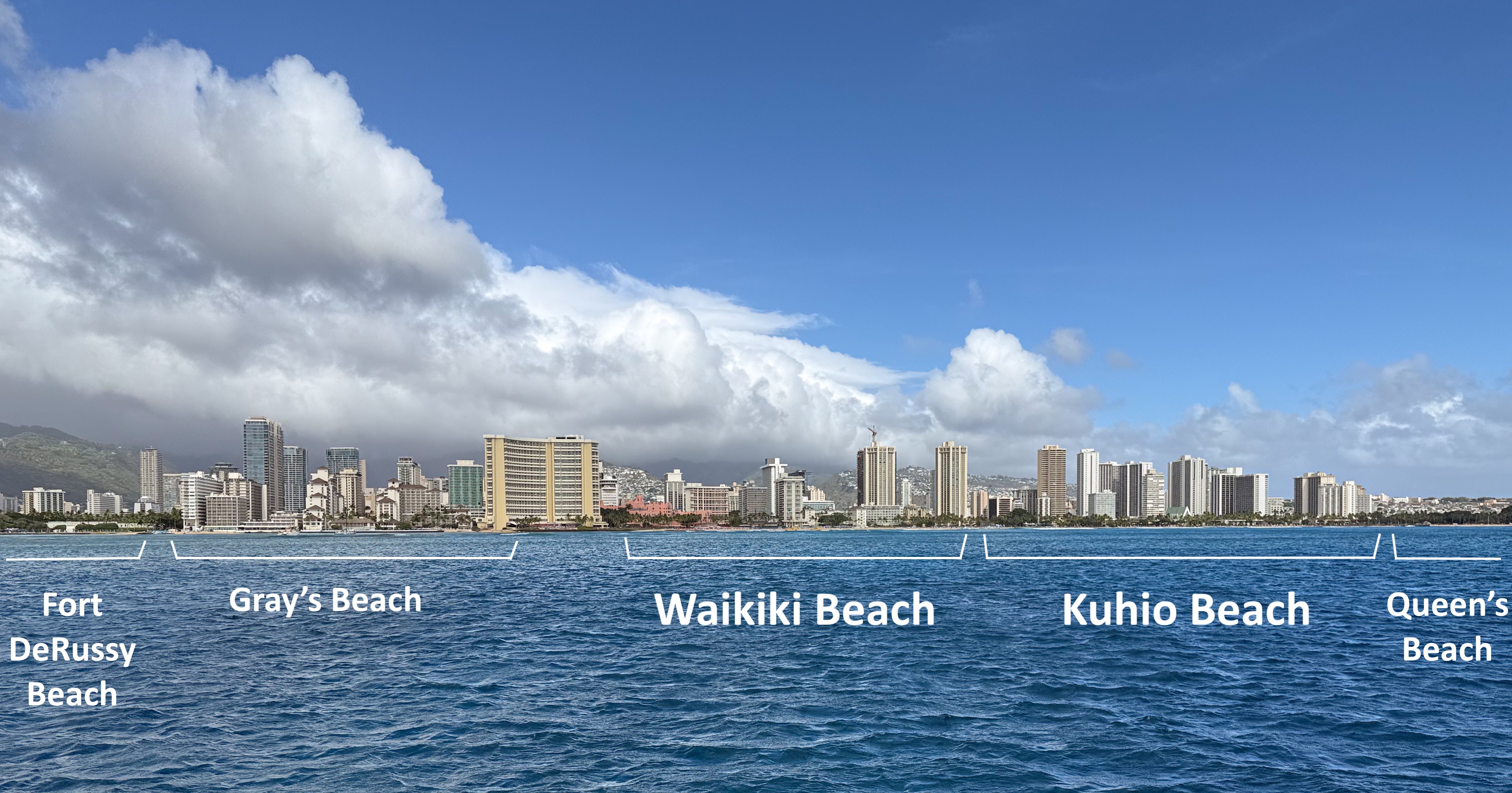
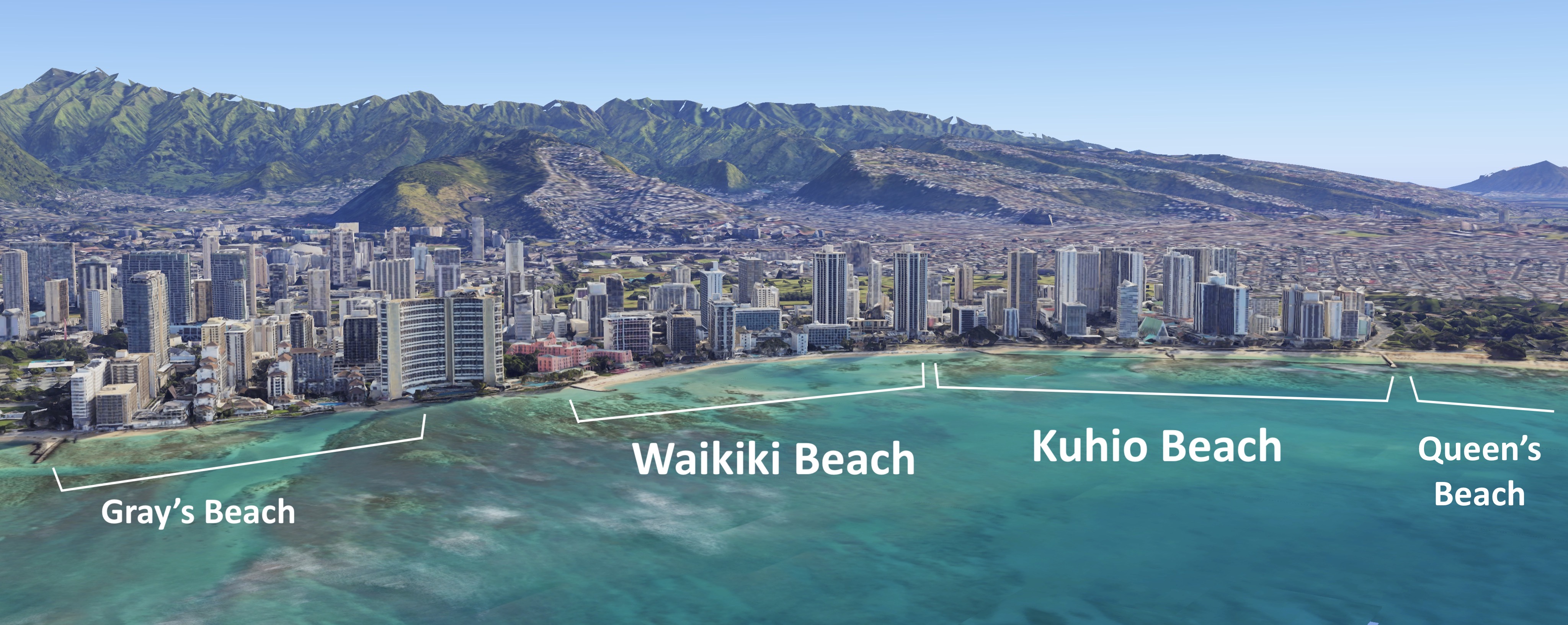
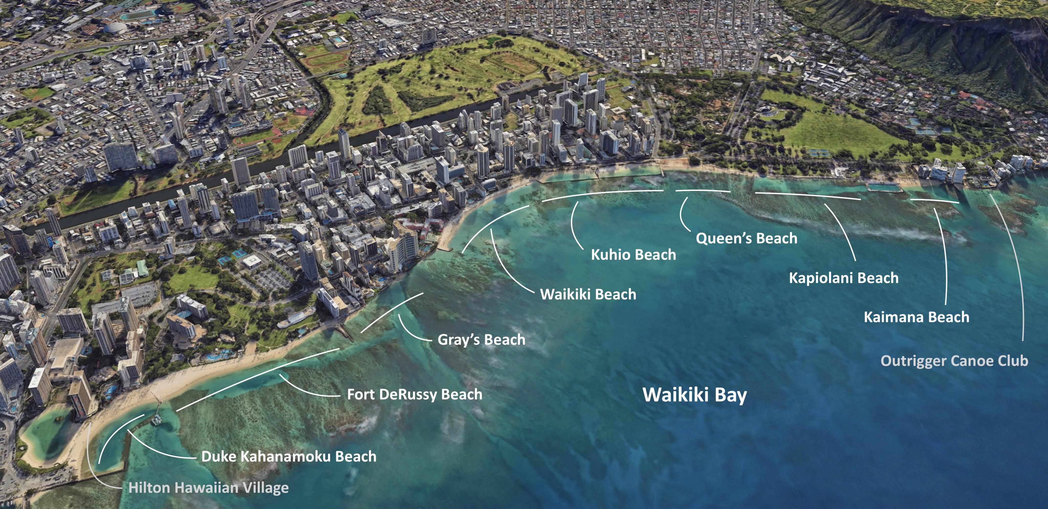
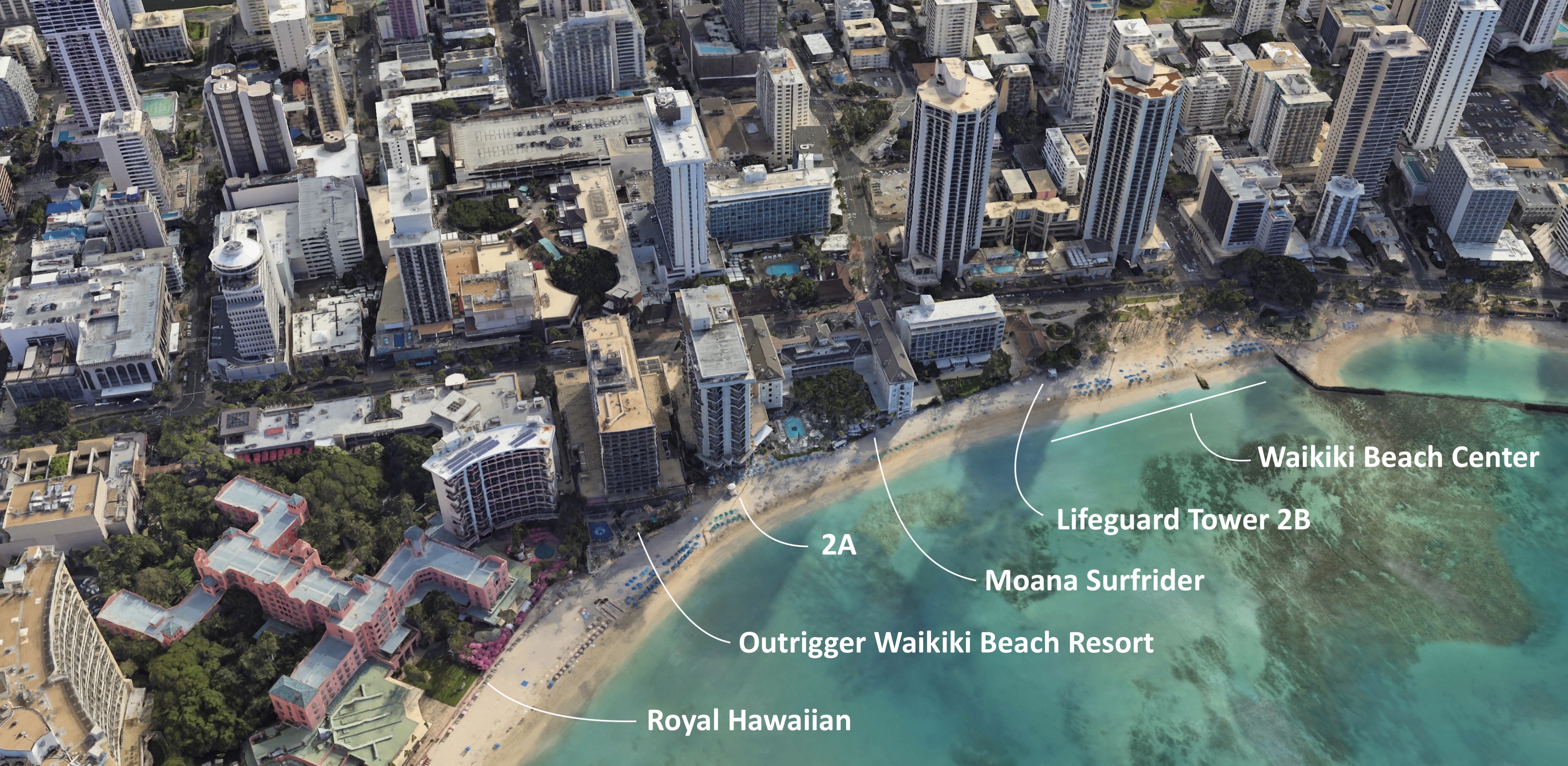
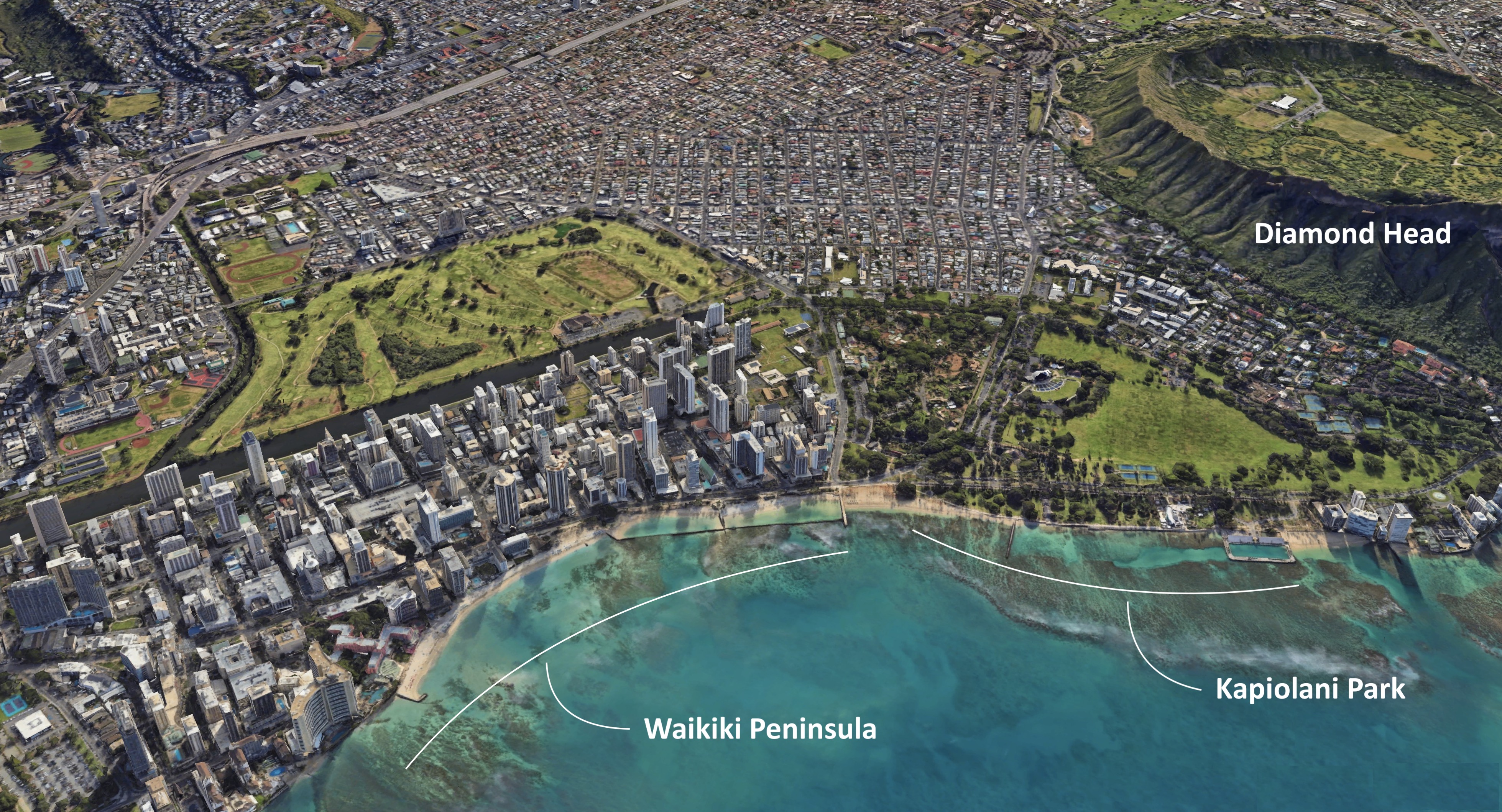
Kuhio Beach is one of six beaches along Waikiki Bay, all located within the Waikīkī district. From west to east, they are Duke Kahanamoku Beach, Fort DeRussy Beach, Gray’s Beach, Waikiki Beach, Kuhio Beach, and Queen’s Beach. For more info see this.
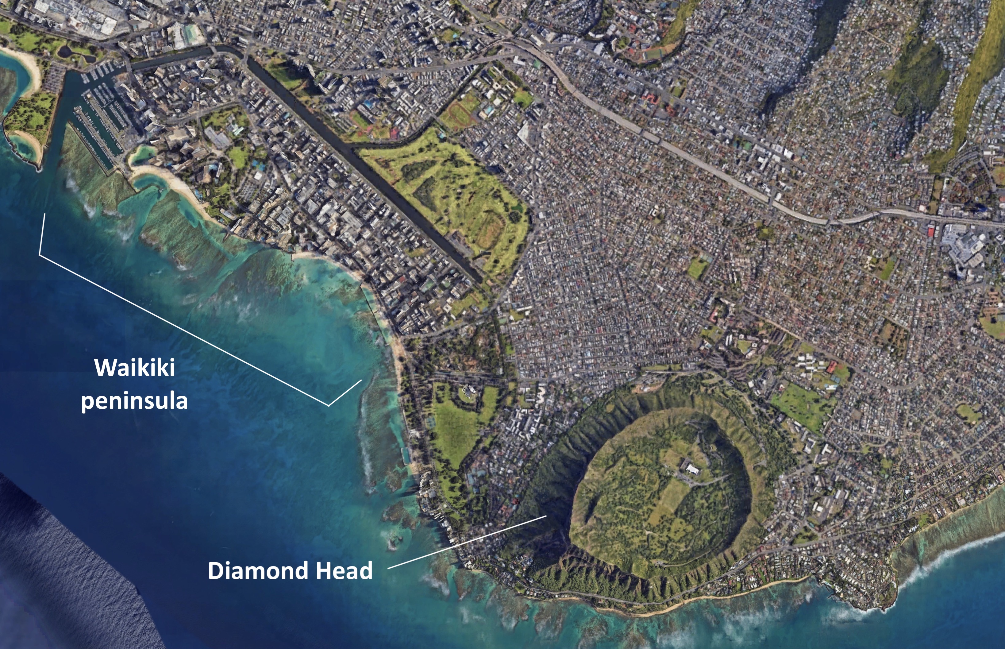
The Waikiki district is a man-made peninsula in Honolulu. It sits close to Diamond Head, and as a result the dormant volcanic crater features prominently in many pictures taken from the six Waikiki beaches.
It is surprisingly difficult to find free maps of Waikiki in the familiar guidebook style. I ended up photographing an official map while out for a walk, and it later proved useful while writing this essay. I wish I had access to it during the planning stage of the trip. For those interested in surfing, snorkeling, kayaking, or diving, the Oahu Hawaii Dive Guide from Franko Maps is worth purchasing. It is a two-sided laminated map.
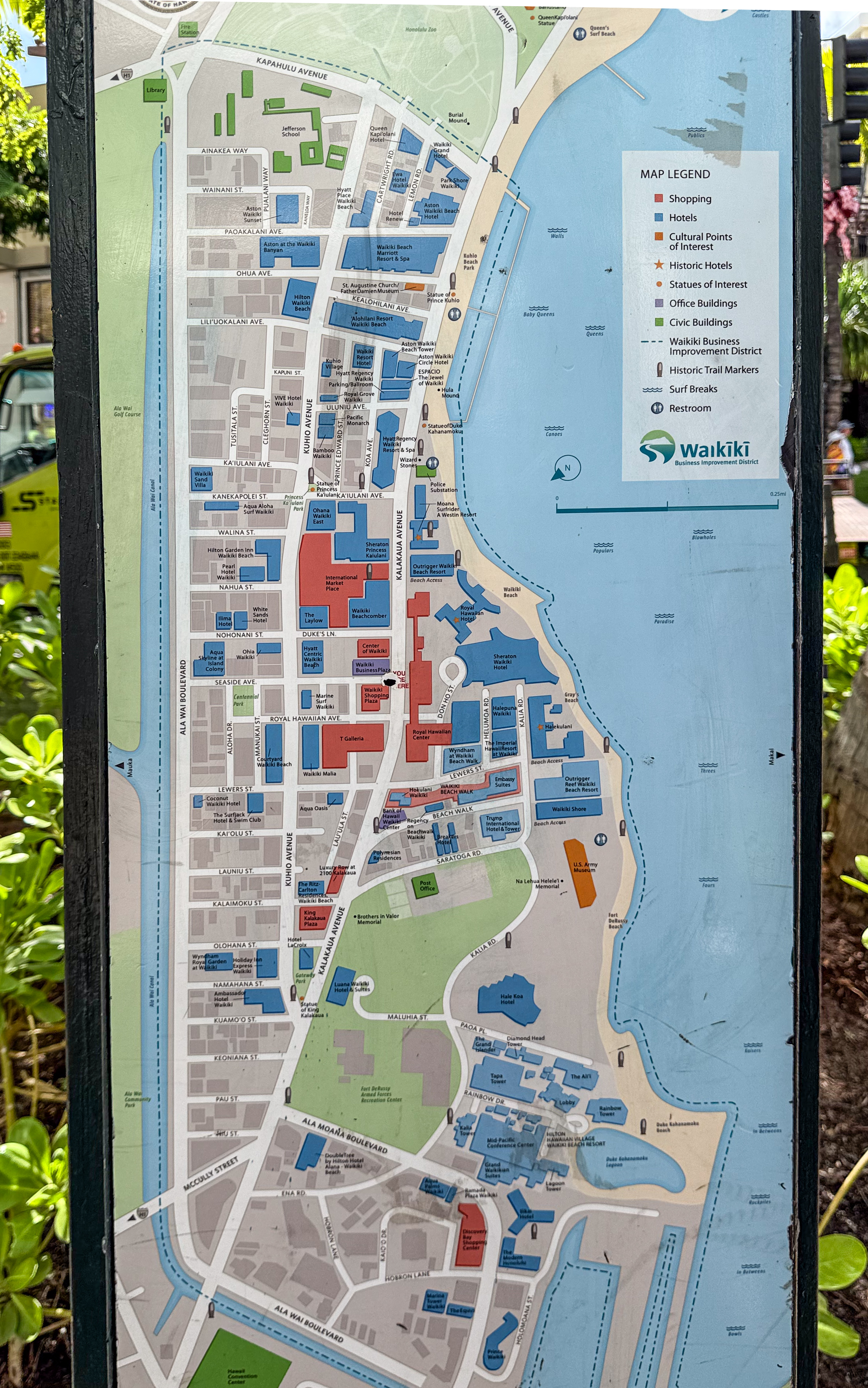
For a deeper understanding of Waikiki’s landmarks and how Kuhio Beach fits into the broader layout, as seen from a plane departing Oahu, refer to this post.


What is Kuhio Beach
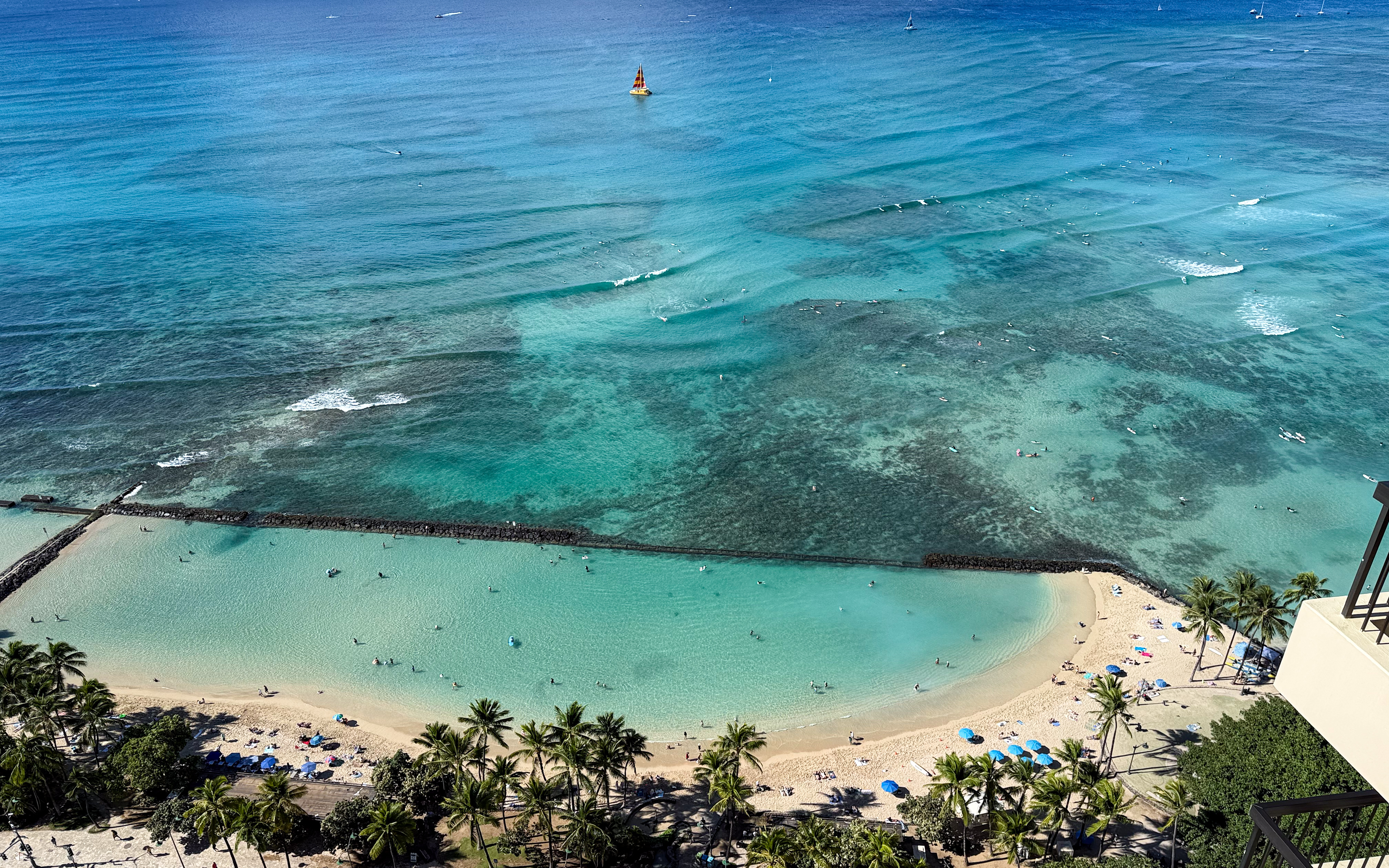
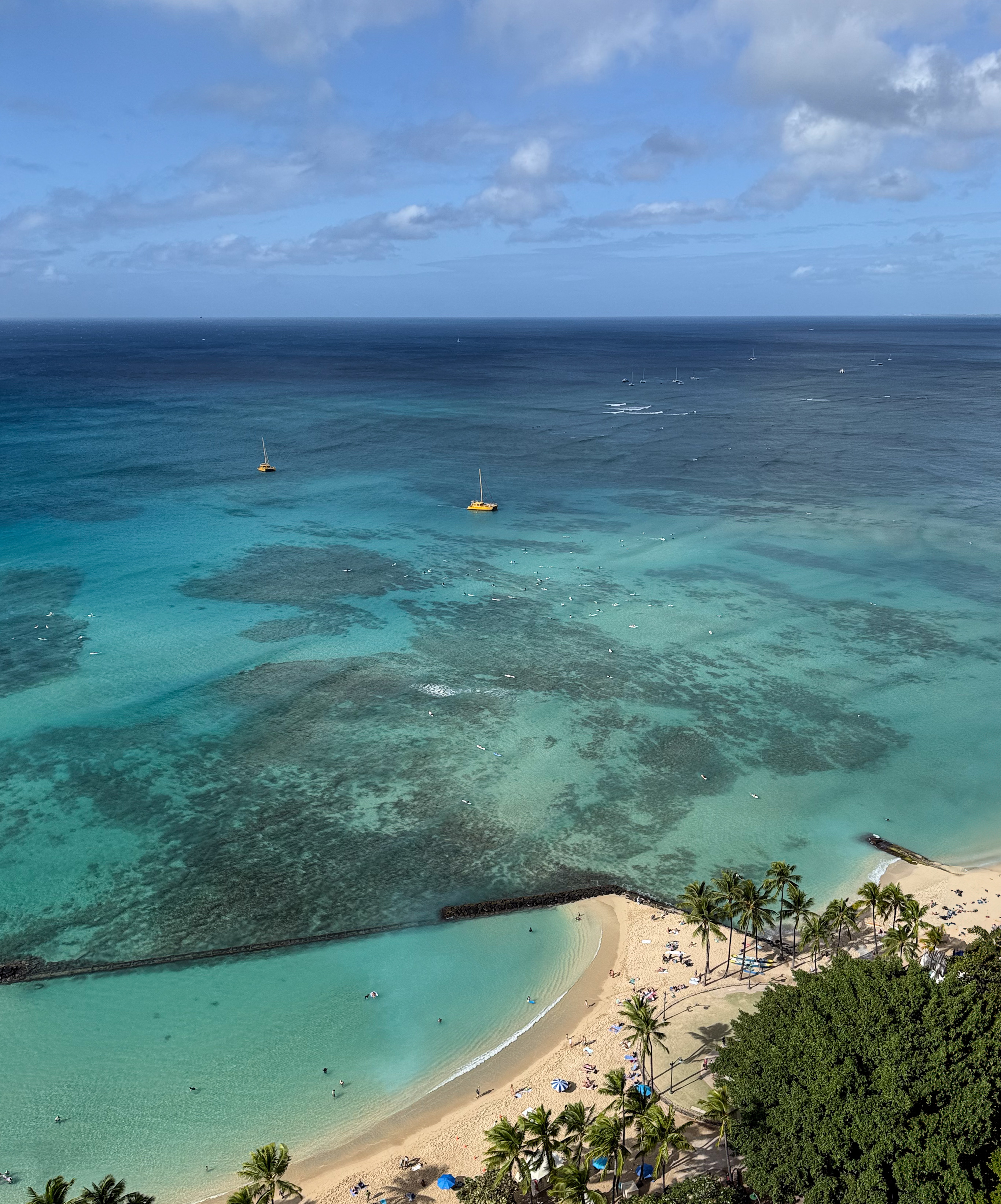
This stretch of sand is officially called Kuhio Beach Park and includes two walled swimming areas affectionately known by locals as “the ponds”. There are no colloquial names that distinguish one from the other, and generally local adults do not swim in these artificial pools. Instead, they use these ponds mainly to paddle out to the surf breaks. For clarity, I will refer to them as the west pond and the east pond, based on their geographic locations. Locals do bring kine keiki (the children) to these shallow and safe ponds. Thus Kuhio Beach is often known as the Baby Beach.
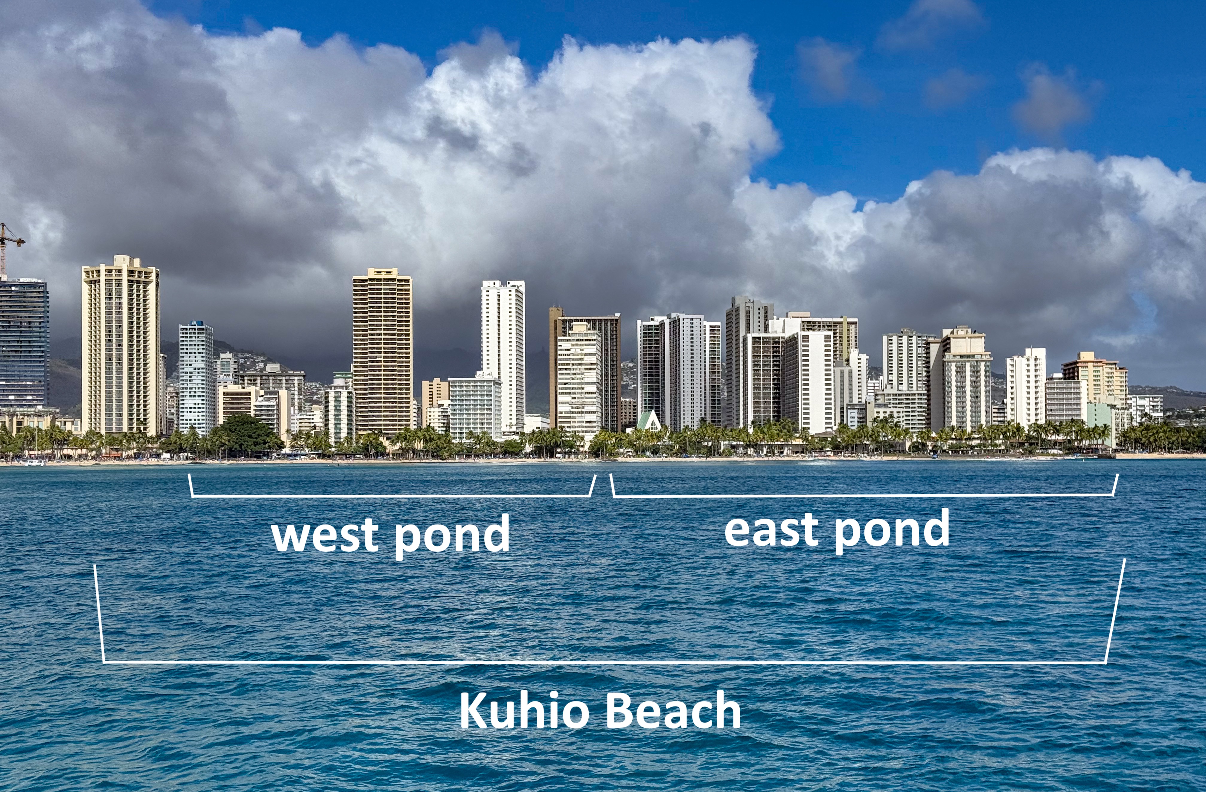

Reef and sand shape the underwater terrain, creating consistent spots where waves break, allowing surfers to catch them and ride toward the shore. These surf breaks are well known, with names such as Canoes, located outside the west pond, and Queens, located outside the east pond.

Canoes, the most popular surf break in Waikiki, is named for the Hawaiians and early surfers who launched outrigger canoes from this shore. Queens surf break takes its name from Queen Liliʻuokalani, who once had a beach home here. The name Queen’s Beach is actually a shorthand for Queen’s Surf Beach, a narrow stretch of sand named after the surf break. For more info see this.

Walls break is named after the east-end wall of the east pond, known as the Waikiki Wall. This broad concrete structure offers visitors a sweeping view of the entire Waikiki shoreline.
Locals often refer to the Waikiki Wall simply as “The Wall.” Technically, it is a groyne (or groin) and was originally called the Kapahulu Groin, as it extended from a storm drain running beneath Kapahulu Avenue, the Kapahulu Storm Drain. For more info see this and this.
The seawall stretches approximately 400 yards, spanning both ponds, which are separated by a divider with a sandy pathway. The east pond has two small inlets, while the west pond features a large inlet roughly 72 yards wide. At low tide, the underwater portion of the seawall in this large inlet sometimes emerges above the surface.

Confusingly, the entire two-pond structure is also colloquially called “the walls,” referring collectively to the concrete groyne, the long rocky/concrete seawall, and the dividers. Kids often call the inlets “gaps.” Surfers paddle through the two inlets on the west pond when heading out to Canoes. See this and this.
As mentioned, locals do not distinguish the two ponds by specific names. In theory, they could be called Canoes Pond and Queens Pond, after the nearby surf breaks, or Ewa Pond and Diamond Head Pond, using the directional labels locals adopt for west and east.
As it turns out, the Hawaii state government has formal names for these swimming areas, though they are never officially called ponds. Instead, the two are referred to as basins. Official documents refer to them as either the Ewa and Diamond Head basins, or the North and South basins. No locals actually use these terms colloquially. See this 1999 proposal to restructure the ponds which didn’t actually pan out. Also see this, this and this.
I don’t usually embed other people’s videos, but Jordan’s narrated videos are an exception. I don’t fly drones with high-resolution cameras on my vacations, so his footage provides the only bird’s-eye drone videos of Kuhio Beach Park here. Subscribe to his channel. He consistently produces high-quality videos.
Your first day begins at sunset
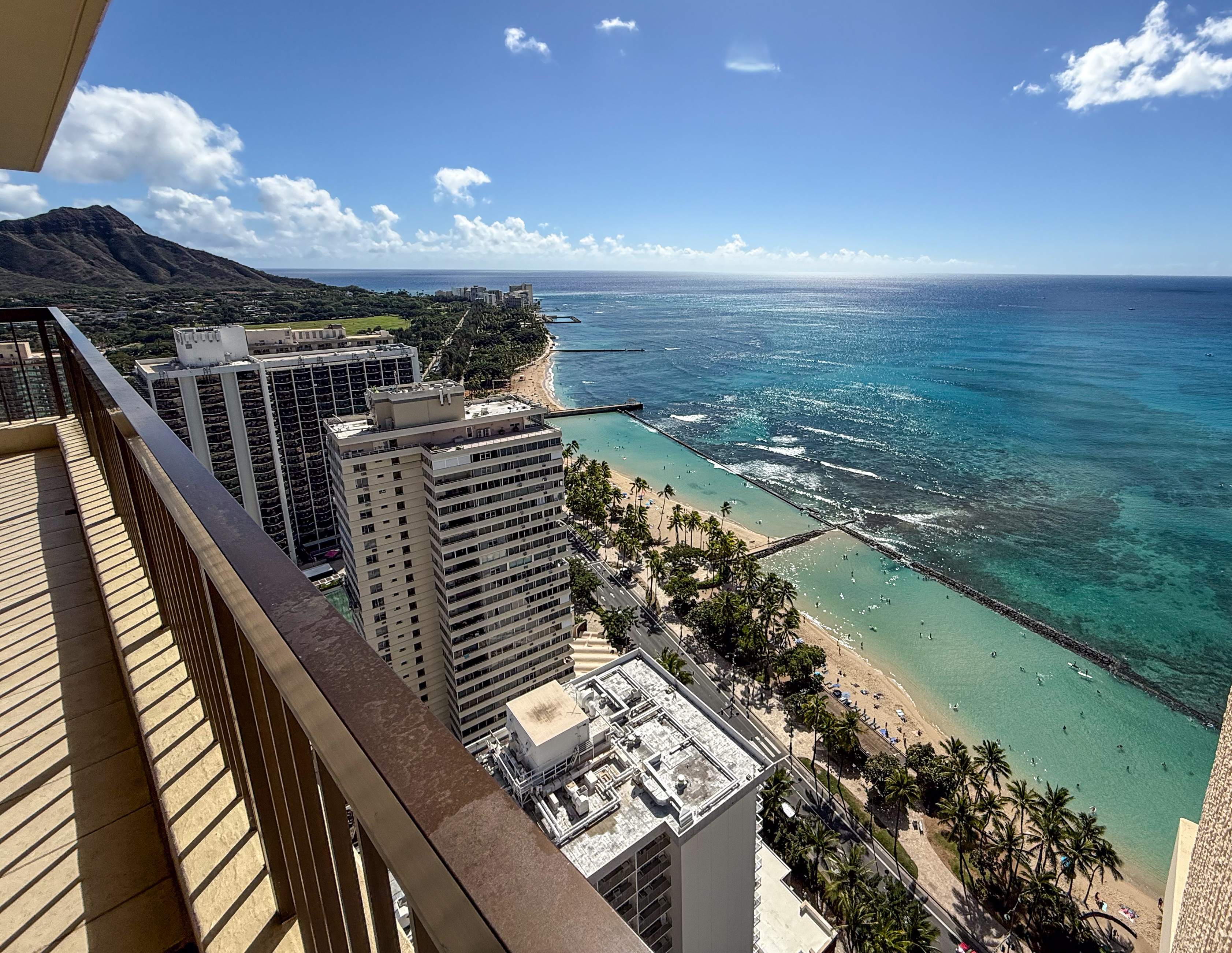
If you are staying by Kuhio Beach, your first day usually begins at sunset, simply because of the timing of your flight. By the time you settle into your room, the sun is already nearing the horizon. It is the first view you take in as you step out onto the lanai (balcony).

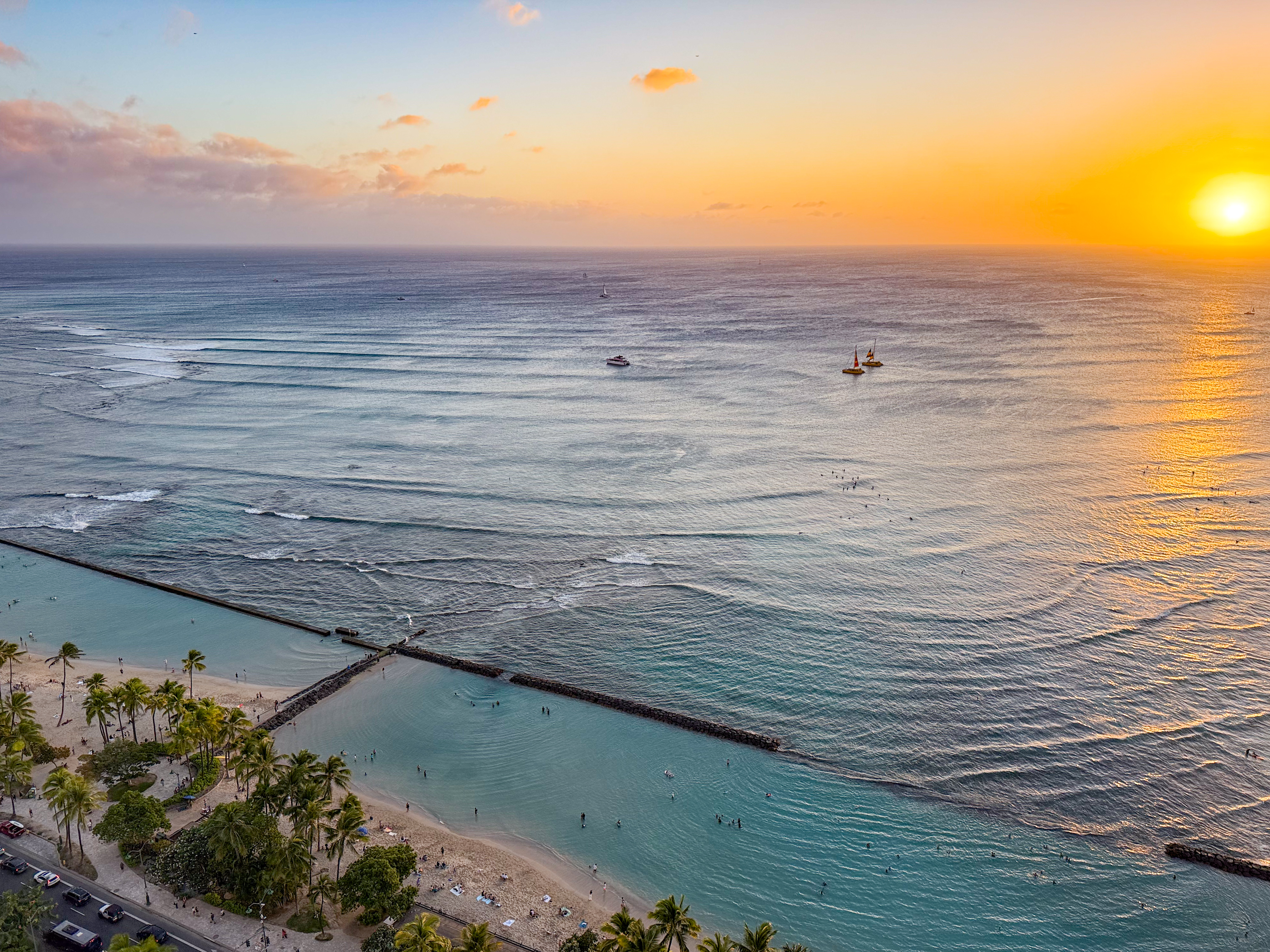
You can watch the sun sink below the horizon from Waikiki throughout the winter, thanks to the bay’s geographical orientation. In general, this view isn’t possible from Oahu’s windward, north, or south shores. I can only vouch for this spectacle during the winter shoulder season. In peak summer, the sun’s trajectory may set behind the landmass at Ewa when viewed from Kuhio Beach.
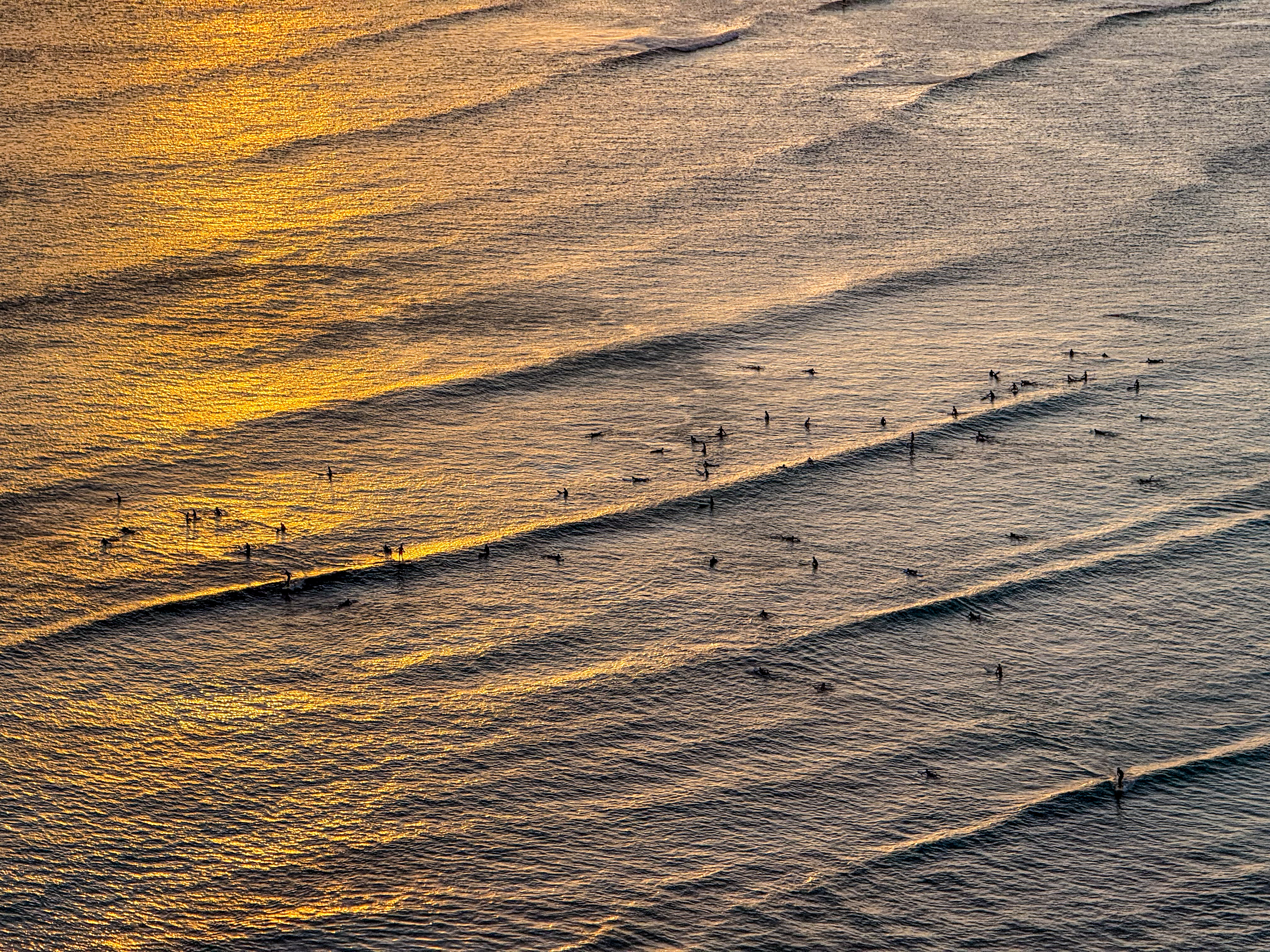
The video below captures this panorama around 5:30 p.m. By this time, the beach crowd has thinned slightly, though the water remains lively. Surfers continue to brave the waves from before sunrise well into the evening, while boats carry tourists on sunset tours of the ocean.
Bring a pair of binoculars on your next trip. You won’t regret it. Watch avid surfers catch waves at sunset and long after, and capture shots like shown below.

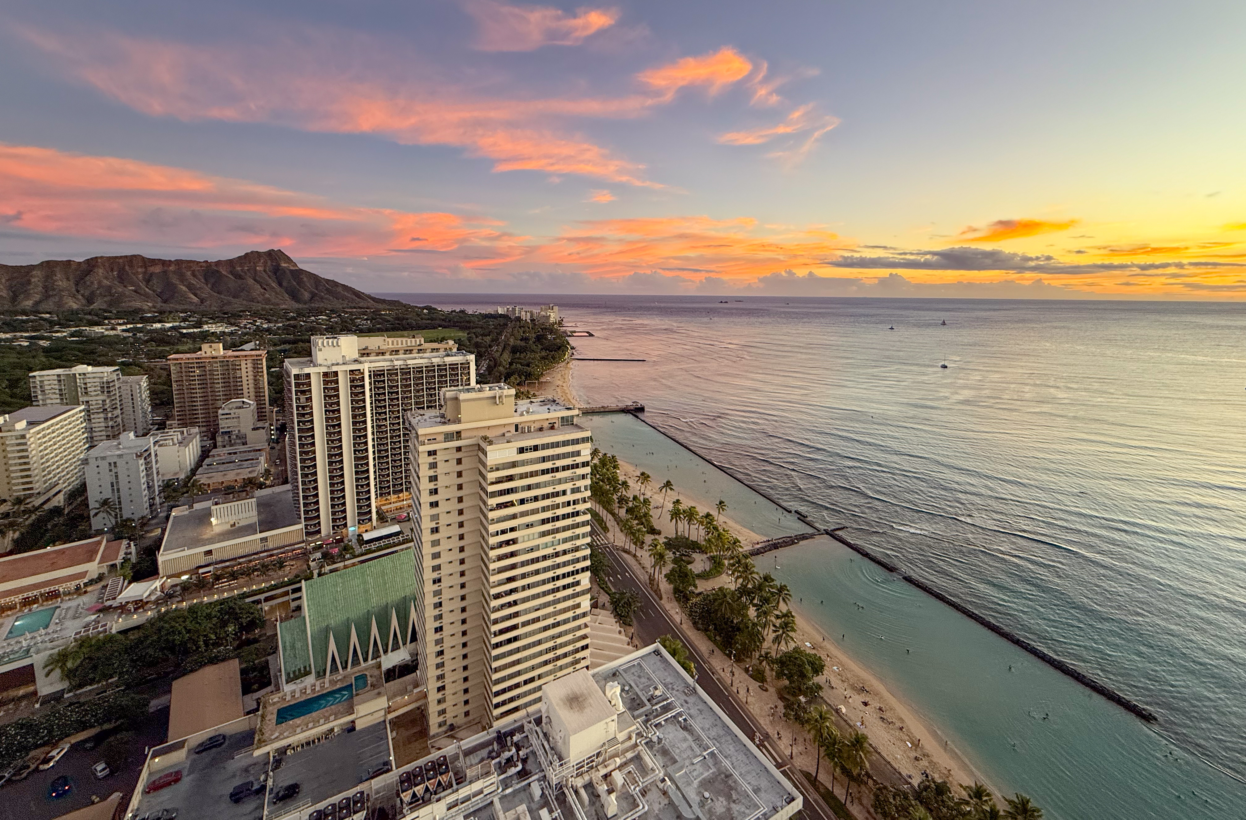
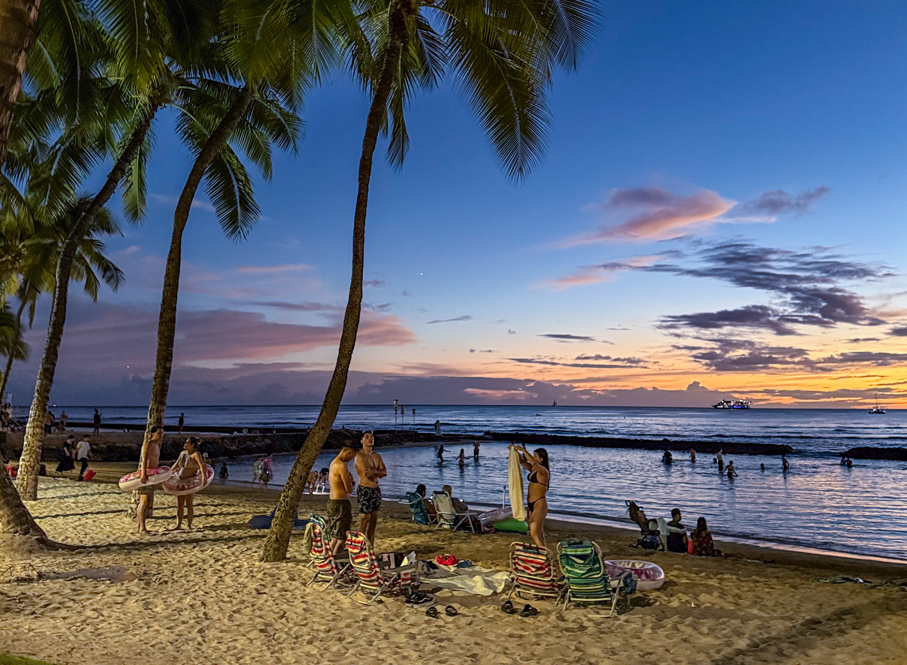
The sun has now disappeared below the horizon. It is around 6 p.m., and the sky glows pink with afterglow, light reflected off the clouds. About half of the visitors still remain in the ponds, while others continue to surf at Canoes.
Night begins to take hold shortly after, around 6:10 p.m. The sky darkens quickly, and the remaining swimmers in Kuhio Ponds head home. Yet plenty of surfers continue to brave the waves, riding long past sunset against an ocean still illuminated by afterglow. They won’t stop until darkness fully settles. Meanwhile, life on land comes alive for the evening.

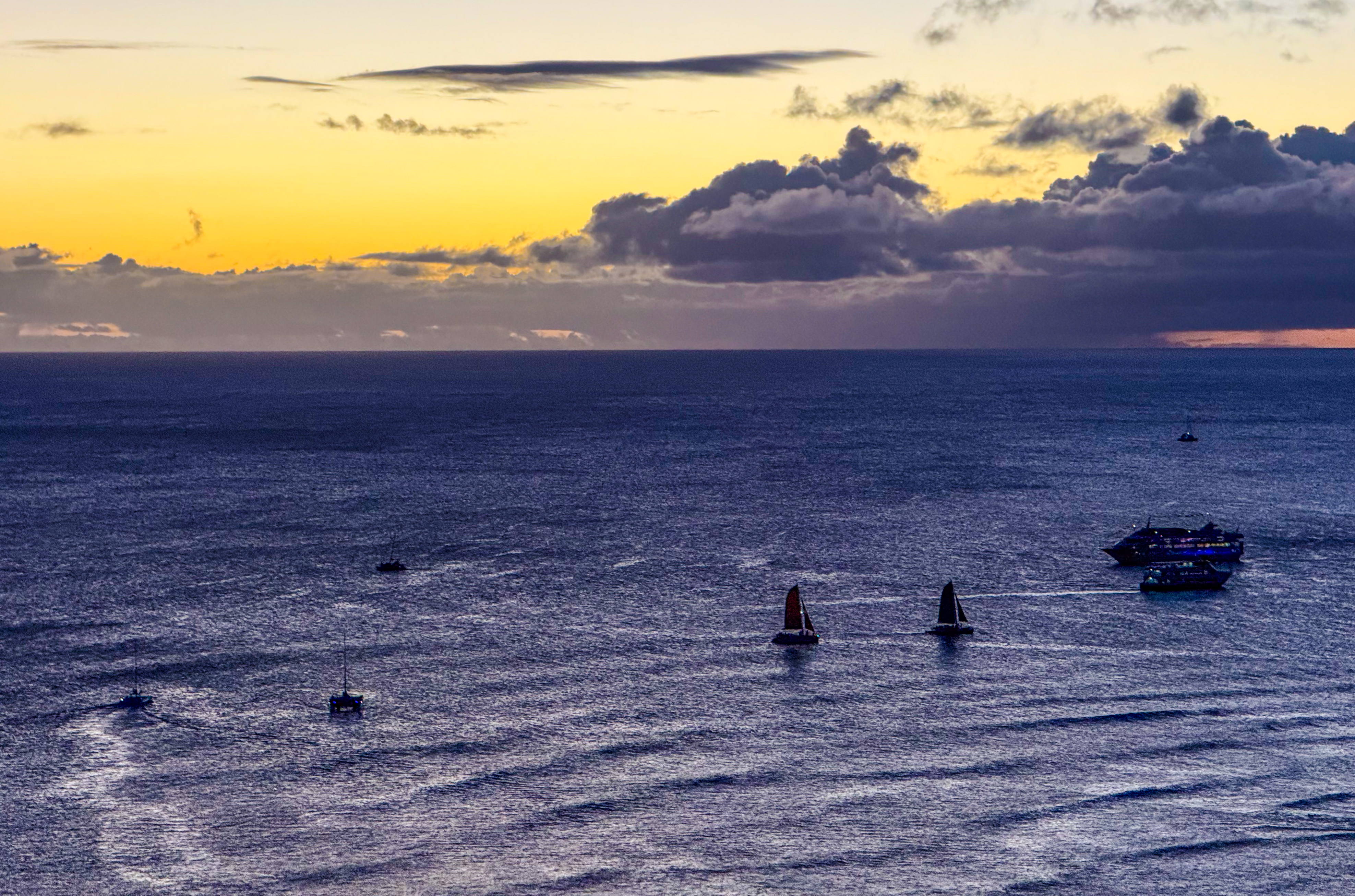
Counterintuitively, this is the busiest time for boat tours. Merrymakers drink and dine aboard vessels of all types on Waikiki Bay, set against a backdrop of alpenglow.
Now is a good time to walk the streets. From the ground, you continue to follow the tour boats on the water, the first things you notice as you cross the main thoroughfare, Kalakaua Avenue. Around you, the streets are filled with a mix of people: surfers in wetsuits, locals in sandals, and tourists in shoes clearly not made for the beach.

Seen from the beach, the stone walls of Kuhio Ponds rise barely a foot above the water. The inlet section is currently submerged. Meanwhile, a bunch of tourists snap sunset photos with flashes. I hope they knew what they were doing, and didn’t end up with overexposed faces against a dark backdrop.

Locals linger in the ponds and on the beach long after sunset. The two ponds are fairly shallow, and at low tide, kids can safely walk across most of their area.
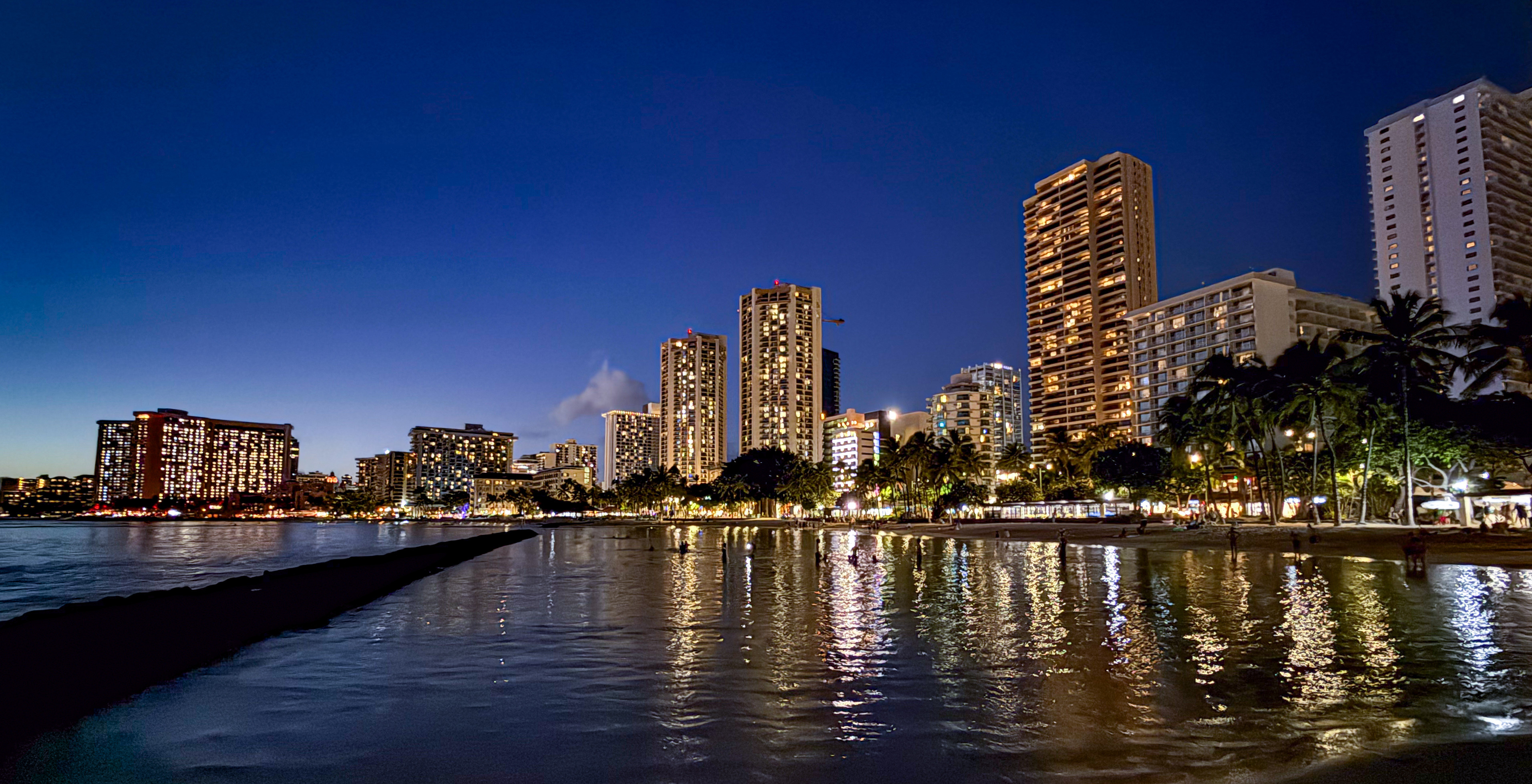
Walk out to the ocean along the divider wall between the two ponds, then turn around. The illuminated skyline of the Waikiki shore comes into view.
It is now around 6:20 p.m. Some people still linger in Kuhio ponds, where the water is shallow and never exceeds adult height. Others are taking pictures and selfies with flash.
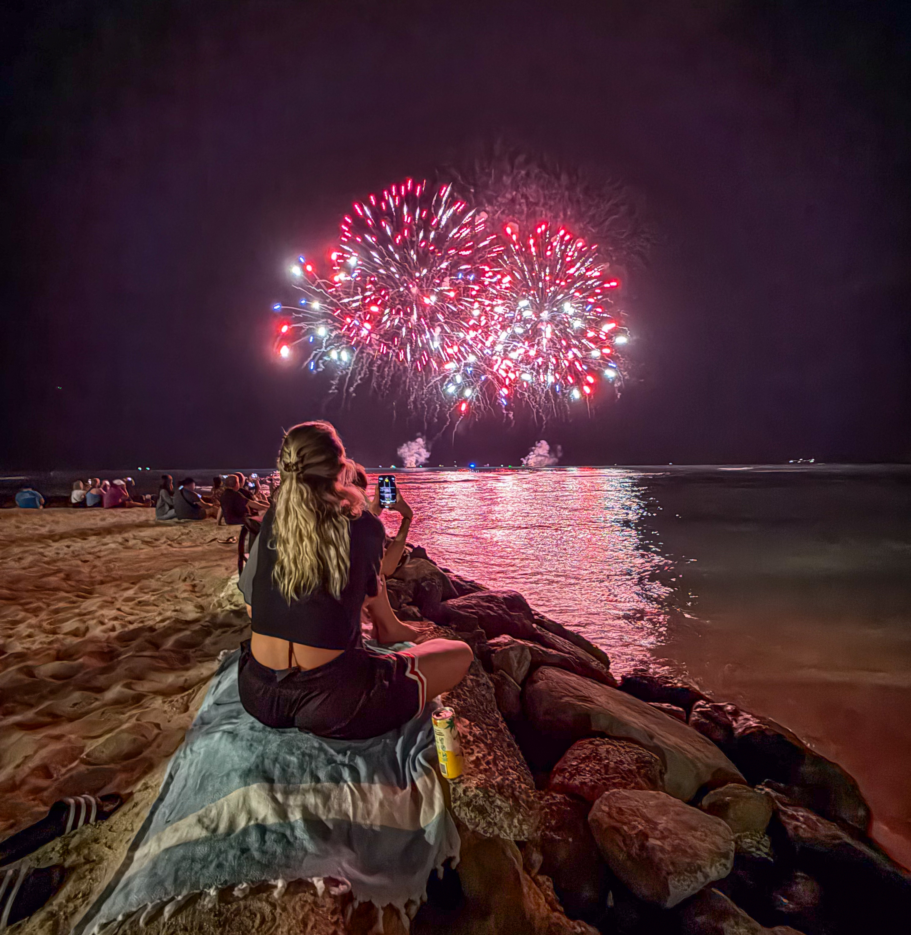
The Hilton Hawaiian Village hosts fireworks every Friday night. I imagine they do this not only to entertain their guests but also to entice visitors to walk all the way west to Duke Kahanamoku Beach, which they might not otherwise explore. On this particular night, however, the city of Sakai in Japan gifted a special fireworks display to Honolulu. The show took place right at Canoes break, in front of the Duke Kahanamoku statue at the center of Waikiki Beach.
The city of Honolulu can be especially picturesque at night. Mountain communities built along ridges appear striking. On a clear evening, you can see far into the distance, identifying distinct neighborhoods by their shapes. In Hawaii, this perspective is called a “mauka” view, meaning toward the mountains, while “makai” indicates a direction toward the ocean.

Kuhio Beach at sunrise
On your second day in Waikiki, you finally get to see the sunrise. Rooms in Waikiki are at a premium, and those with a view are even more sought-after. Rooms facing makai, with a view of the ocean, are labeled “Oceanview.” If the room overlooks the beach and provides direct access to it, it is considered “Oceanfront.” Rooms facing mauka offer a “Mountain view.”
If the Diamond Head crater is visible to the east, the room is described as having a “Diamond Head view.” A room facing Waikiki Beach from Kuhio Beach would technically be called “Ewa” by locals, meaning “west of Waikiki toward Ewa.” However, not all tourists are familiar with this designation.
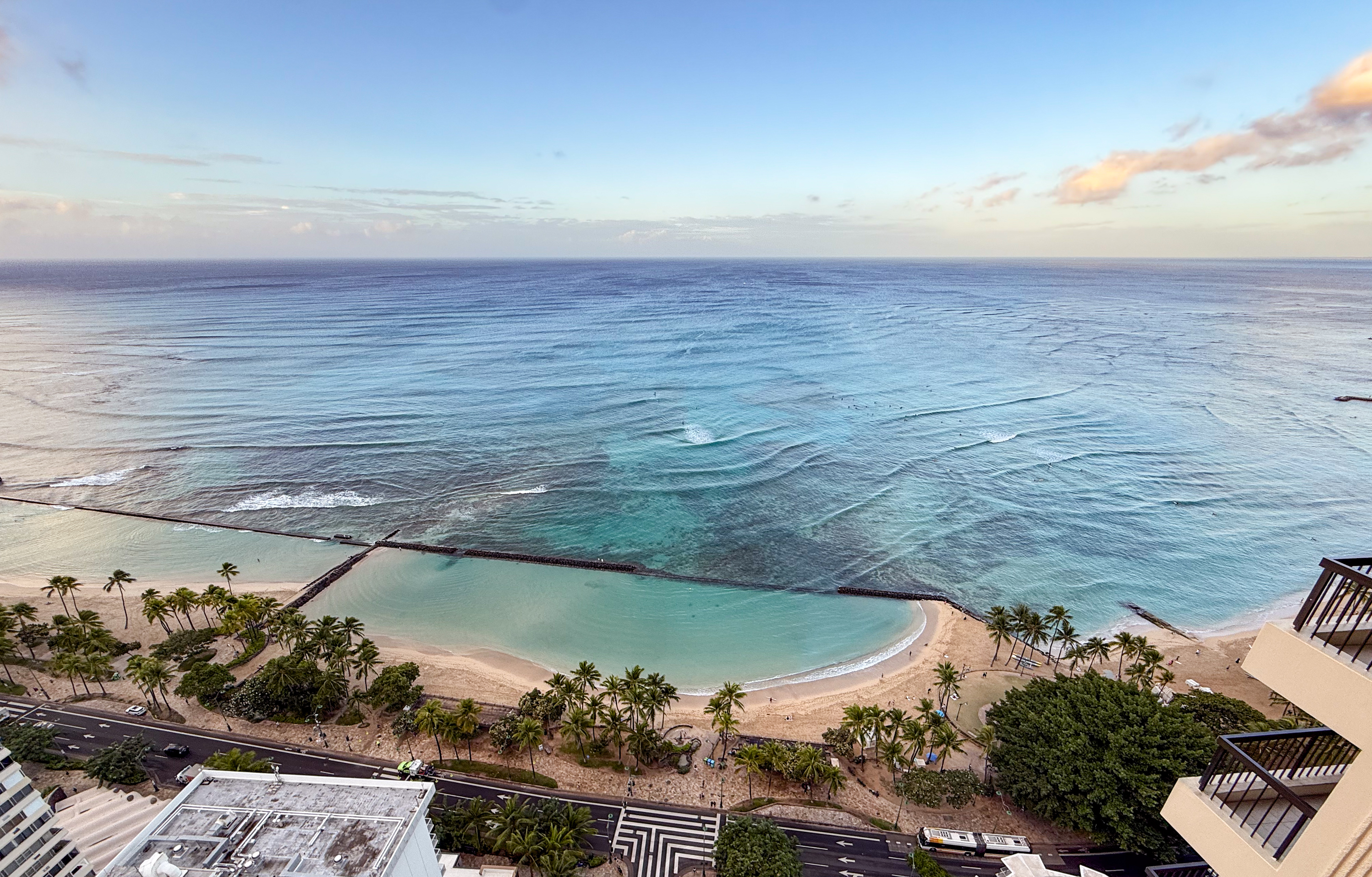
The west pond is empty, while two standup paddlers can be seen in the east pond. The ocean, however, is far from still. Zoom in on Canoes break and Queens break in the following picture to spot surfers already enjoying the waves, even before the sun has risen.
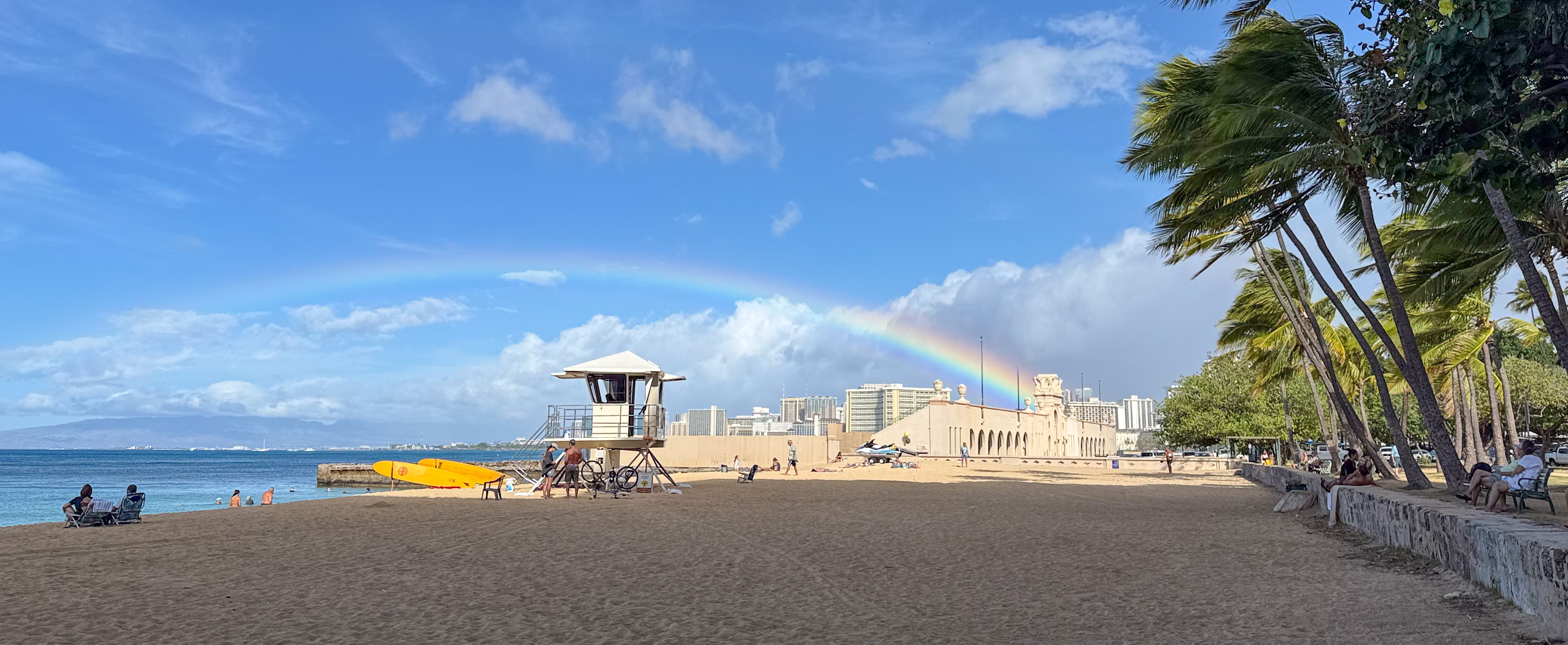
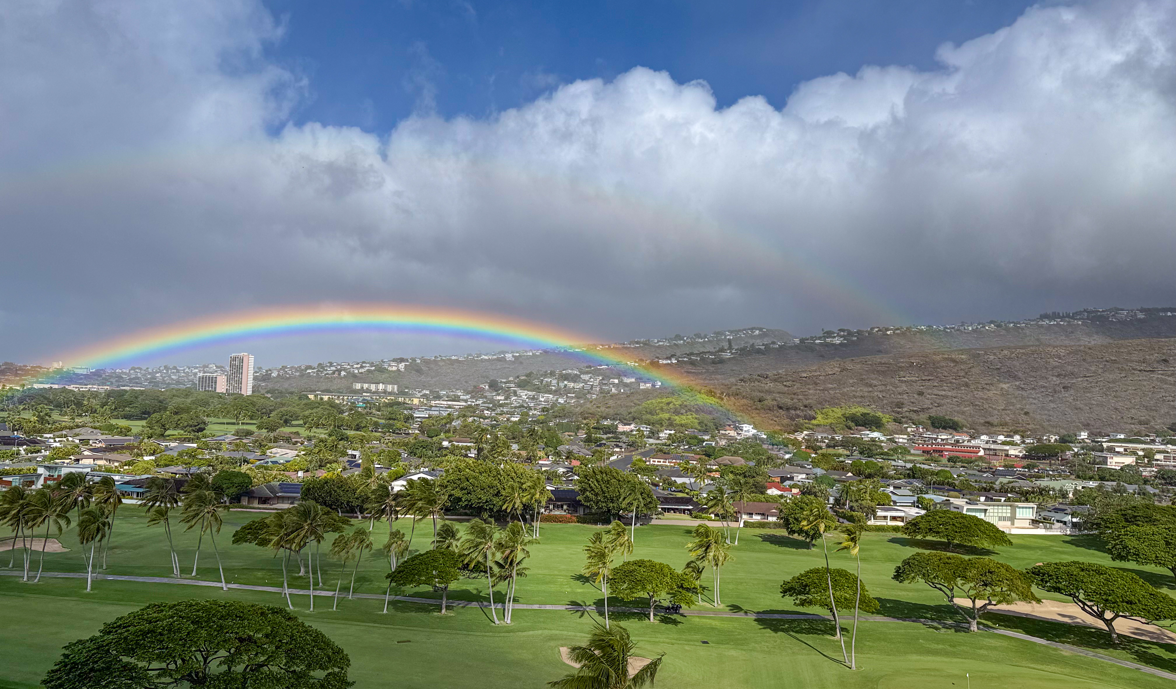
Being early November, the start of the rainy season, rainbows, and sometimes even double rainbows, are often visible when the sun is behind you, at your six o’clock. In the following picture, I looked in the direction of the previous night’s sunset and spotted a clear rainbow with a faint outer arc, the sun positioned behind me near Diamond Head at sunrise.

The sun is still behind Diamond Head, yet its alpenglow illuminates the ocean, providing more than enough light for the surfers.
At 7 a.m., the city is still half-dormant. Like the beach, the rooftop swimming pools of hotels sit empty in the soft light of sunrise.

The following video captures this panorama around 7:30 a.m. Notice the number of surfers already at Canoes break, while the rest of the beach remains mostly empty. On the streets, the city has just begun morning cleaning, still working to clear the remnants of last night’s litter.
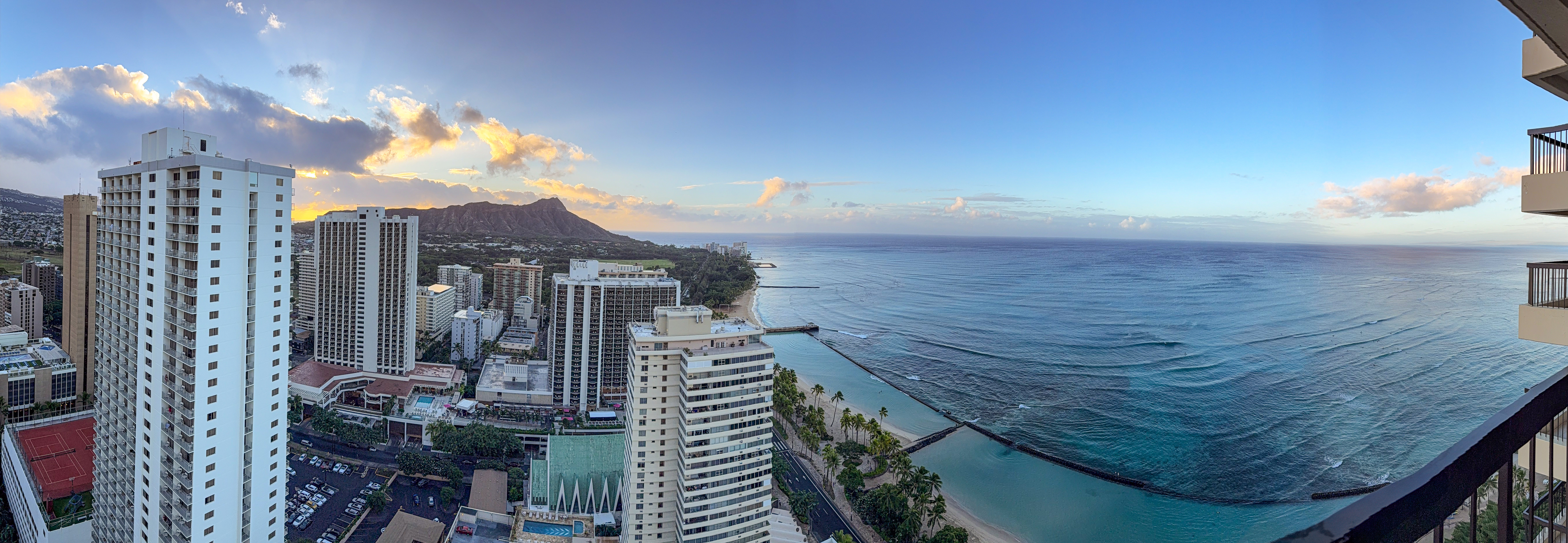
Last night’s mountain view looks very different at sunrise. The Ala Wai Canal, hidden in the darkness, now reveals itself, and the golf course appears far more expansive than it seemed at night.
This room enjoys a mountain view, best served at sunrise.

This toilet corner sports a Diamond Head view.

The living room offers an extensive ocean view. One may even think of this as an oceanfront view, since only a 35-foot-wide street separates the building from the beach.
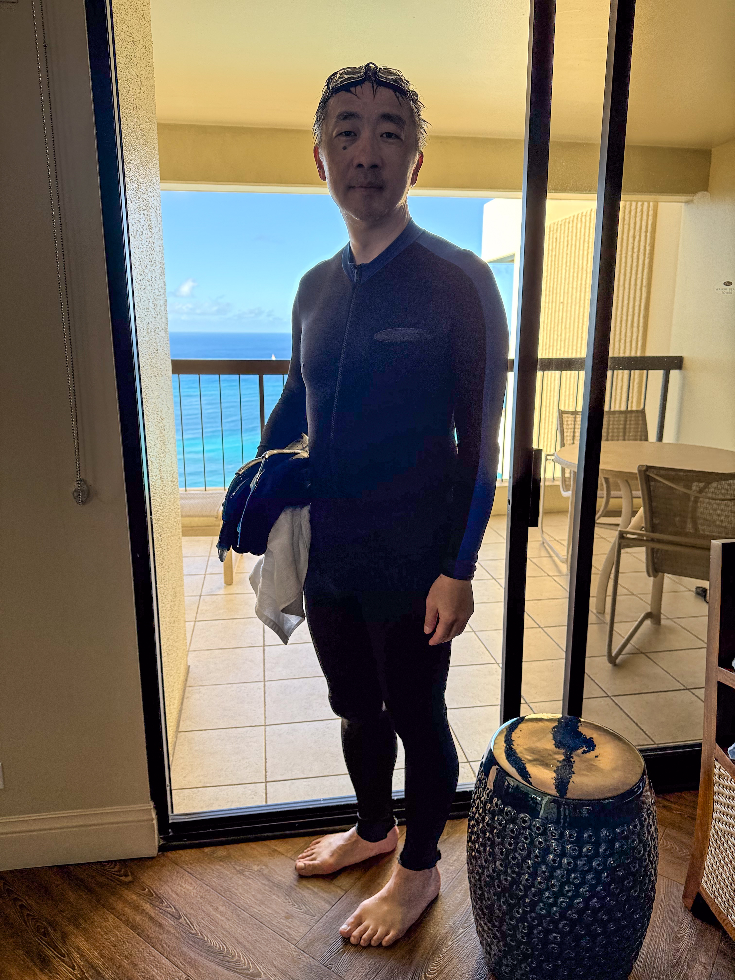
Taking a morning swim at Kuhio Beach
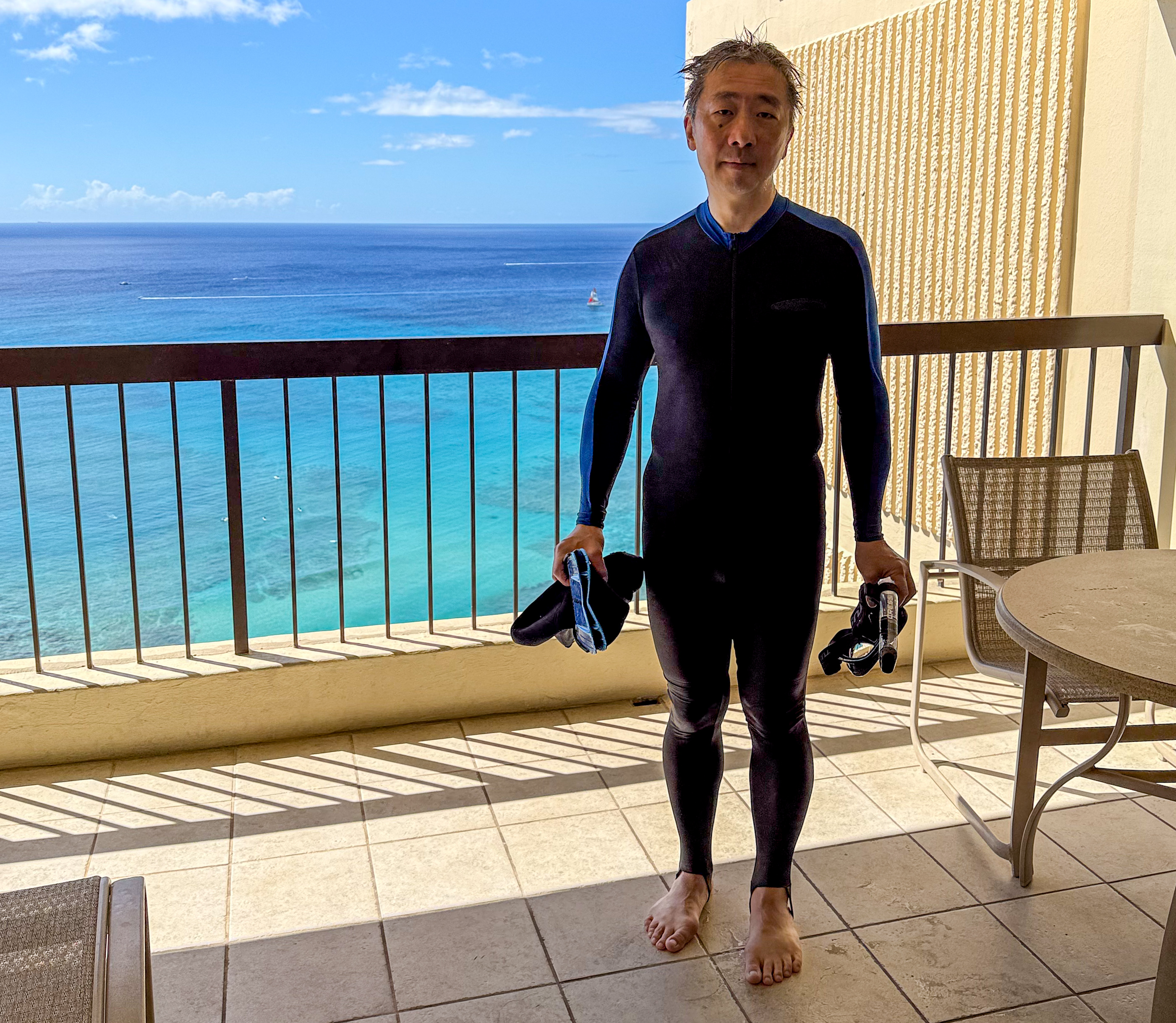
Now is a perfect time for a swim in one of the walled ponds. The beach is empty, and I am not yet ready to venture beyond the seawall to the reef, snorkeling will have to wait for another day. I slip into a full-body wetsuit and neoprene socks, strap on my goggles, and grab my fins as I take the elevator down to the sand.

Nobody bats an eye as I walk out of the building in full “armor.” That’s normal here. As I mentioned earlier, the beach is right in view, just across the street.

As mentioned, the city is still half-dormant at 7 a.m. By 7:30, the cleaning crew has just arrived, and delivery trucks cruise the streets. The ground remains scattered with remnants of last night’s activity, and more homeless people can be seen loitering compared to midday.
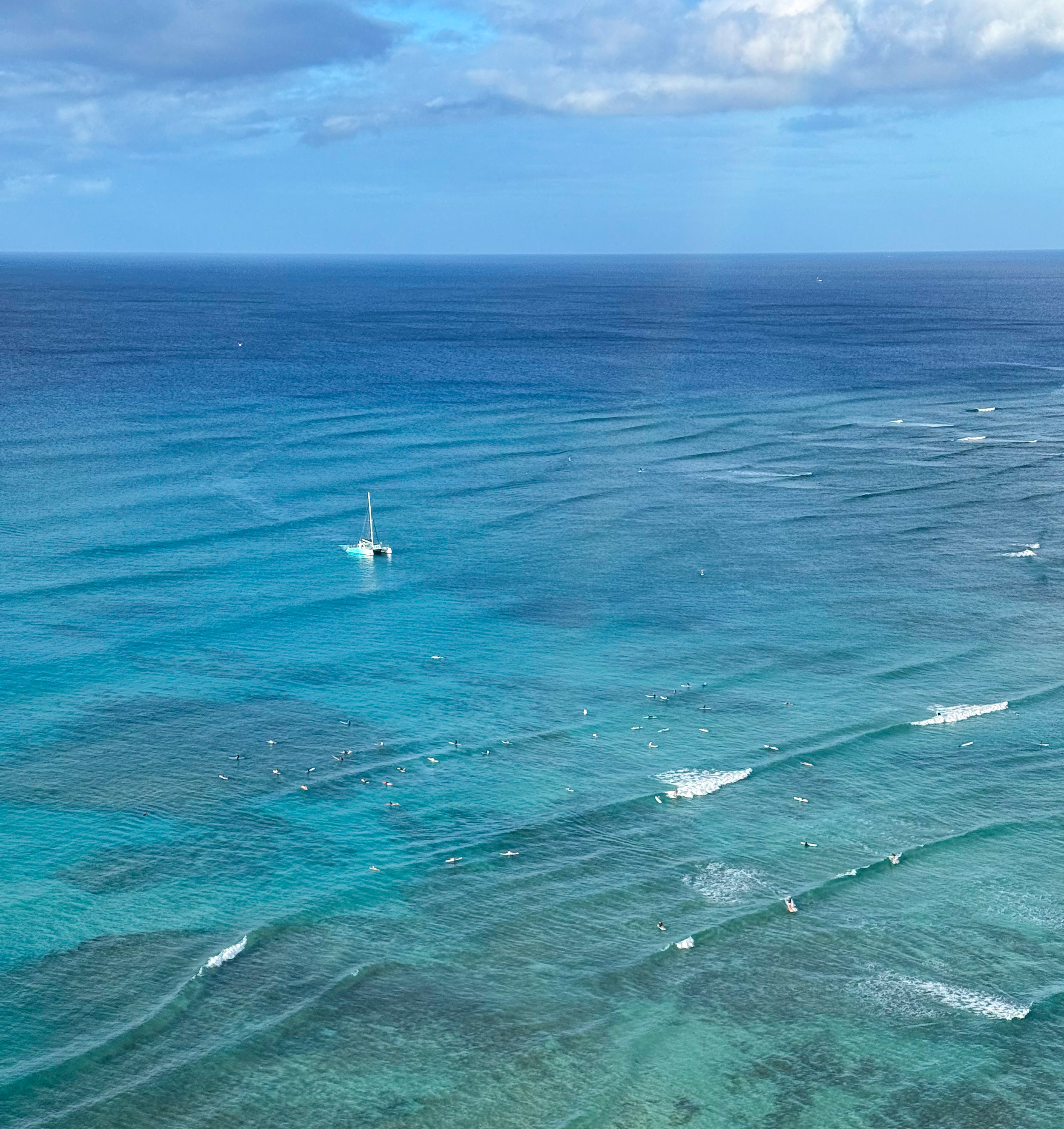
By 9 a.m., Canoes can already be considered crowded, and sailboats now dot the bay. More people have arrived to swim in the ponds, though the beach itself remains comfortably empty. I subscribe to the view that the best beach is the one you can easily walk to, much like the best camera is the one in your pocket. Being able to step out and swim on a whim at a nearly vacant beach is priceless.

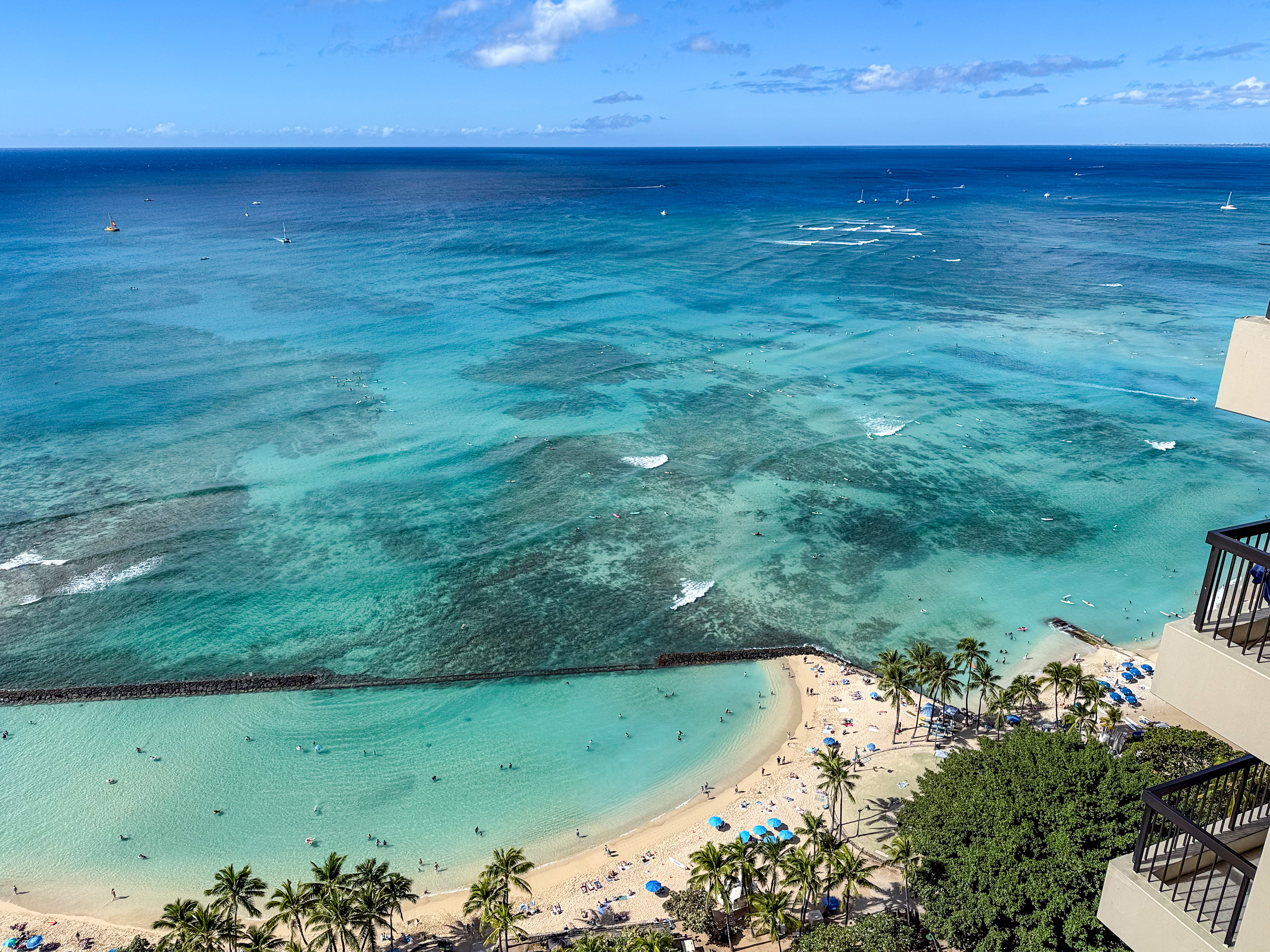
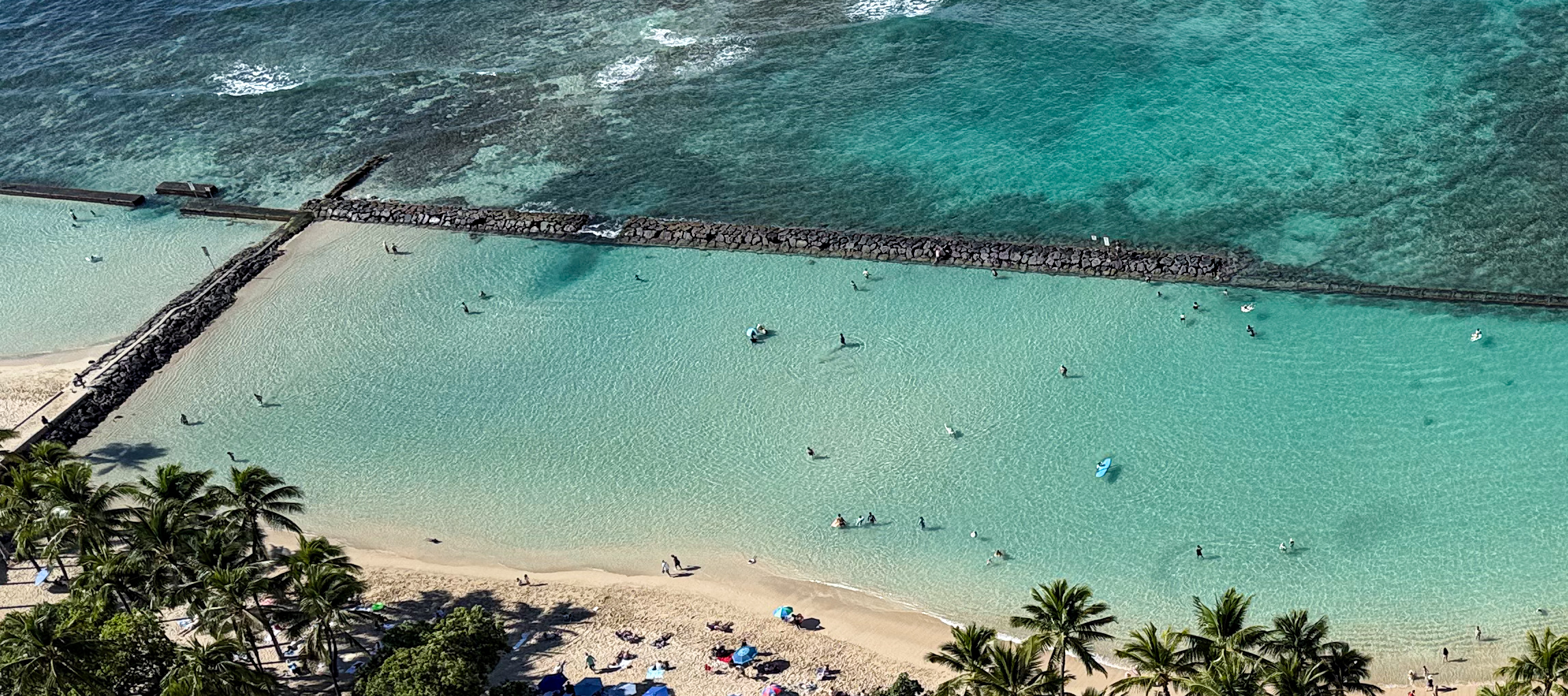
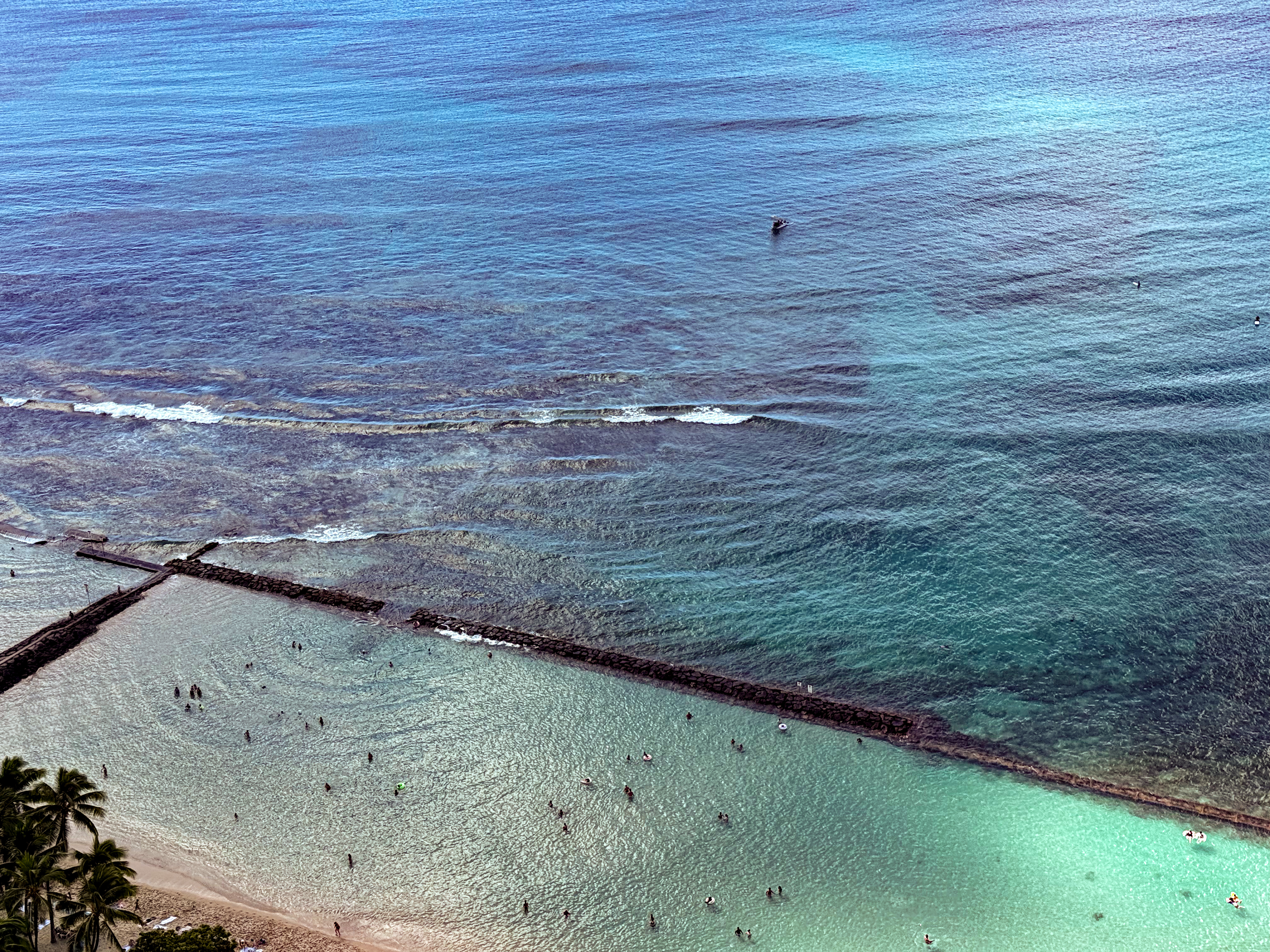
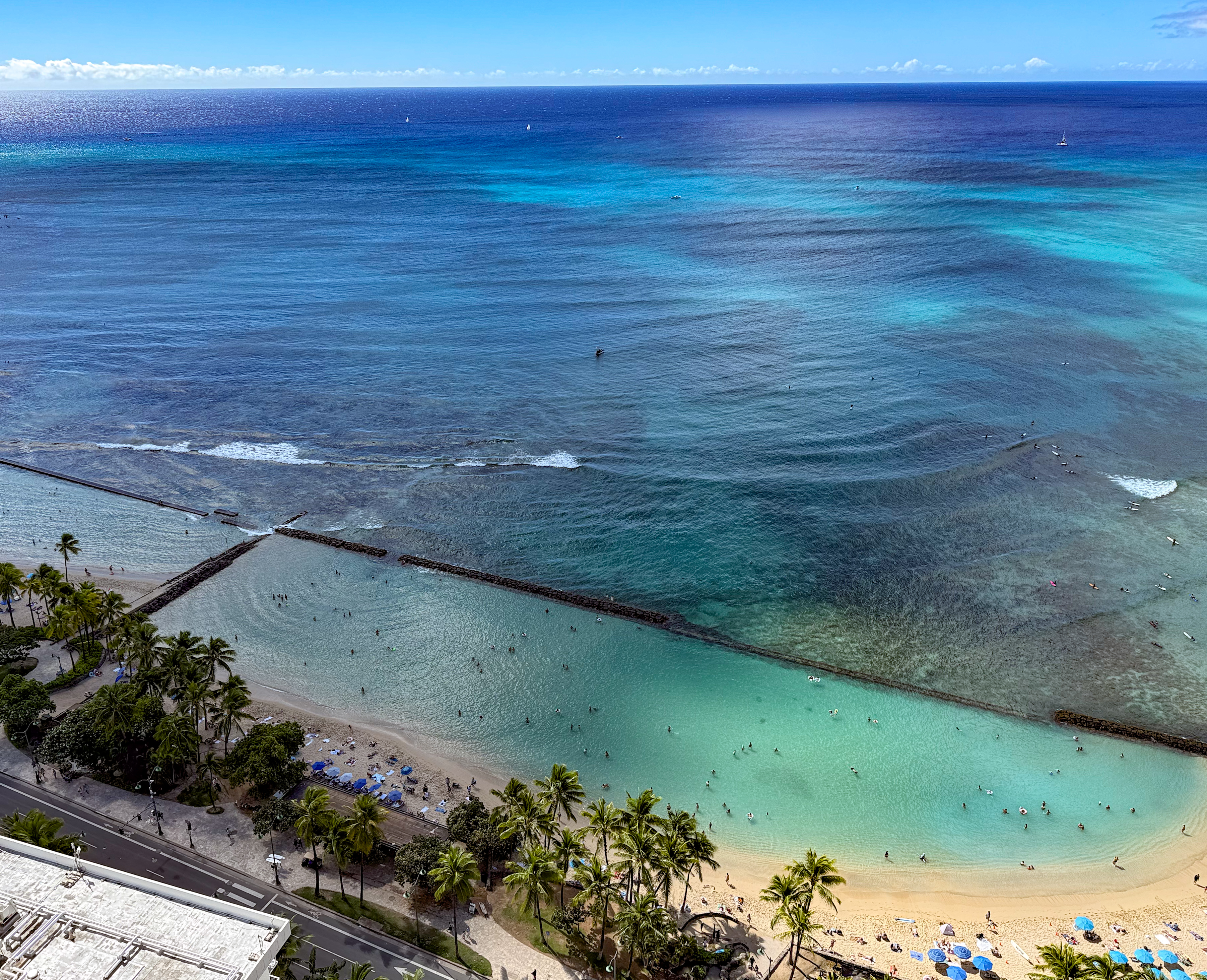
Here is a closer look at the seawall at the west pond. The small inlet on the left and the large inlet on the right are clearly visible. Waves, already moderated by Queens break and Baby Queens break, wash over the lower barrier into the pond, keeping the water fresh. Zoom in on the image to see people standing on sand near the small inlet. A light yellowish tint indicates very shallow sand, while light green marks areas no deeper than chest height. The dark green patch by the small inlet, however, is deeper than an adult’s height.
Zoom in on the following close-up image to see the details of the seawall and the large inlet. The seawall is a mix of cement and large rocks. Though not visible at this resolution, fish of all kinds dart around just beneath the surface, weaving between the rocks. Along most of this stretch of the west pond seawall, you can simply stand by the wall and peek underwater to watch them. More on snorkeling later.

The large inlet is clearly visible in the following picture. It spans roughly 72 yards, with a concrete platform that is usually submerged except at extreme low tide. The dark patches of reef just outside the inlet are teeming with fish. Again, more on snorkeling later.
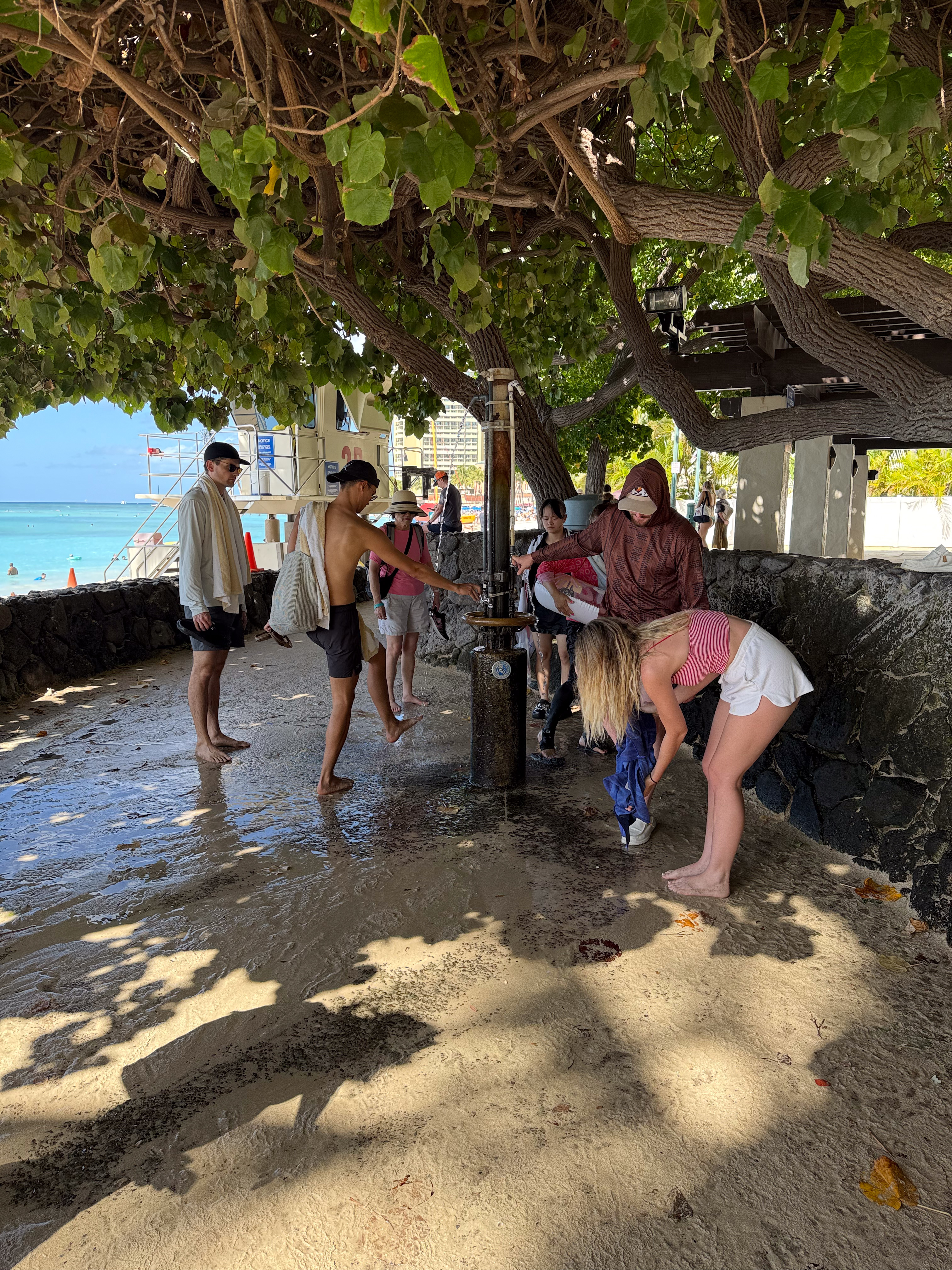
I walked back into the building after my swim. I had already rinsed my goggles, fins, and wetsuit at the beach rinse station. But I also ceremonially rinsed my feet at the building’s own station. Everyone appreciates a sand-free building, at least to a reasonable extent. Honestly, you won’t find a completely sand-free space this close to the beach.
A certain family member, who doesn’t share my rapport with the ocean, marveled that I made it back in one piece. They had been tracking me with binoculars, keeping a mental score as I stumbled in the water. They expected lifeguards to rush to my rescue at any moment. But somehow, I always managed to recover.
Having an ocean view and having easy access to the ocean both come at a cost. It is certainly nice to enjoy a great view from your room at any time of day; I had such a view, and I loved it. But if I had to choose between the two next time, I would gladly trade a stunning view for direct access to a beach like this.
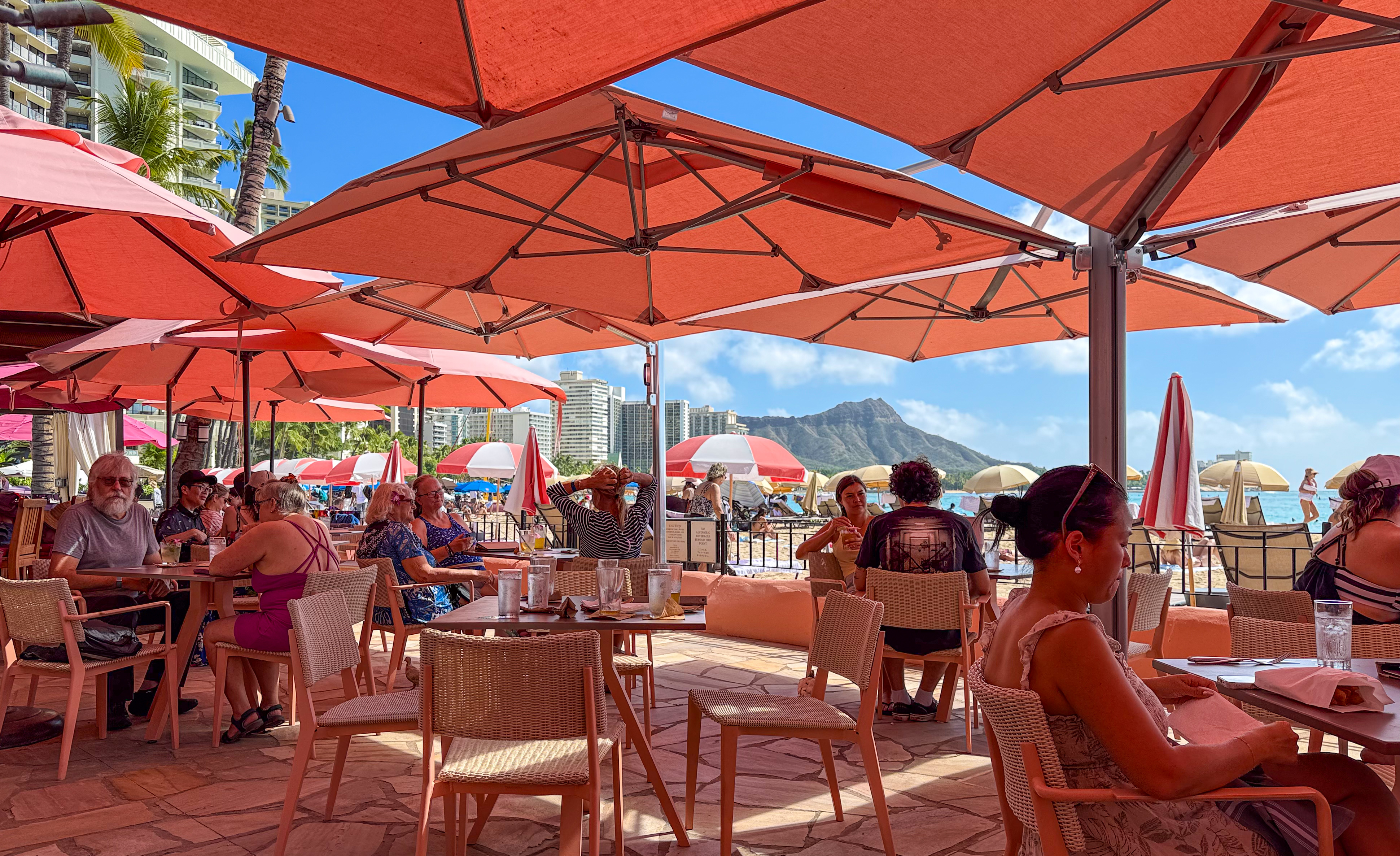
Noon crowd at Kuhio Beach
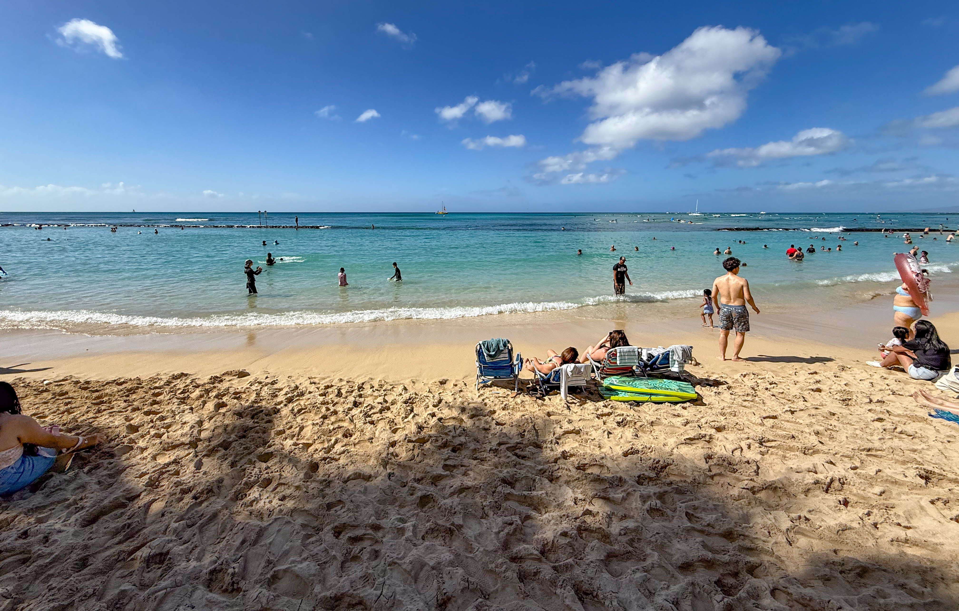
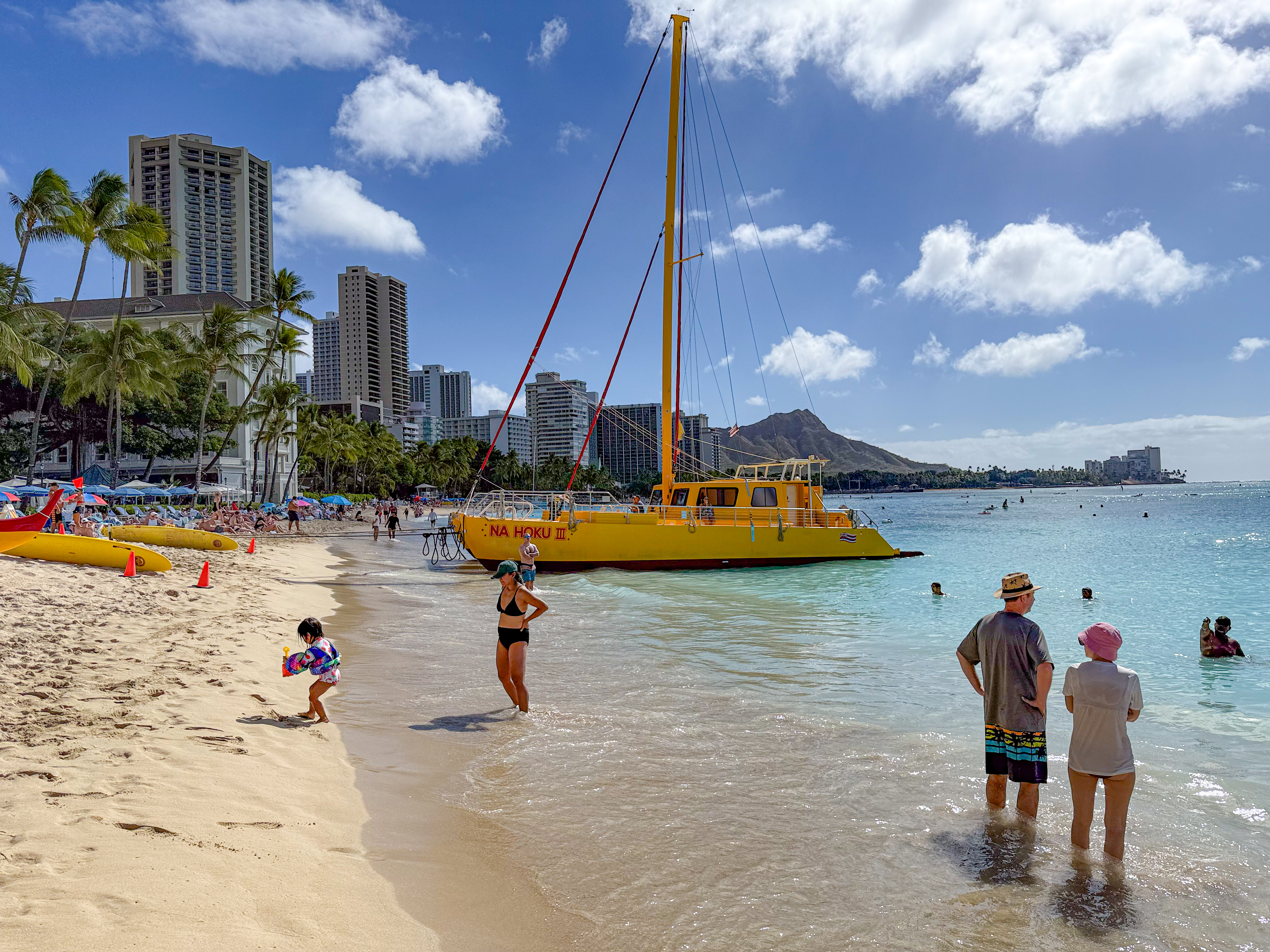
By 11 a.m., everyone who wants to be at the beach has arrived. Surfers, of course, are already out at Canoes. Speaking of canoes, an outrigger canoe is also trying to catch a wave. Meanwhile, Na Hoku 3 ferries passengers to and from the beach, blaring its horn to alert surfers as it makes a beeline for the shore.
The following scene shows the peak crowd at 1 p.m. on a Tuesday in November. Each day was roughly the same. A surfer paddles out from the pond toward the small inlet, while novice snorkelers practice safely within the seawall before venturing out to the reef. And the sunbathers… they are everywhere. To me, it felt crowded, but I didn’t mind, since I was almost always in the water. The pond is large enough to feel like a huge swimming pool, and beyond it, the ocean stretches out immensely. Just be careful not to swim in the path of the surfers.

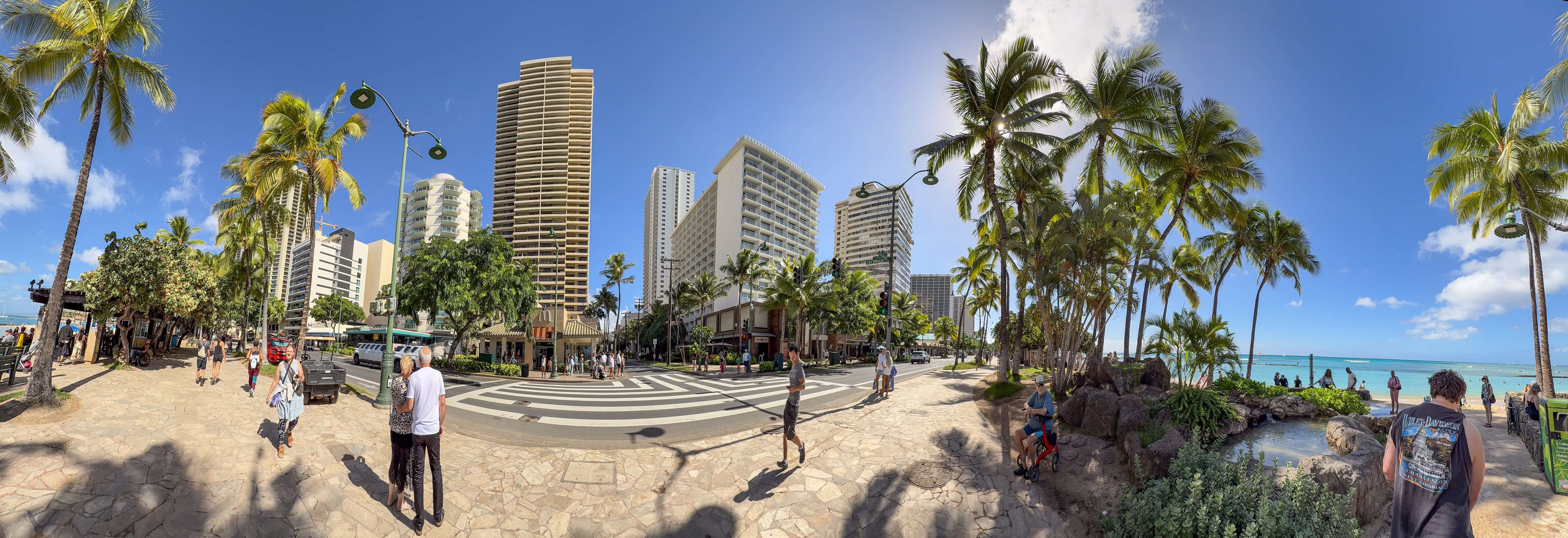
The street doesn’t feel crowded in November; it feels alive. The panorama taken from the walkway conveys a sense of immediacy between the buildings and the ocean. That McDonald’s at the center of the panorama is famous for its ocean view. My apologies to the jogger, whom my phone’s panoramic shot stretched into a stick.
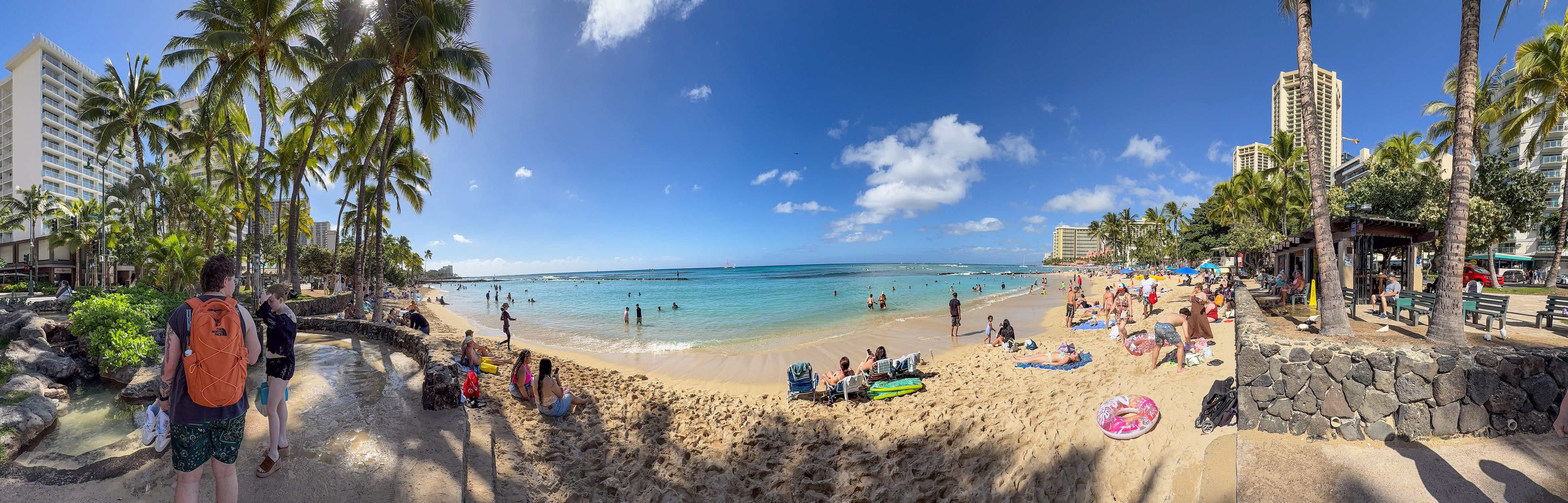
Turn around, and you are greeted with the ground-level view of the noon crowd at the beach. Once again, panoramic photos don’t mix well with runners; they turned a woman running along the shore into a stick as well.
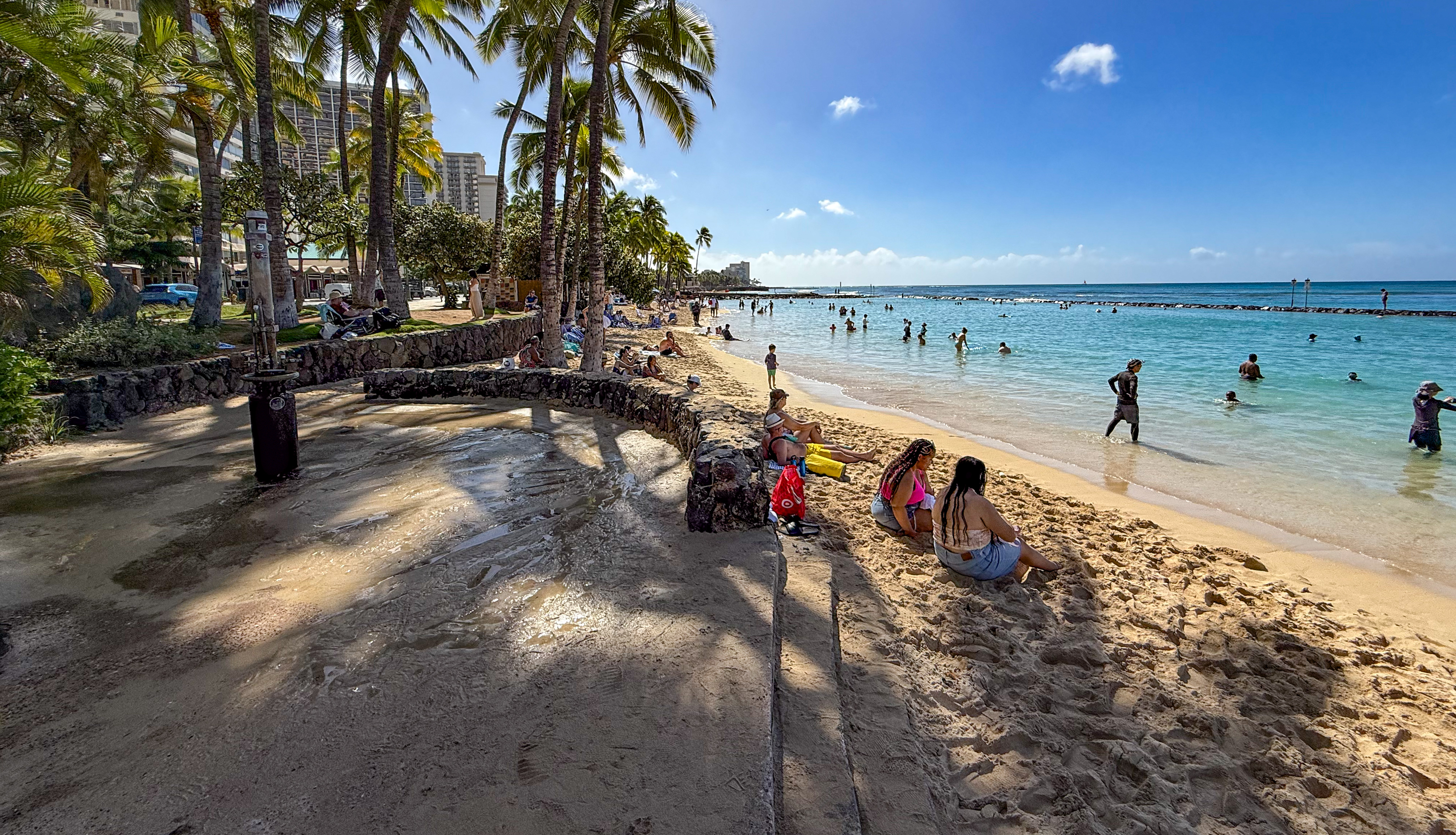
Earlier, I mentioned the rinse station by the beach. Here it is, equipped with shower heads and foot-wash nozzles. Facilities like these are available at beaches all along Waikiki Bay. The following image shows a view of the west pond looking toward Diamond Head to the east.
The following image shows the ocean view from the same spot. The seawall on the left ends where the large inlet begins. Waves sweep through the inlet, which continues underwater as part of the concrete seawall. Surfers are visible riding the waves at Canoes, and sailboats appear unnaturally close to the pond. In reality, they are far away; this illusion is caused by “perceived distance compression.” See this long essay if you are curious about apparent size (angular size).
The following image shows the west pond looking toward Ewa (west) and the Duke Kahanamoku statue, taken from the same spot.
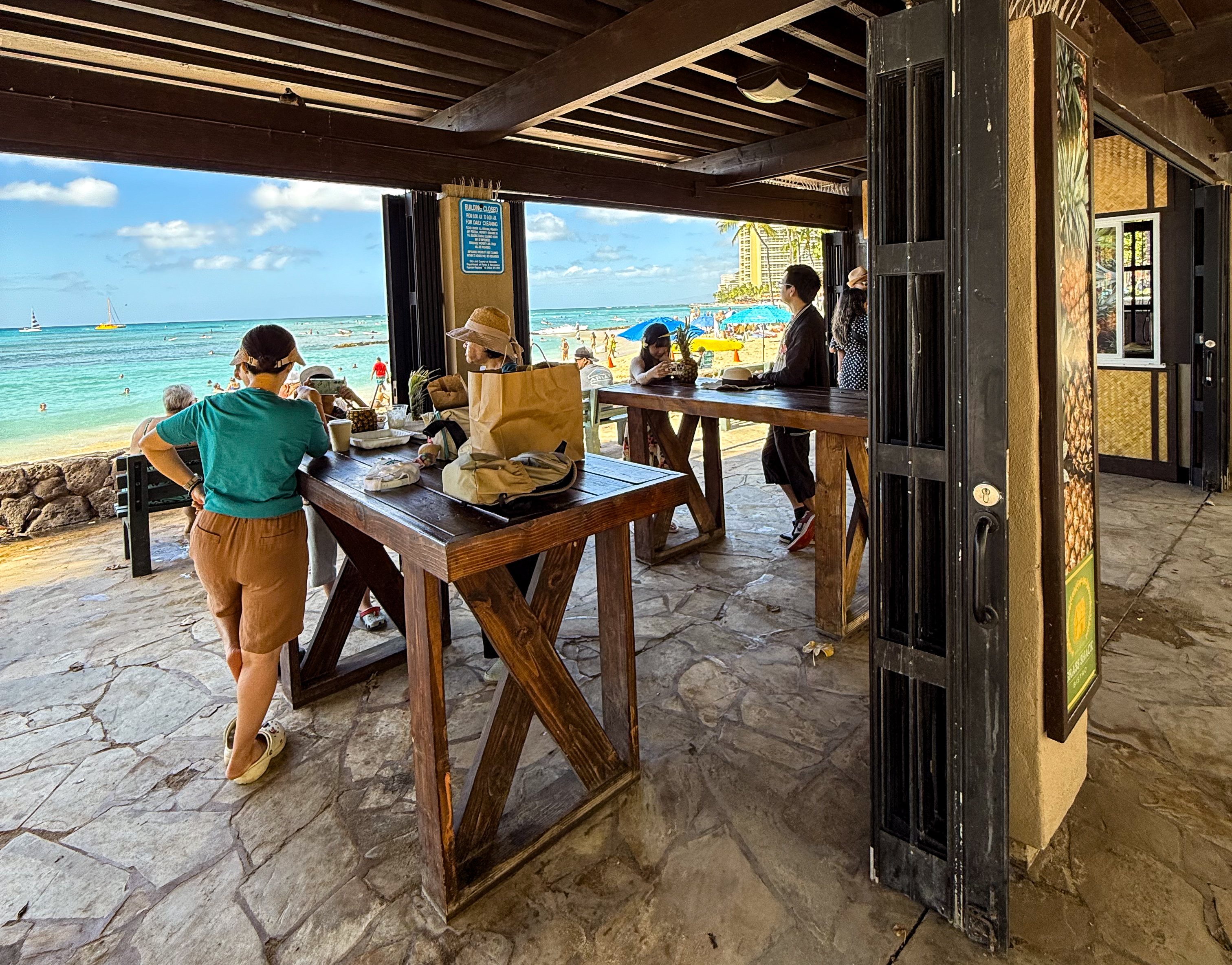
A concession stand with tables overlooks the pond, with the ocean stretching out beyond.
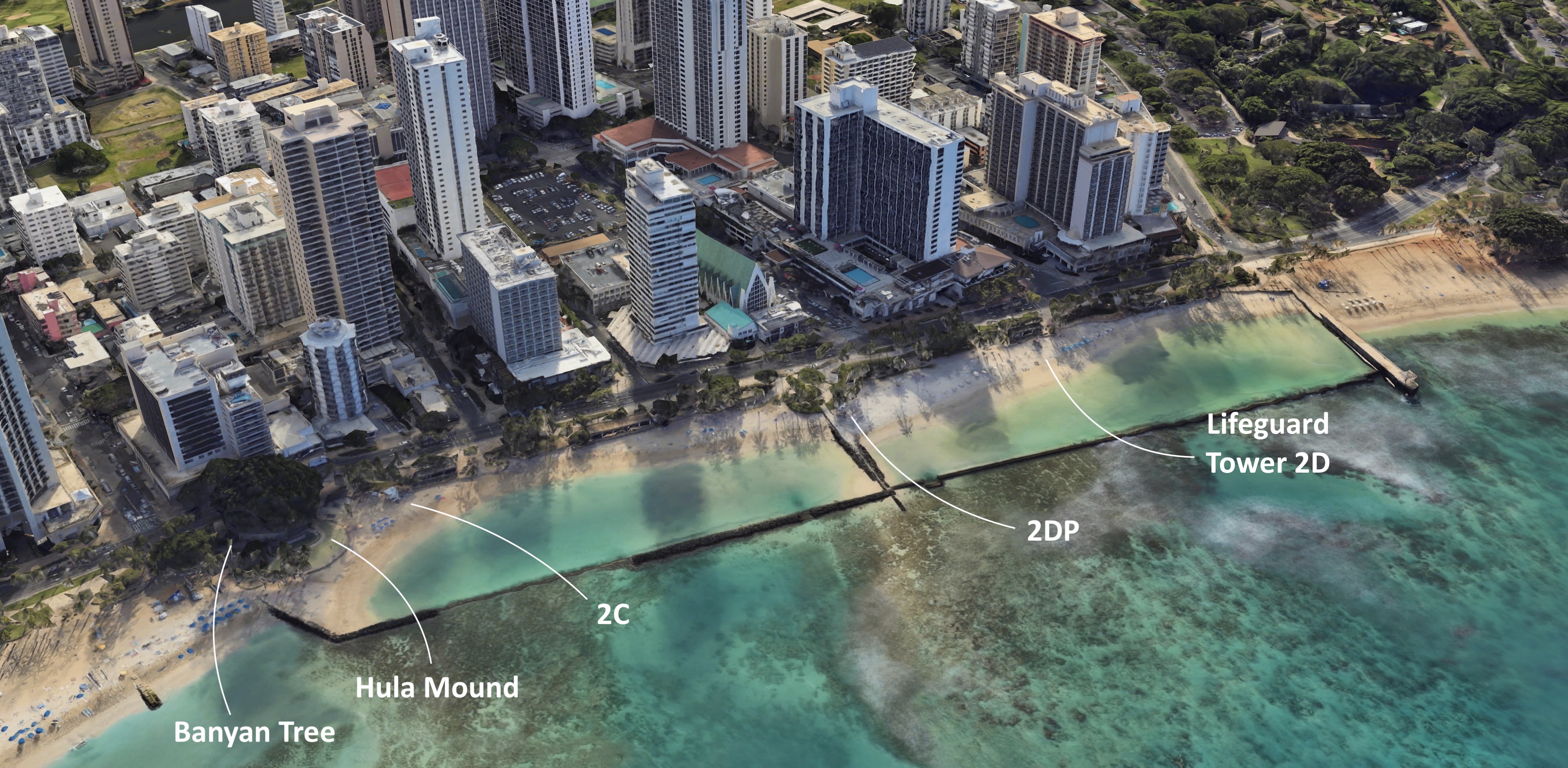
At the time of this writing, there are 48 lifeguard towers across Oahu. Three of them are located at Kuhio Beach Park: Towers 2C, 2DP, and 2D. The following image shows Tower 2C at the west pond. For more information see this list and this map.
Lifeguards officially open towers at 8 a.m. For someone like me, with only moderate swimming abilities, it’s reassuring to know there are trained eyes watching my back. Kuhio Beach Park has the advantage of three towers all to itself. In comparison, Duke Kahanamoku Beach and Fort DeRussy Beach, just a ten minutes’ walk to the west, have no lifeguard towers, despite being longer and just as popular.
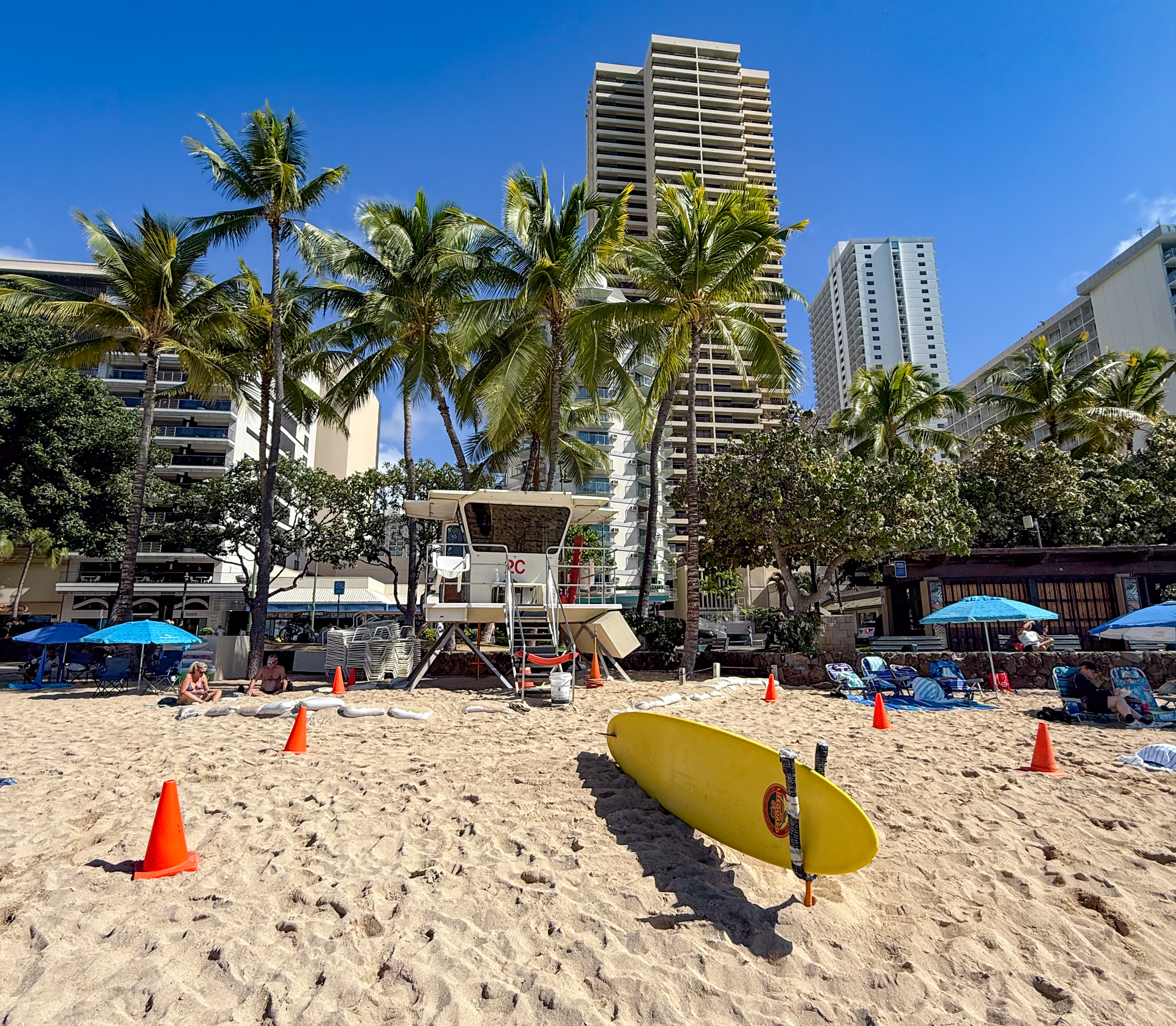
Immediately next to Lifeguard Tower 2C are the famous Hula Mound and Banyan Tree. I’m not sure which is more well-known; some might argue it’s actually the Duke Kahanamoku statue, visible just beyond both in this picture. In any case, the mound hosts regular torch-lighting ceremonies and free hula shows at sunset.

Waikiki Beach Center
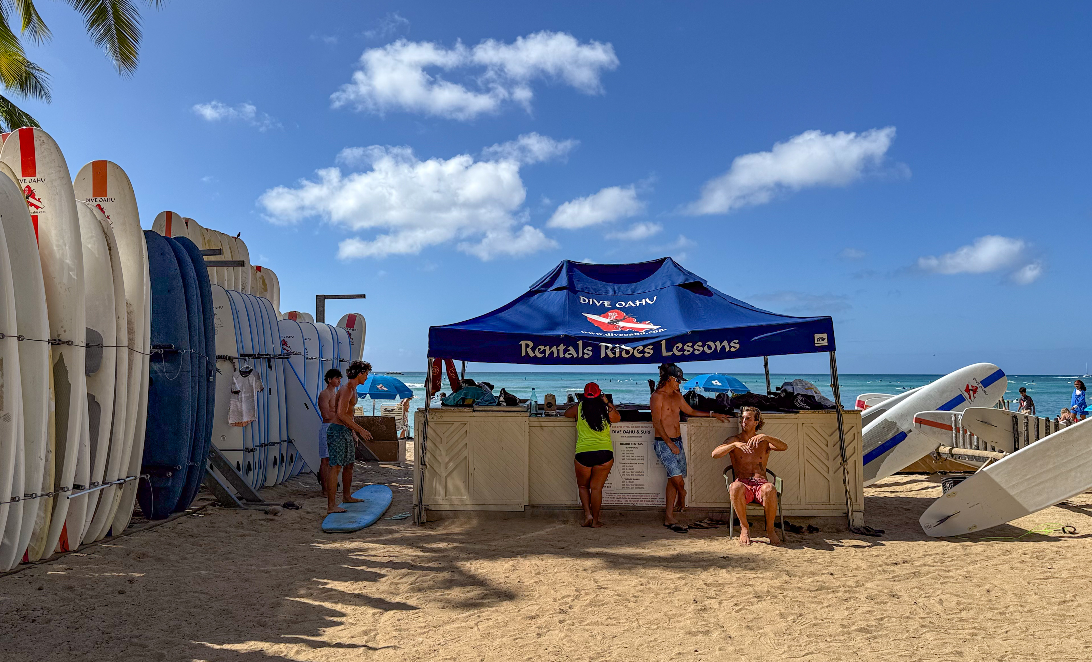
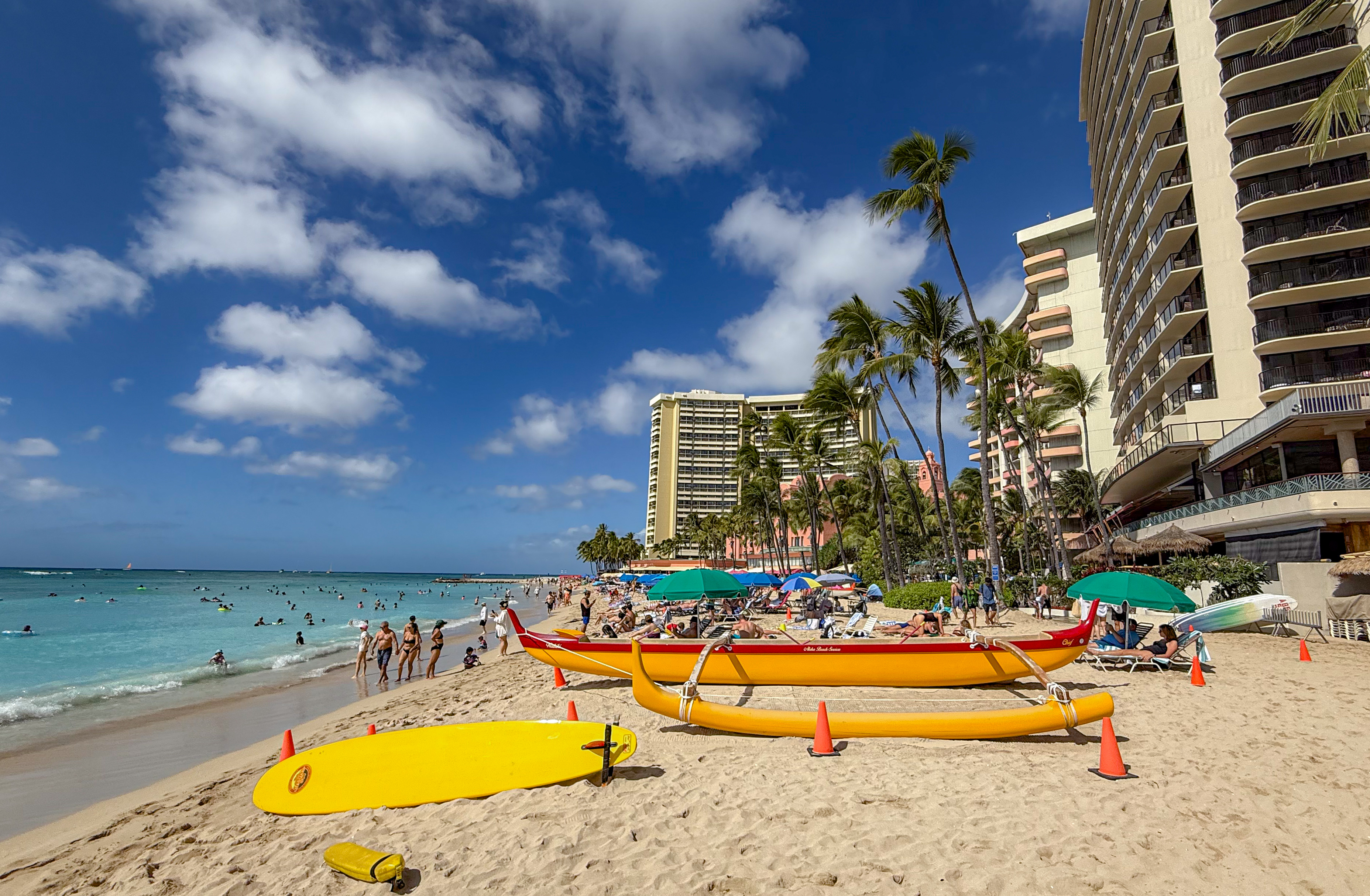
Walk another ten yards toward the Duke Kahanamoku statue, and you’ll find surfboard rentals offering group or individual lessons. I tried boogie boarding once on this trip; it didn’t go very well. Next time, I’ll either watch a lot of YouTube videos beforehand or pay someone to teach me. They also rent boogie boards and stand-up paddleboards. If you want professional photos of yourself surfing (or attempting to surf) they’ll happily take your money too, at $100 per person.
We have now reached the Ewa end of Kuhio Beach Park, marked by the Duke Kahanamoku statue (not visible in this picture). The Hawea catamaran picks up guests right in front of the statue.

The label “Waikiki Beach Center” describes the area where Kuhio Beach and Waikiki Beach proper overlap. However, you won’t find a consistent definition of this term online. Some rental websites list it as a short-term rental building. Others use it as a real-estate designation. Still others refer to the building complex that includes the Waikiki Police Station. And some simply use it to describe surfboard rental activities.
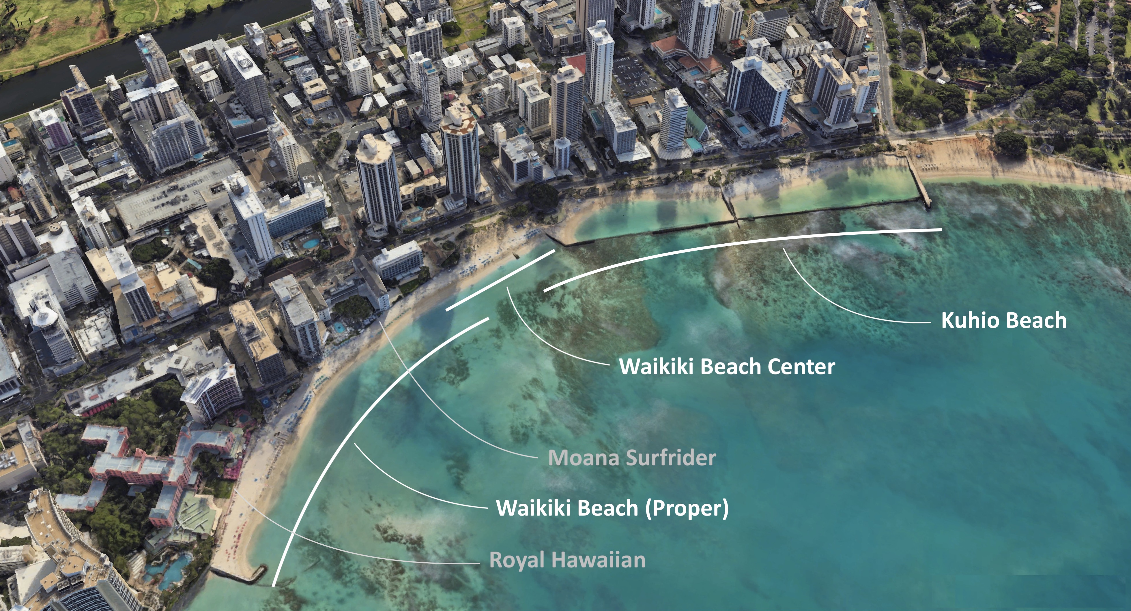
By 1977, when John Clark published Beaches of O‘ahu, there were three distinct areas: Kuhio Beach, Waikiki Beach Center, and Royal-Moana Beach. By the 2004 edition, Waikiki Beach Center and Royal-Moana Beach were no longer listed. It seems that Waikiki Beach has since come to serve a dual purpose: as a label for the entire two-mile shoreline of Waikiki Bay, and also for a specific narrow stretch of sand fronting the Moana Surfrider and Royal Hawaiian hotels.
The two-mile Waikiki Beach shoreline stretches from the Hilton Hawaiian Village all the way to the Outrigger Canoe Club, which includes Kaimana Beach. The narrow stretch known as Waikiki Beach proper is bounded by the Sheraton Moana Surfrider Hotel (the first hotel built on this shoreline in 1901) at the east end, and the Royal Hawaiian (the third hotel built in 1927) at the west end.

Waikiki Beach or Royal-Moana Beach
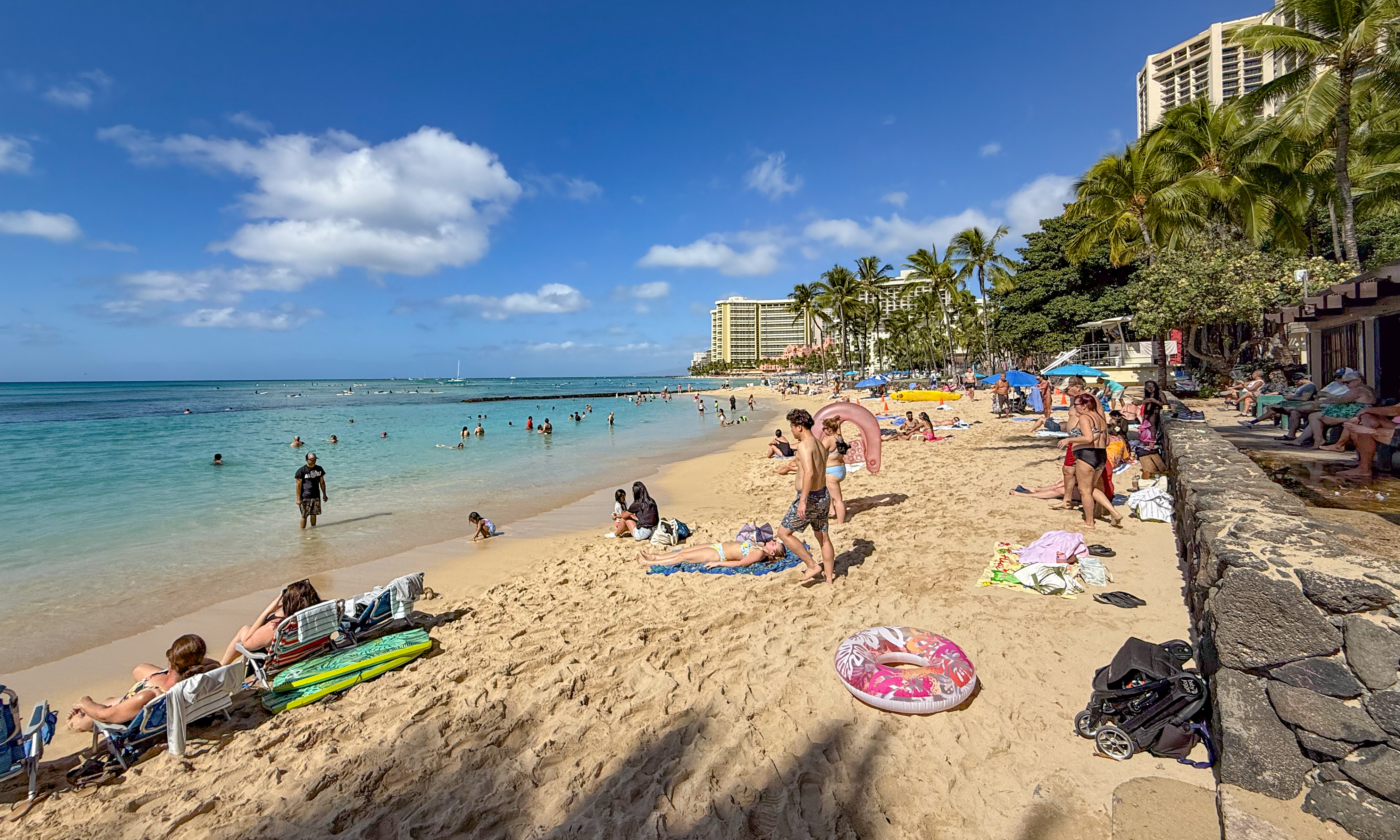
If you continue walking toward Ewa (west), you enter Waikiki Beach proper. This stretch of shoreline is noticeably busier, even in November.

Another lifeguard station covers this busy stretch of beach. Waikiki Beach proper has two towers: Tower 2A, located in front of the Moana Surfrider, and Tower 2B at Waikiki Beach Center. For more information see this list and this map.

Box jellyfish tend to appear eight to ten days after a full moon. This may or may not be an issue. A lifeguard walked around with a jellyfish warning sign, and nobody seemed to pay much attention. I’ve read that lifeguards may close a beach if the number of jellyfish becomes alarmingly high. But that hasn’t happened to me yet. Check with the Jellyfish Calendar.
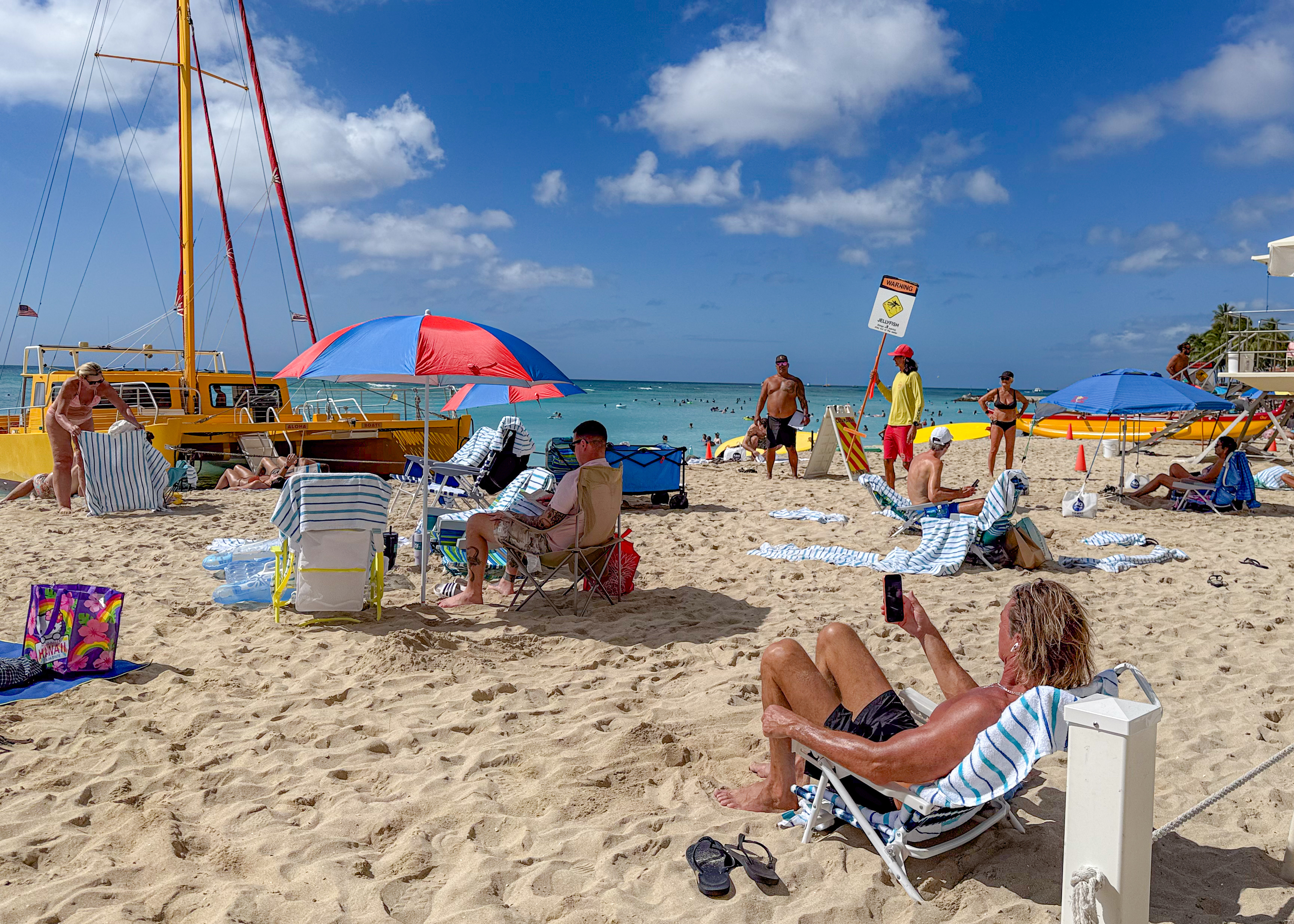
Unlike Kuhio Beach, Waikiki Beach is packed year-round. Too many resorts front the sand, and personally, I don’t see why I would spend the day at a crowded beach, stuck behind other people’s umbrellas. You can find that experience anywhere else on the island, or outside of Hawaii. For me, the real attraction is the warm, year-round ocean and the reef. But that’s just my perspective.

Boat traffic through Canoes break
Some sailboats depart directly from Waikiki Beach. You may have noticed beached catamarans in some earlier pictures. These include the Hawea, which picks up passengers in front of the Duke Kahanamoku statue, and the Na Hoku 3, located between the Outrigger Waikiki Beach Resort and the Moana Surfrider. Some of these boats set sail as early as 8:30 a.m., and all offer special sunset sails.
In the following scene, the Na Hoku 3 and Ke Kai catamarans carry tourists on a sunset tour, cutting through surfers like Moses parting the sea, and nobody bats an eye. This happens every day, and the surfers at Canoes break offshore from Kuhio Beach are well-adjusted to the routine.
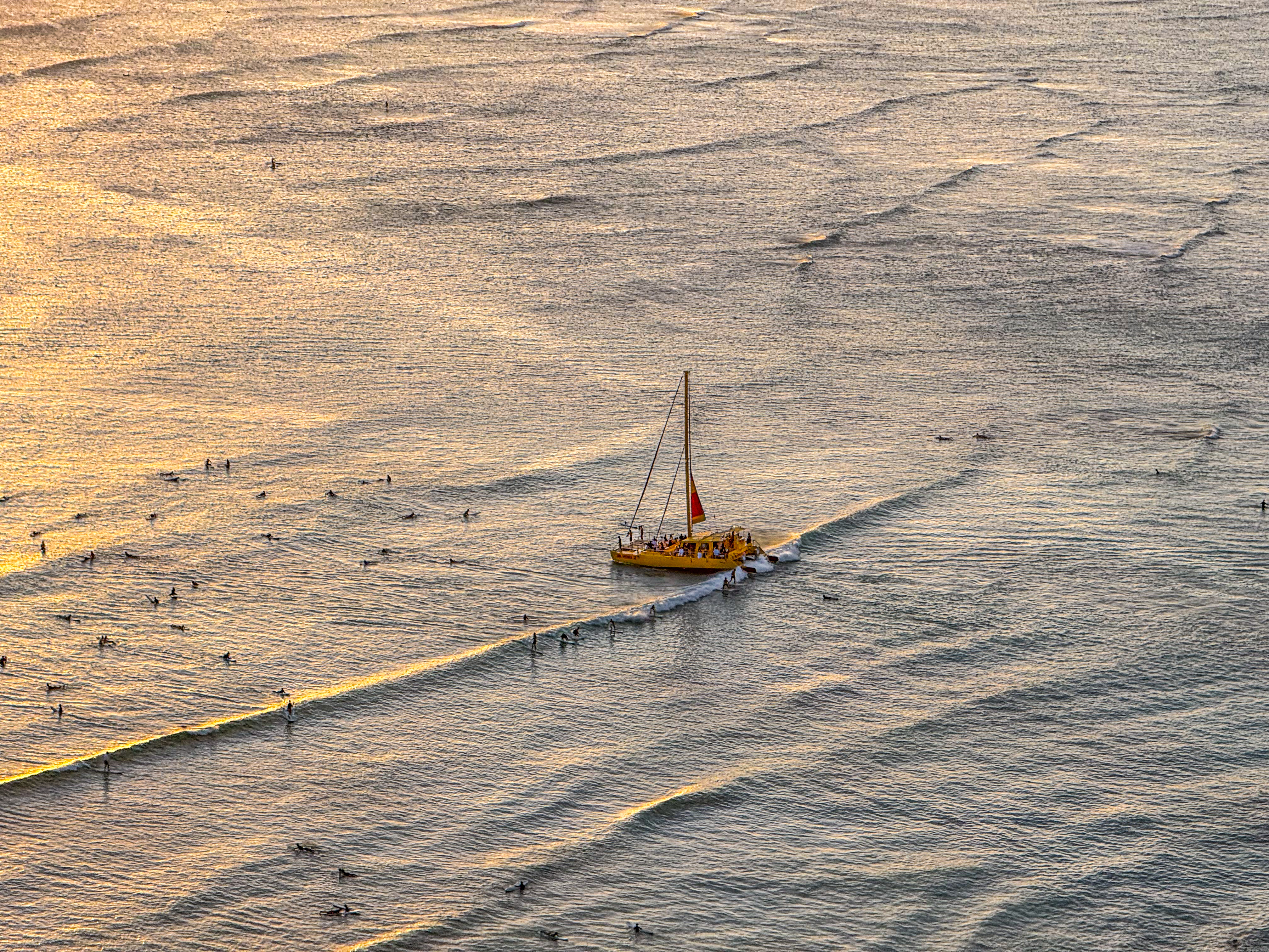
Na Hoku 3 lands in between Outrigger Waikiki Beach Resort and Moana Surfrider to drop off and pick up guests.
Snorkeling at Kuhio Beach
You may have heard that the best snorkeling on Oahu is at Hanauma Bay. Or that to see green sea turtles, you need to take a snorkel boat out to Turtle Canyon offshore from Waikiki Beach. These are only half-truths.
If you can’t secure reservations at Hanauma due to your schedule, there are still alternatives. It’s true that Hanauma generally offers the calmest and clearest waters on the island, but you can find the same fish, and possibly even more, right here in the west Kuhio Pond along its rock wall.
There may be more mature turtles at Turtle Canyon, which is known as a turtle cleaning station. Still, I spotted two large green sea turtles in just 20 minutes at the reef between the west pond’s large inlet and Canoes break. And beyond the rock wall, you’ll find larger schools of bigger fish. Same is true throughout the Waikiki Marine Life Conservation District (MLCD), including at Queen’s Beach.
You can actually spot green sea turtles with binoculars from a high floor. I haven’t found a telephoto shot to show this, though. Turtle spotting from this far away is not easy, because of lighting and waves. Through a pair of binoculars, turtles often look like reef rocks. They tend to stay in one place for long stretches, grazing on algae. And when they do move, they swim at a leisurely pace, their motion masked by the waves. In the end, I watched snorkelers instead. When a snorkeler stops swimming and hovers in place for more than 20 seconds, more often than not you will find what looks like a reef rock slowly shifting next to them. That’s your green sea turtle.
Snorkel gear is easy to rent throughout Waikiki. You can also buy a new set at ABC Stores located at nearly every corner in Waikiki. If you’re fairly new to snorkeling, make sure to choose a mask that fits your face properly. Leaks will wash away defoggers and can ruin your snorkeling experience, as I explained here.

If you’re staying in Waikiki, like most visitors, all you need to do is walk to the nearest beach in the Waikiki series. If you’re a confident swimmer, almost any beach will lead out to a reef where you can spot fish, and more importantly, green sea turtles. You will, of course, have to contend with mild waves.
Some reefs are directly in the path of surfers, such as the one by Canoes. Countless surfers ride waves over a corner of this reef, so be careful and avoid getting too close to their path.

For a beginner snorkeling experience, start inside the rock seawall at the west Kuhio pond. Along this entire stretch of wall, you can simply stand on the sand and peek into the water to watch fish. Wear swim goggles obviously. Or put on a snorkel mask if you prefer. Those in the know swim up and down the wall to see fish weaving in and out of the rocks; a snorkel tube is not even necessary.
This rock wall is marked “A” on the following map. It is teeming with fish similar to those you might see at Hanauma Bay, though they are smaller. They dart in and out of the gaps between the rocks along the wall.
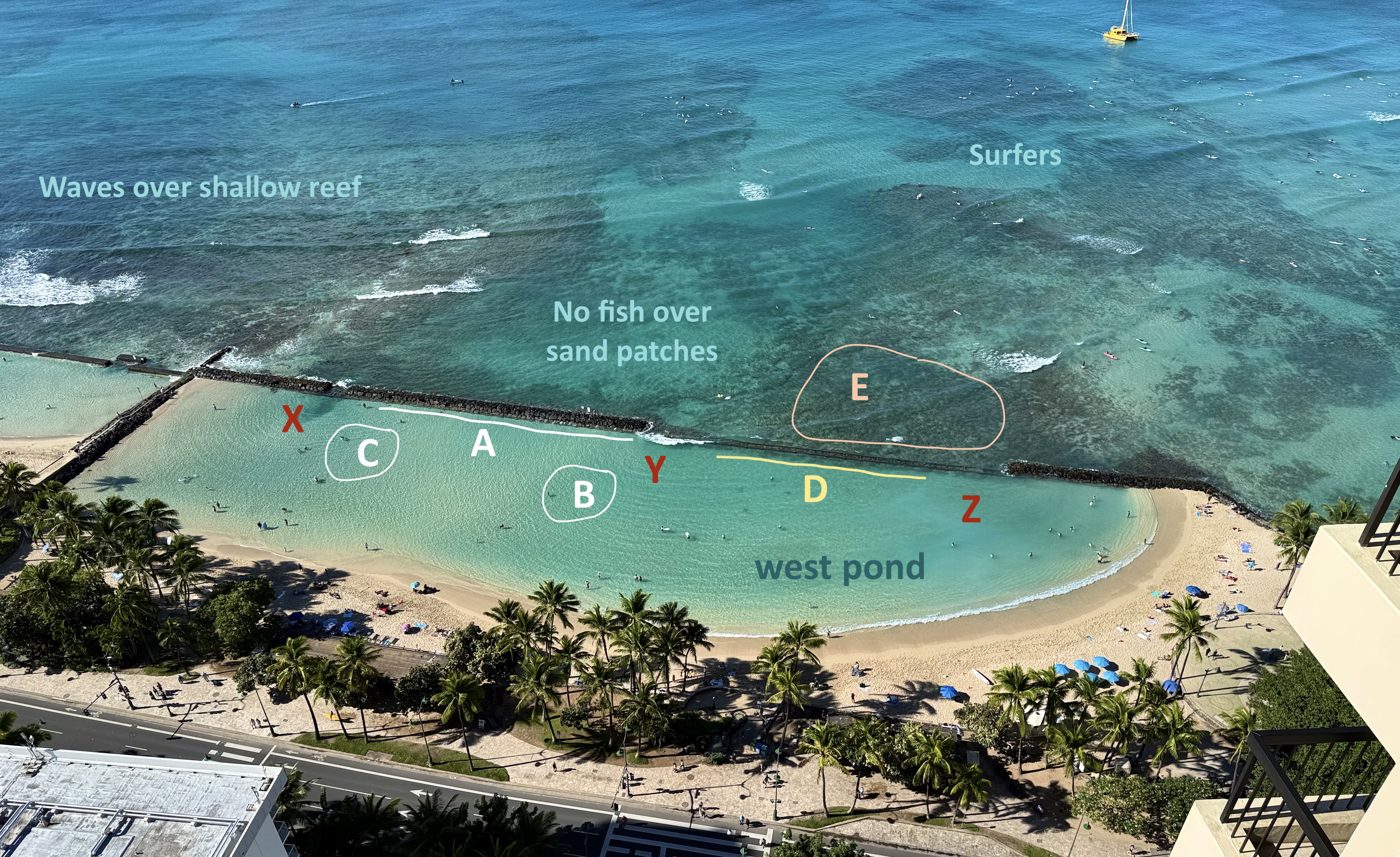
During my week-long stay in November, I consistently found schools of juvenile yellowstripe goatfish within the pond. Known as ‘oama when under seven inches long, they look quite different from their adult counterparts. I spotted them congregating around areas “B” and “C”, and they were present every day. I also saw them at Kaimana and Kahala; they seemed to be everywhere in November. Wherever ‘oama school, you will usually find a few juvenile trumpetfish as well, though I’m not sure why.
I also found an assortment of fish along the rock wall stretch marked “D”, similar to stretch “A”. However, this entire stretch forms a water inlet, and mild waves wash into the pond here. The water is slightly murkier, so only venture into this area if you’re comfortable with its deeper floor.
Stay away from the inlet marked “X”. Waves rush into the pond here, carving out a deeper floor. But that may be why ‘oama tend to school near this inlet. Similarly, “Y” is where waves create a slightly deeper floor on the opposite side, which is also why a large school of ‘oama gathers there. The entire area marked “Z” is murky, so it’s best to avoid it.
After a while, I grew more confident by observing the height of the waves from inside the pond. I practiced breathing through the mild waves washing in. And eventually swam out of the pond through the inlet into area “E”. There, I found larger versions of the same fish, including tang, triggerfish, butterflyfish, parrotfish, wrasse, and bluefin trevally. I even spotted a huge moray eel. And within 20 minutes, two green sea turtles came into view. I stopped swimming and simply floated in the water, watching these graceful creatures munch on the reef.
There are no fish to see in clear sand patches, and as mentioned earlier, avoid the path of surfers. I also found the reef at Baby Queens break, just outside the east Kuhio pond, to be too shallow and the wave action too strong to be enjoyable. Perhaps conditions are different on another day or at a different tide.
You will also find reef further away from Waikiki center. The entire stretch of Waikiki Marine Life Conservation District is off limits for fishing. You can launch into this reef from Queen’s Beach. See Jordan’s film.

Around Kuhio Beach
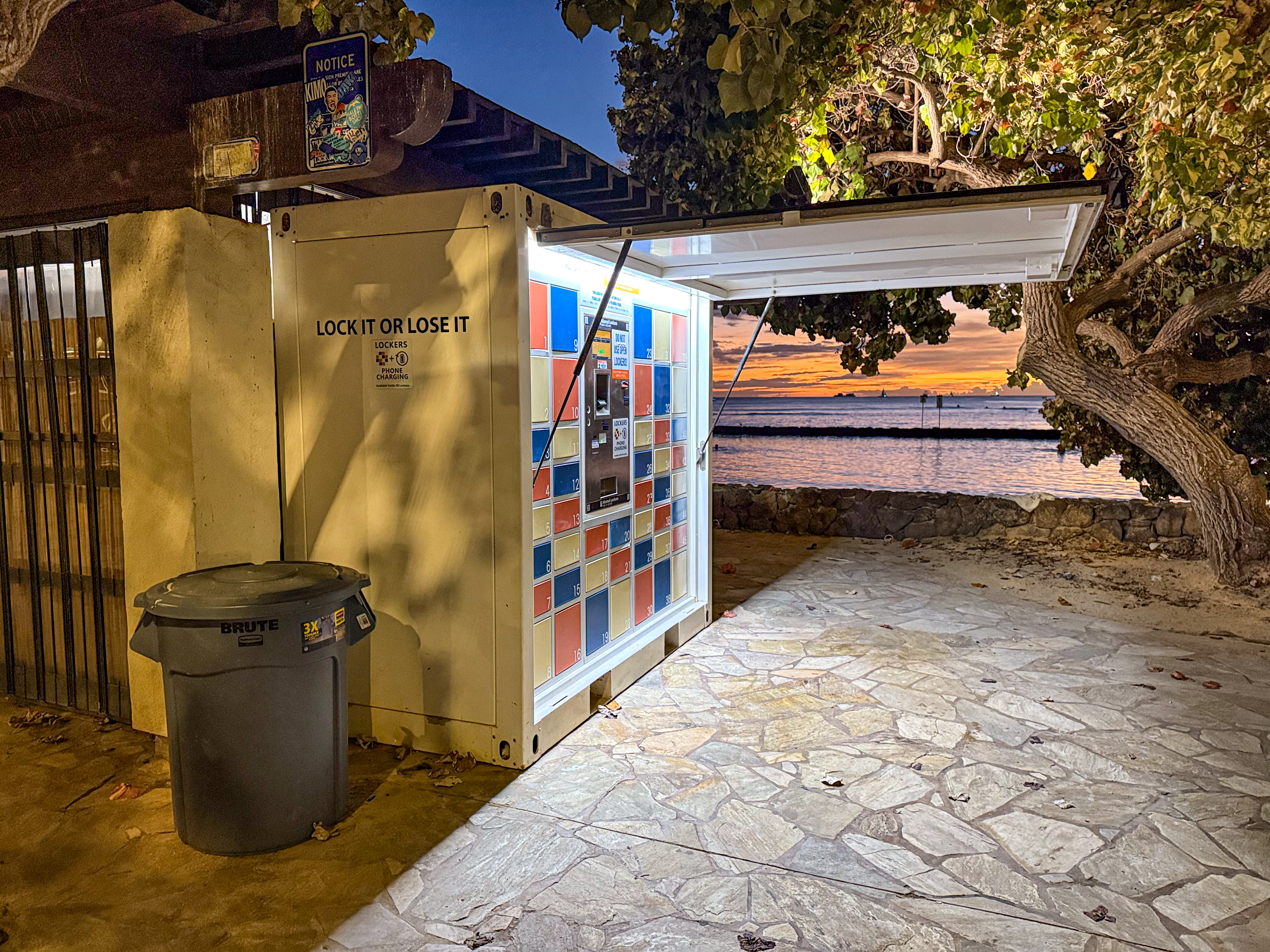
Right by the Kuhio ponds you will find locker boxes like this.
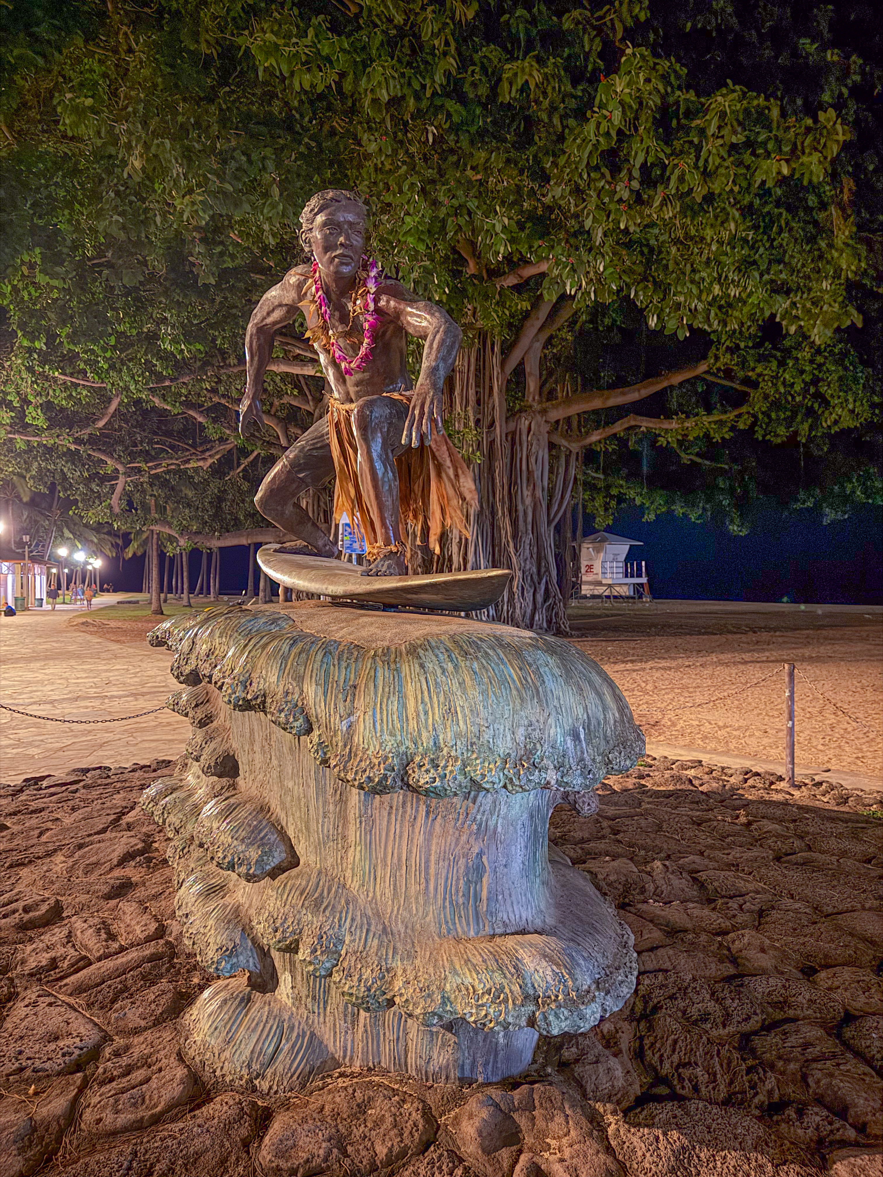
As you walk toward Diamond Head, you’ll see a statue of a surfer riding a wave. This marks the start of Kapiolani Park, and technically, the Waikiki Peninsula ends here. The Lifeguard Tower 2E seen in the background is officially registered as a tower within Kapiolani Park.
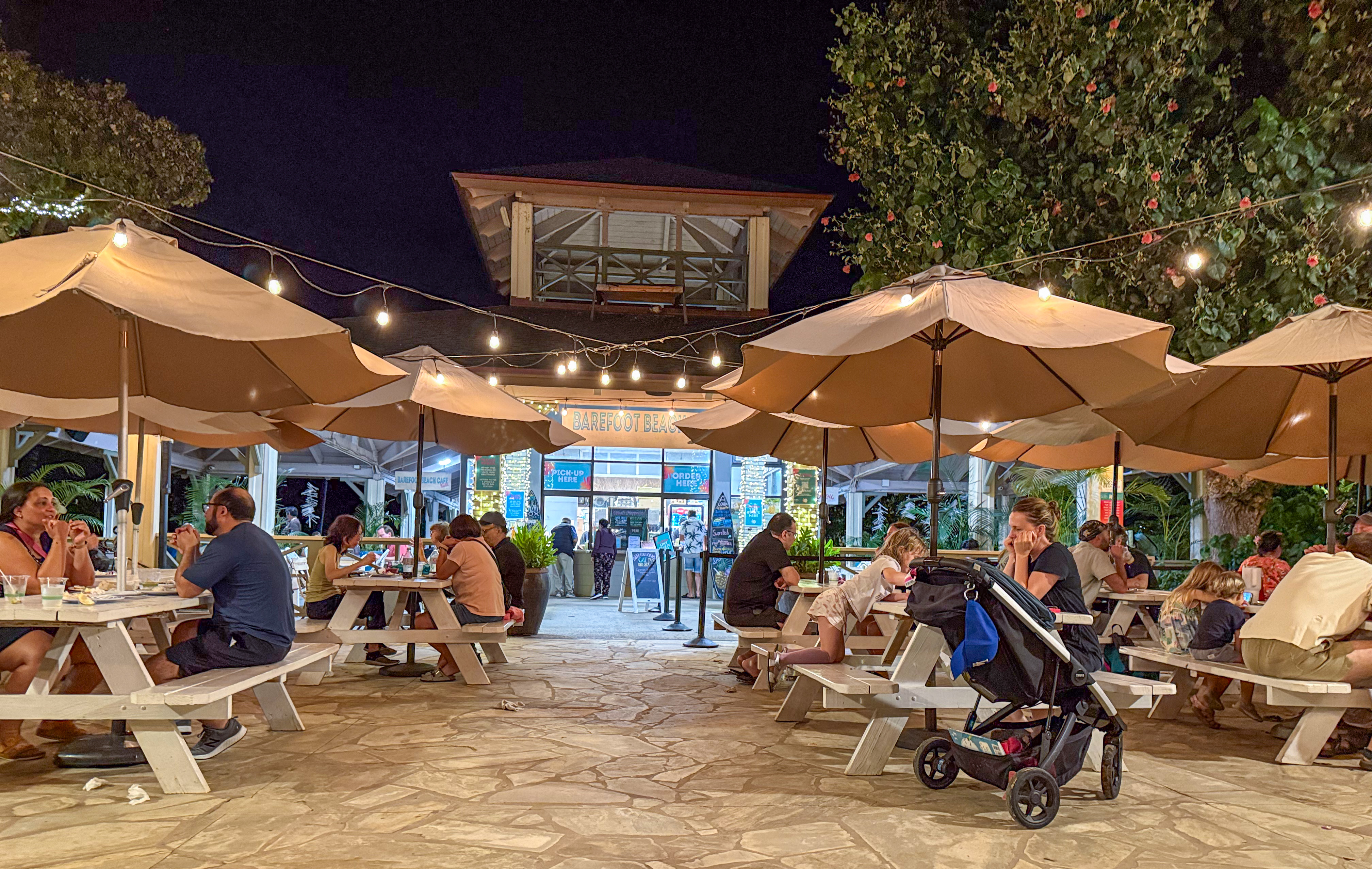
There are very few restaurants and cafés directly on the oceanfront. Barefoot Beach Café is likely the only one not affiliated with a resort in Waikiki.
If you walk instead from Kuhio Beach toward the Royal Hawaiian in the Ewa direction, you’ll pass the Waikiki Police Station.

Kalakaua Avenue is the “main street” of Waikiki. Along the Kuhio Beach stretch, it’s one of the few sections where you can see the ocean directly from the street. Unlike Waikiki Beach, no hotels or resorts are built directly on the beach here, though some are located just across Kalakaua Avenue. As a result, Kuhio Beach doesn’t feel monopolized by resorts; you won’t see rows of beach chairs set out by daybreak, sitting empty yet blocking locals from the sand.
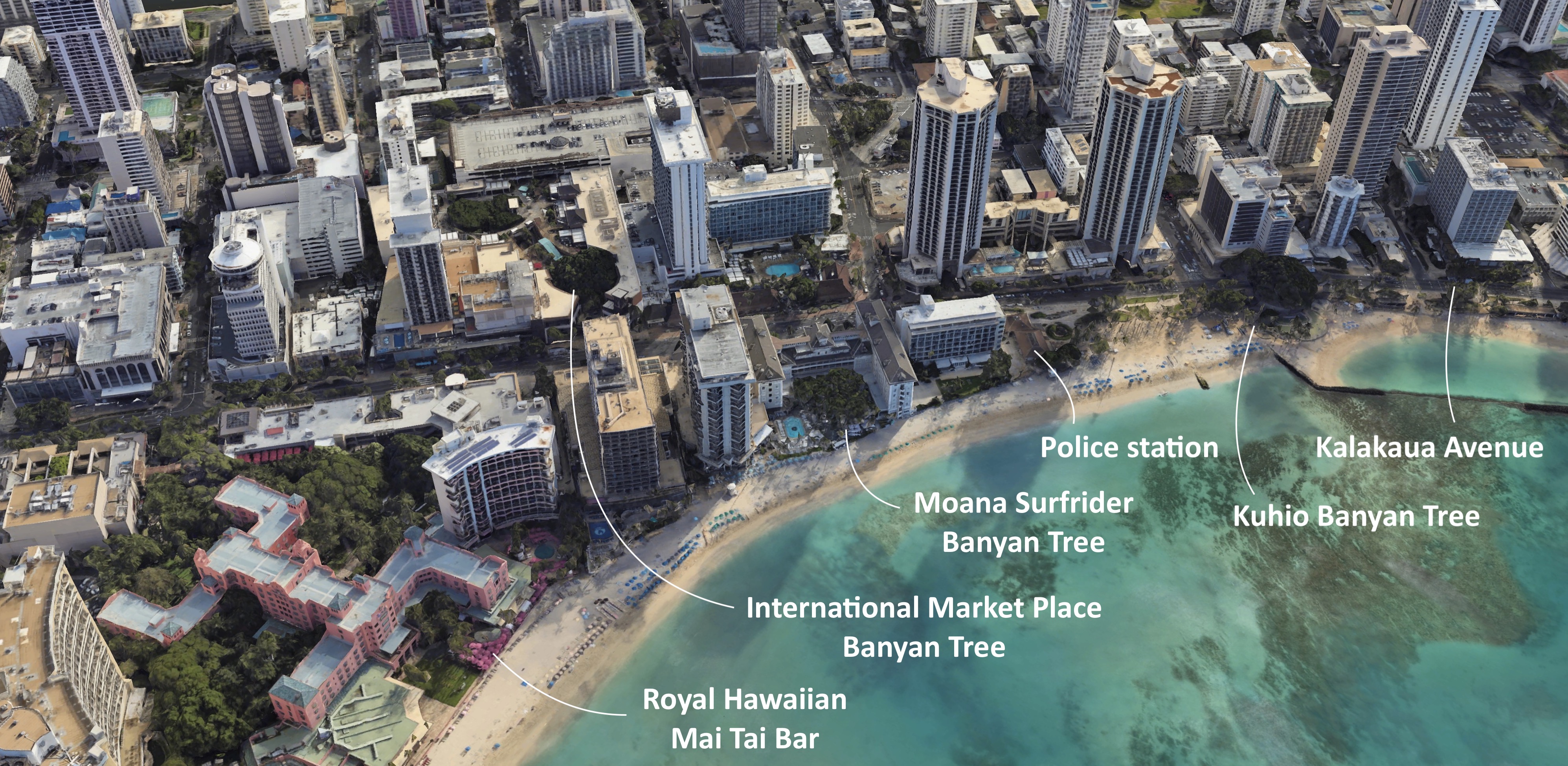
The Waikiki Police Station marks the end of the Kuhio Beach stretch. If you continue west on Kalakaua Avenue past the station, the shoreline disappears from view. Instead, you come upon the entrance to the Moana Surfrider.
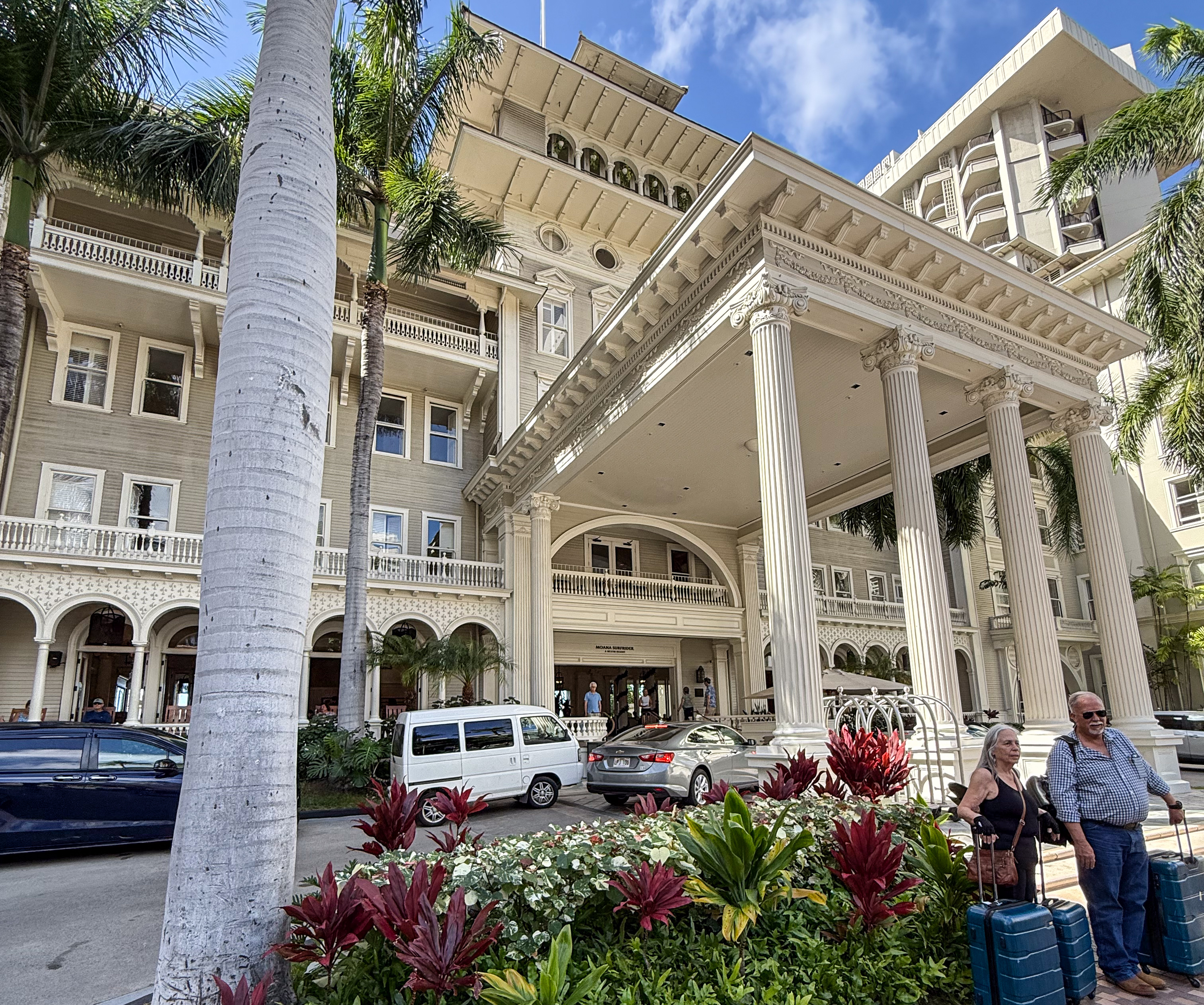
Walk into the Moana Surfrider and continue toward the ocean. You’ll arrive at its famous Banyan Tree and the café beneath it. As you explore Waikiki and the rest of Oahu, you’ll keep encountering unbelievably immense banyan trees and monkeypod trees.

Walk along the beach, and you’ll soon reach the famous Mai Tai Bar at the Royal Hawaiian. This traditional resort certainly takes the color pink seriously.
Walk back to Kalakaua Avenue and cross the street to reach the International Market Place. Right by the entrance stands yet another famous Banyan Tree. As I mentioned, you can’t walk a hundred yards in Waikiki without encountering another historical banyan. It seems that, on Oahu, buildings are often designed and built around these ancient trees.

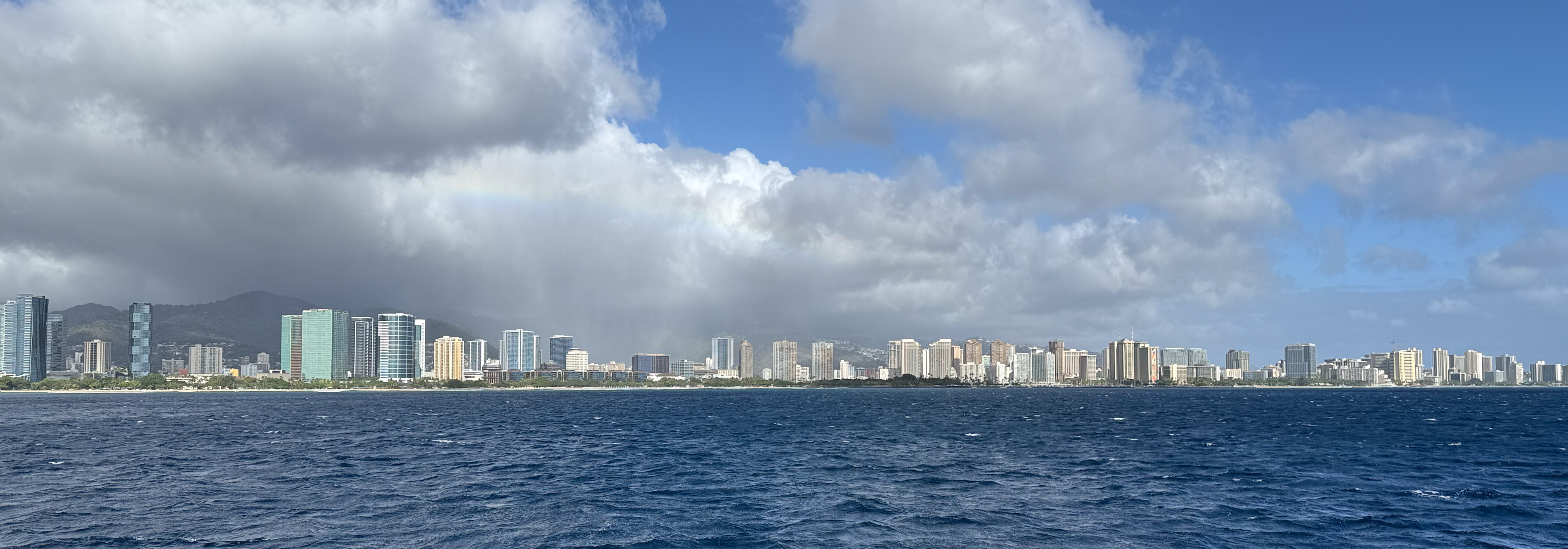
The Waikiki skyline
Waikiki Bay boasts an impressive skyline. But it’s hard to fully appreciate while standing on the ground between the buildings. Here is a picture of the skyline taken from a boat.
The approximate location of the boat is marked on the following map. Three additional inland vantage points are also indicated. These are popular spots for taking in the Waikiki skyline.
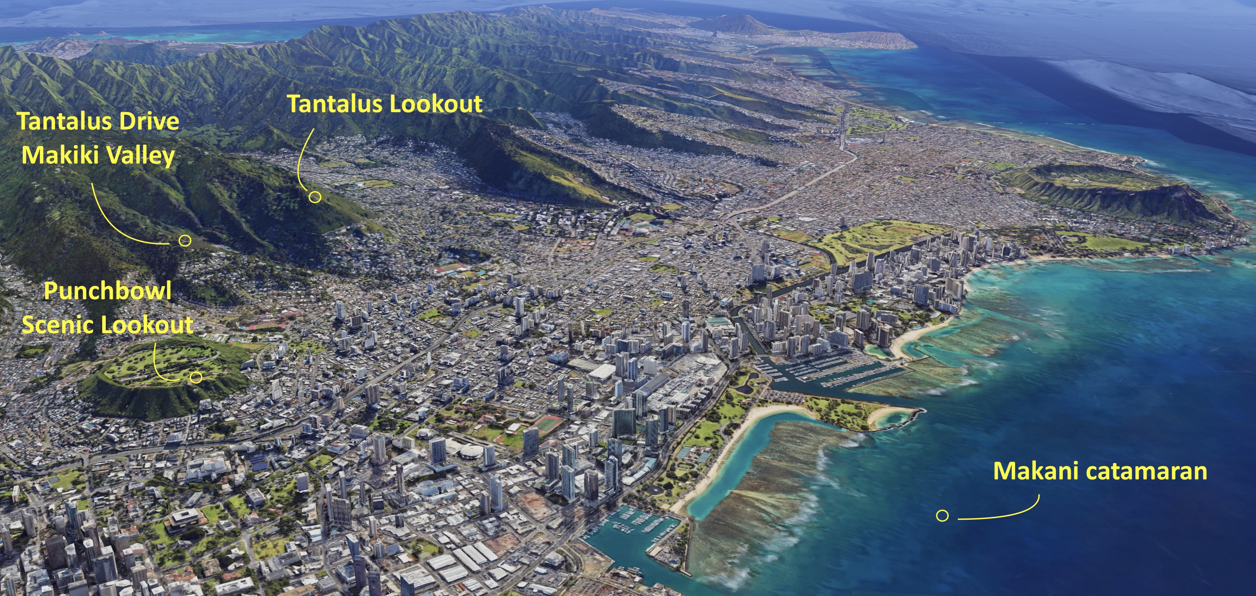
You’ll often find pictures taken from these three higher-altitude locations mislabeled online. I’m not surprised; these spots are close to one another, and at first glance, they seem to offer the same view of the city. But that’s not actually the case.
Here is the skyline as seen from Tantalus Lookout, arguably one of the most popular viewpoints on the island. From here, you can see the shoreline and skyline stretching from Ala Moana, across the entire Waikiki Bay, all the way to Diamond Head.
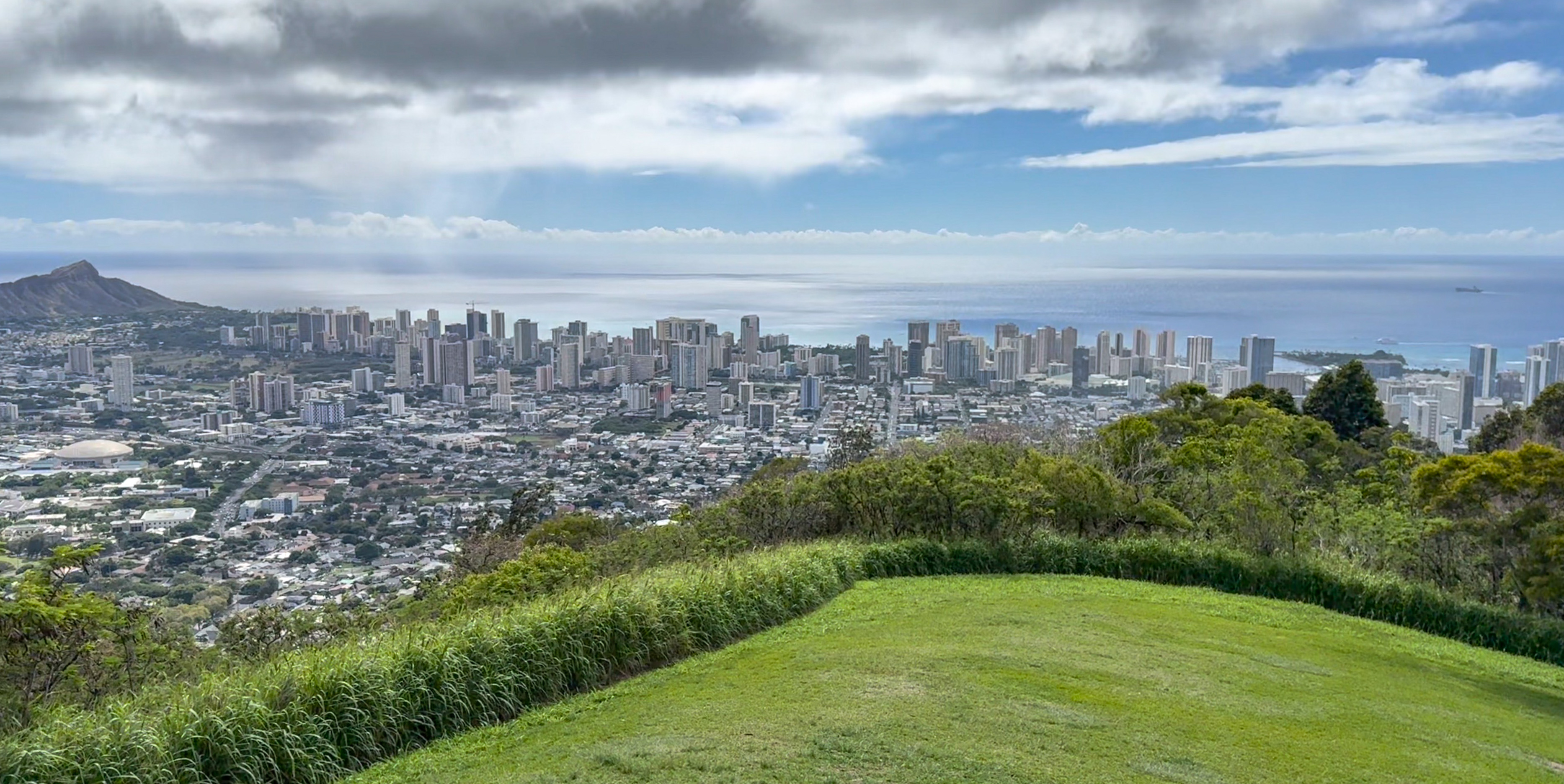
Next is the view from near the start of Tantalus Drive, just past Makiki Valley. The distant buildings along Kuhio Beach look similar from here, but the closer buildings near Ala Moana are seen from a different angle at this vantage point.
The third vantage point is from Punchbowl Scenic Lookout. This panorama offers a unique perspective on the skyline compared to the previous two locations.
Did you notice an unusual visual effect in this panorama? Let me highlight it. All the tall skyscrapers along the shoreline appear to be the same maximum height, and their rooftops seem to line up perfectly with the horizon when viewed from Punchbowl Scenic Lookout. This suggests that the lookout is at roughly the same elevation as those rooftops. A quick search confirms this chance observation – these buildings are all built to a maximum height of 400 feet.
Rainy and shoulder seasons at Oahu
We booked our November stay specifically during what is known as the shoulder season, October to November, between the busy summer season and the December holiday rush. November also marks the beginning of the rainy season, which runs from November through March.

And they aren’t kidding when they say “rainy season.” We rented a car for our entire stay and drove all over Oahu. We didn’t see a clear blue-sky day in Kaneohe or other windward towns. That’s not to say the sun never peeked out from behind the clouds.
Like the other Hawaiian islands, Oahu has a multi-climate personality, shaped by the northeast trade winds and its mountain ranges. The side of the island you’re on largely determines the climate you experience. But microclimates exist as well. Sometimes the same cloud will rain on your town while leaving the next one over dry. You’ve seen examples of these microclimates in action earlier.
My experience at Waikiki, however, was noticeably different. The sun was out more often than not, and it rarely rained on the beach. The leeward side of the island was even sunnier.
The following video covers all of Waikiki plus Ala Moana. See if you can spot the faint rainbow and the neighborhood getting rained on. Note how the entire beach shoreline remains bathed in sunshine? Welcome to Hawaii in November.
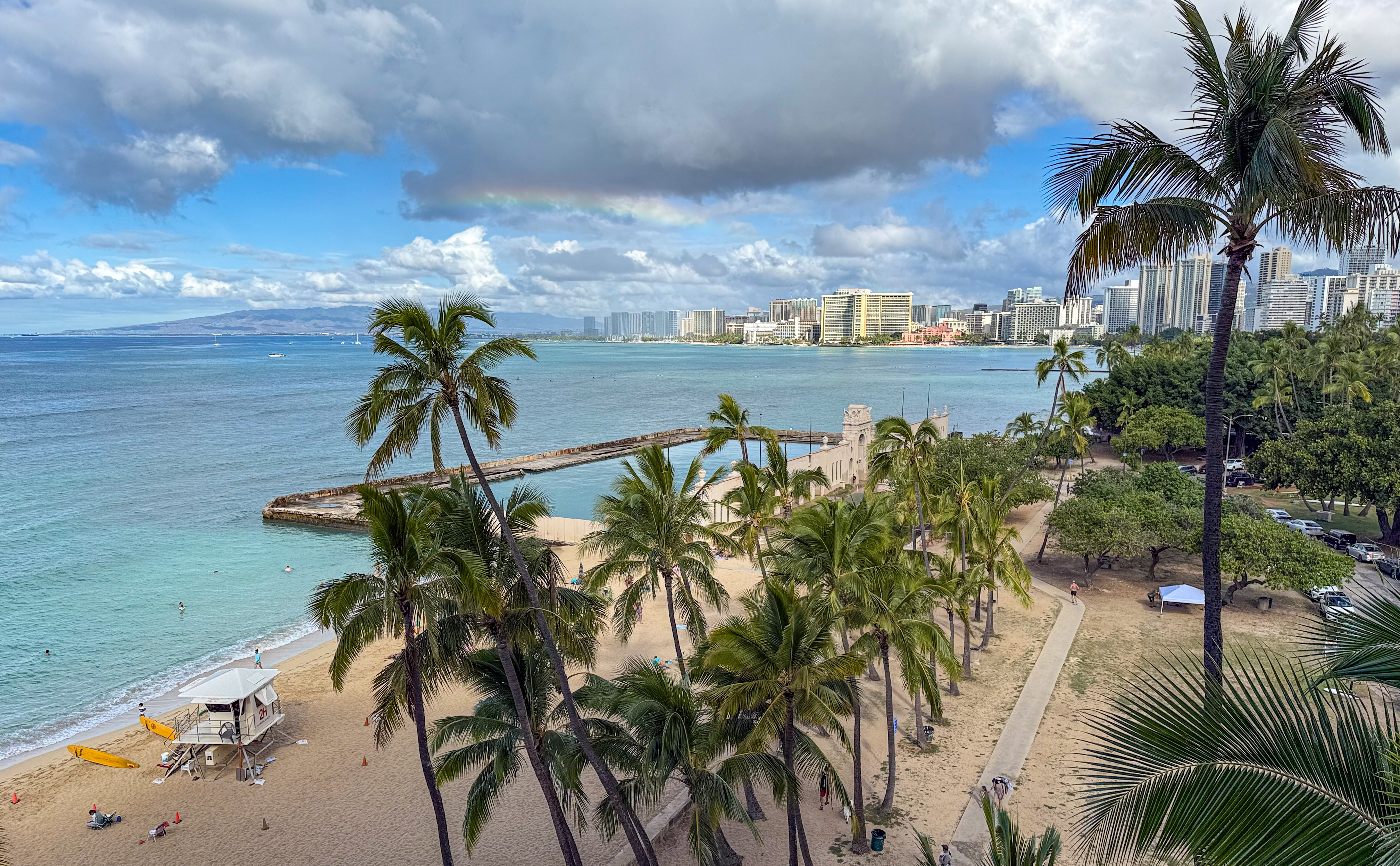
On this island, clouds, rain, and rainbows go hand in hand. You’ll often see all three at the same time.
A bright shoreline quickly dimmed as dark clouds rolled in, snuffing out the sunshine. The water temperature, however, remained warm and constant throughout my stay on the island. Soon enough, the clouds lifted, and laughter returned to the beach.
The following is a panoramic video from Tantalus Lookout. From here, you can see almost all of Honolulu, including the stretch from the airport to Diamond Head, weather permitting. It did not, at least not on this rainy day in November. Clouds poured rain over several towns. During our three-week stay at Oahu at the start of the rainy season, we visited the lookout three times. The other two visits offered only slightly better weather.
We also visited Nuuanu Pali Lookout three times. And it rained hard every single time. Some areas of Oahu don’t get a break from the rain in winter. So sad.
The Windy app from windy.com is an essential tool. I paid $30 for a one-year subscription just for this trip. And having hourly hyperlocal forecasts and historical satellite views at my fingertips was well worth the money. This seems to be the consensus on Reddit as well. I also learned a lot about visiting Hawaii from the r/VisitingHawaii wiki.
Locals universally rely on surf reports from SNN, the Surf News Network. It’s a Hawaiian thing. Kayak rental shops even check the surf report before letting you take a kayak out on the ocean. Waves can be no joke, especially in winter. But winter hardly affects the surf at Waikiki Bay. That’s one more reason this shoreline is popular year-round.
Rainbows at Oahu
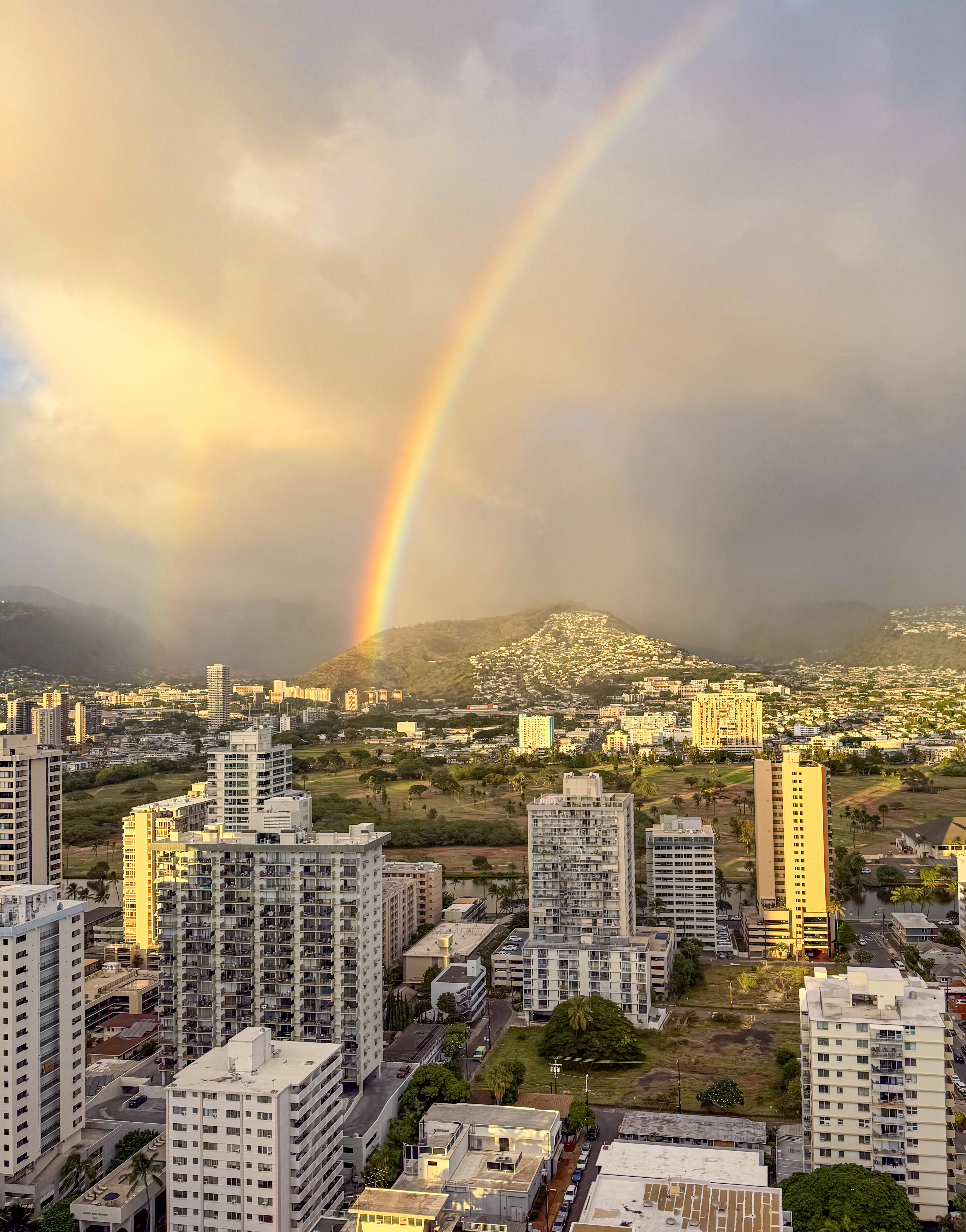
One benefit of visiting during the rainy season is that rainbows appear frequently. Sometimes they were faint, and I only noticed them while processing pictures at home. Invariably, I found a rainbow in every photo taken with the sun at my back. I’ve already shared a few pictures and videos earlier that include rainbows; you may or may not have noticed them.
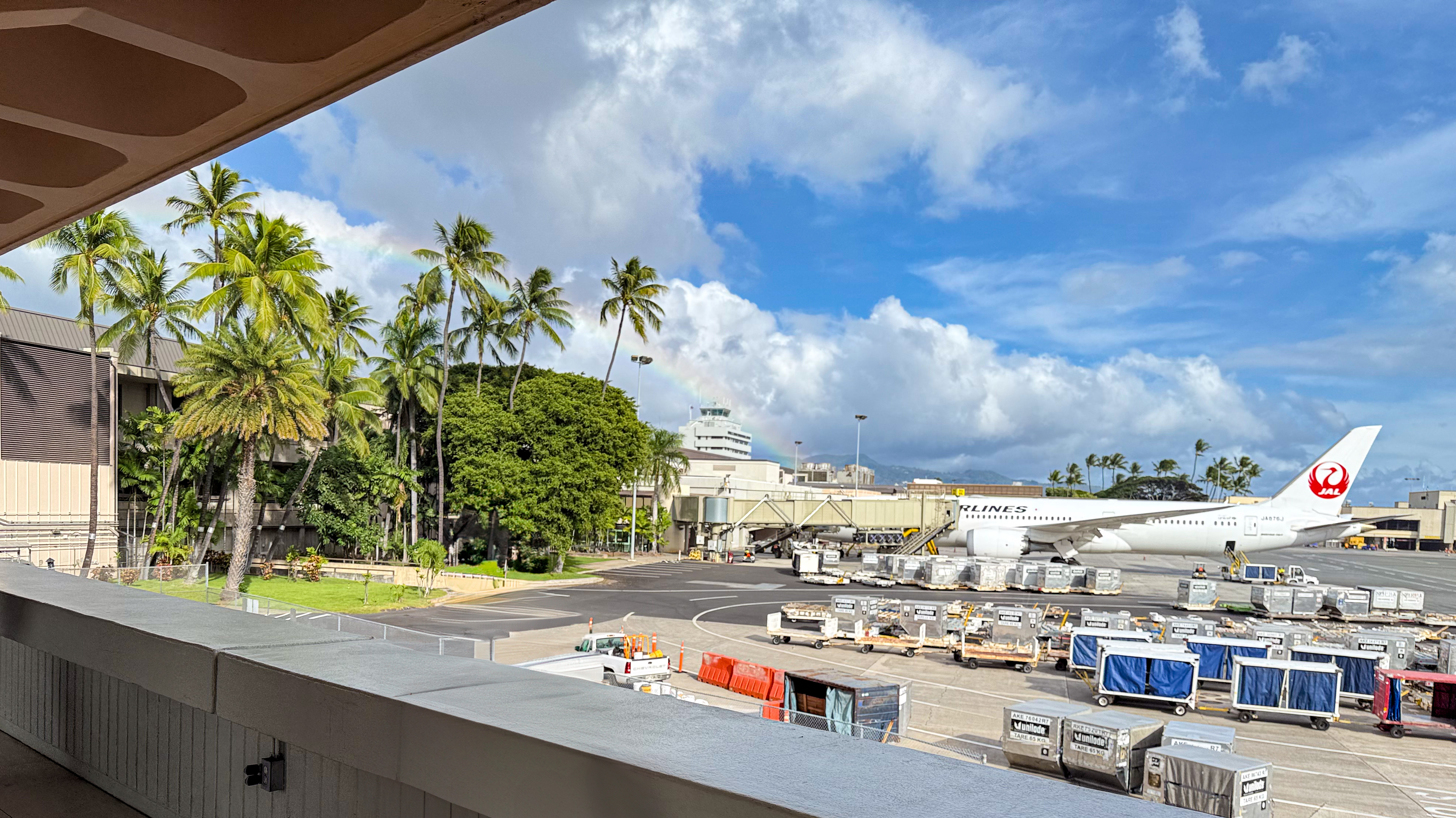
So here is the very first picture I snapped after we stepped off the plane. I was surprised to find myself in an open-air terminal, so I took a photo to prove it, just in case nobody believed me. At the time, we didn’t think much of it. But later, while putting together my Oahu album, I noticed the rainbow.
In some shots, however, the rainbows were so bright and saturated that they looked almost unreal. They don’t call Hawaii the Rainbow State for nothing.

Some rainbows were so faint they went undetected until pictures were processed.
Then there are the double rainbows. Sometimes you can see them with the naked eye, but more often the outer arcs only reveal themselves when photos are processed.
We have gone off on a tangent to talk about aspects of Waikiki and Oahu outside the main topic of this long essay, Kuhio Beach. Now is probably a good time to end this long post.
The End
(last updated 2026-03-31)

