
I’ve always chosen window seats on flights whenever I could. And I never grew tired of watching my plane take off and land. Possibly I am just fascinated with flying, whether it involves model airplanes, computer simulations, or actual planes. But with only a few exceptional landmarks, I could almost never identify in realtime what the plane was flying over. It amazes me that I can’t recognize locations that should be familiar to me where I’ve driven by countless number of times.
The truth is that aerial views often looks quite different from ground views. Even though I kept thinking that I could mentally reconstruct a god’s eye view of my neighborhood, every landing proved me wrong. And my last trip was no exception. As I the plane readied itself for landing, I looked out of the window and couldn’t tell where the plane was. I put my phone against the window pane for the first time, and recorded the entire landing path.
I played the clip backward at home, and fired up Google Maps with Globe View to rotate its map to match the window view of the terrain. Painstakingly I retraced the flight path backward from runway 22L. This turned out to be the quickest way to reconstruct the landing path. In doing so, I’ve joined a bunch of nerds like Joseph Gunn who document, among other thing, flight paths. In fact, I consulted one of his blog posts on flight patterns to confirm landing paths at runway 22L.
But first, here is the video recording of the landing path of Delta 650 in late November 2025. Can you name of the golf course in the thumbnail? That’s the Wheatley Hills Golf Club. But of course, I had no idea when I looked out the window at it.
Here is a map showing the flight path as recorded in the clip. Open the map with Ctl-click or Cmd-click into a separate window to compare it to the video. You can also open the YouTube video in its own window.

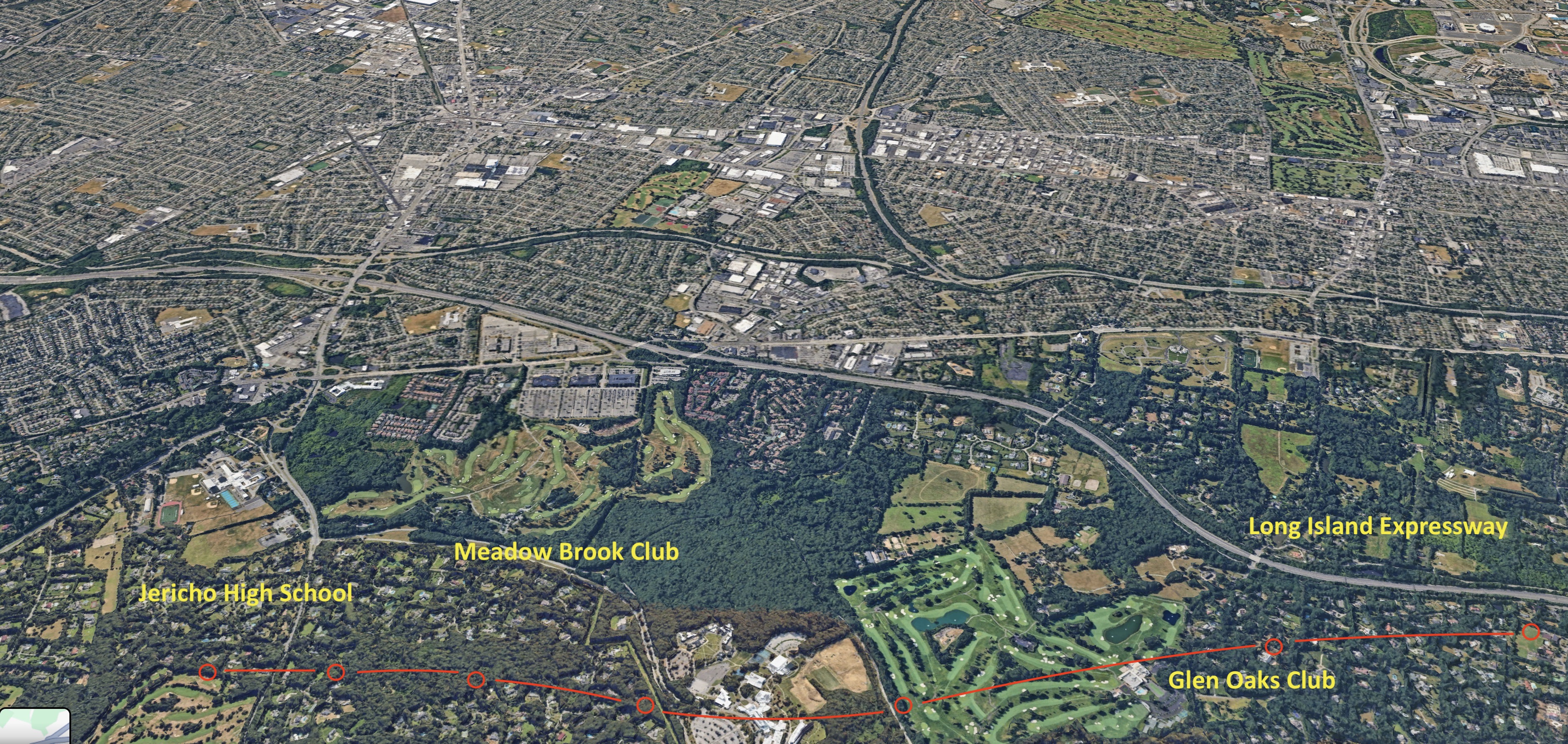
Here are four inset maps with detailed landmarks. The video starts at Jericho High School, with the plane flying by Meadow Brook Club, Glen Oaks Club, Long Island Expressway, East Williston School, Northern State Parkway, and Wheatley Hills Golf Club.

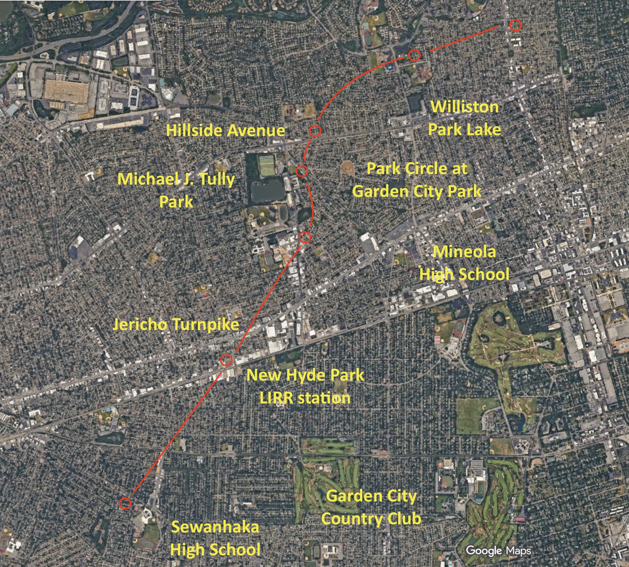
Once it flew past Williston Park Lake, the plane banked left around Park Circle in Garden City Park as it crossed over Hillside Avenue, and turned left leaving Michael J. Tully Park to the right. It made further corrections flying with Mineola High School on its left. It flew over Jericho Turnpike, and New Hyde Park Long Island Railroad station. The plane flew past Sewanhaka High School, with Garden City Country Club to its left.
Shortly after it flew over Beth David Cemetery, Southern State Parkway, and the end of Cross Island Parkway. Its landing path is set, and it continued flying alongside Belt Parkway towards JFK now.

When it reached S. Conduit Avenue, it barely flew over the traffic, with the Green Acres mall in the far background. Now there is just marshland under it, and shortly Runway 22L can be seen. The plane then landed.

What follow are ten 3D maps showing the terrain as seen from the window seat. I fired up Google Maps with Globe View, and rotate the map for each capture, to match the window view as seen at each location.


That’s it. Till next time.

