
The availability of skateable trails on Long Island is pitiful, compare to that in New York City. Despite having a much larger landmass, Long Island features very few publicly-accessible trails with paved and clean surfaces. To wit, click on the follow image to look at biking trails and bike-friendly roads in Nassau county compared to NYC, Queens and Brooklyn.

But not all biking trails and bike-friendly roads are suitable for inline skating. Some trails go significantly uphill and downhill – a challenge for beginner skaters. Some trails are not regularly maintained, and are full of debris that can trip an oblivious rollerblader. Furthermore, sharing a road with actual traffic is not something an inline skater would normally do, except of course, if you do go on a rampage with a few hundred fellow skaters on a Wednesday Night Skate NYC event.
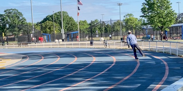
Usually one would prefer clean and paved surfaces. There are actually some outdoor tracks for roller skating and inline skating, such as the rink at Eisenhower Park.
You may find a street-hockey rink somewhere, such as the rink at Mahorhaven Beach Park.
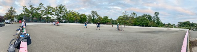
Often these outdoor hockey rinks can be found close to a skatepark. This is the case at Manorhaven. There is a small skatepark where an experienced inline skater may horn their aggressive inline skating skills.

For more skateparks near Nassau, including some locations from Queens, head to the article on Public Skateparks on Long Island.

Outside of these parks, there are also a few nice biking trails in Nassau that are relatively safe for inline skating. These include:
- Bethpage Bikeway
- Ellen Ferrant Memorial Bikeway
- Ocean Parkway Coastal Greenway
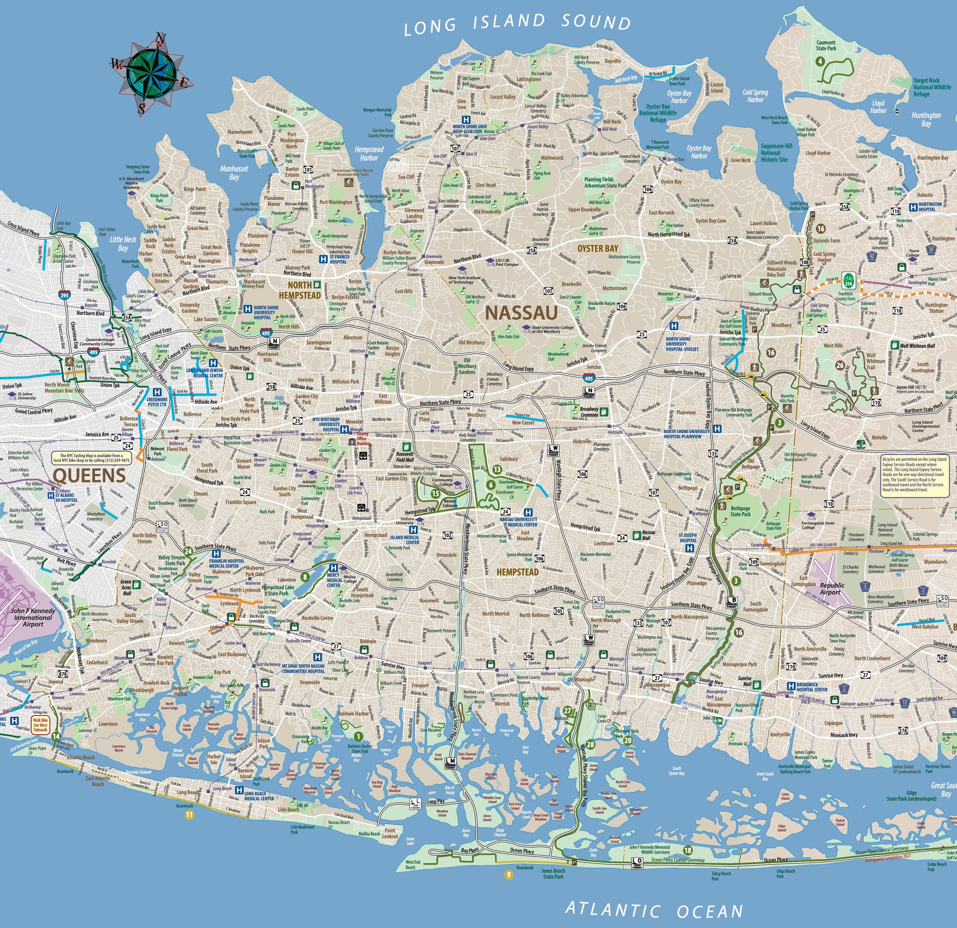
You can find these trails on the Long Island Bikeways & Trailways map, published by the department of transportation. These are huge, printed maps. They are often posted alongside designated biking trails. Perhaps you can get your hands on a printed copy from somewhere. But I don’t know how. Trying to find a copy online turns out to be more difficult than you imagine. Even when you do, you may stumble upon an ancient version. And you can’t tell by looking at the map – it shows no dates whatsoever. I have in fact found two versions of this published map online, both saying they are the “2nd edition”, but clearly one is older than the other. I can tell, because the older version doesn’t show the Hempstead Harbor Woods Mountain Bike Trails opened in 2019.

The government is not good at making this map available online. Or rather, it is not good at maintaining permanent URLs to important pages. That QR code points to a broken page. The newest version of this biking map is apparently last-updated in December 2020. It shows the entirety of Long Island, including both Nassau and Suffolk. It is only available in a large PDF that, on an average computer, freezes for minutes, when you zoom in to look at individual sections.
So here I give you a JPG version of this map, showing biking trails and roads in Nassau county. You can zoom into it from a browser window with no issues. Download it and save it on your phone, for use when you go out there to skate. Presumably this map was last updated in December 2020.
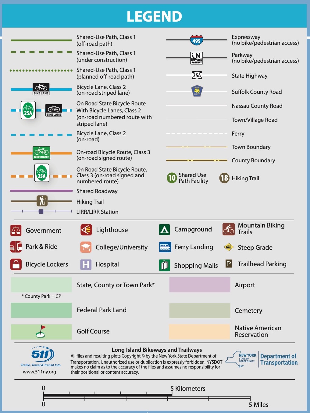
Here is the Legend section of the huge PDF. Now you can zoom into it even on your phone.
Areas of special interests to bikers (and inline skaters) are numbered on the map. This is the annotation section for these special-interest areas.

If you want the unwieldy PDF file, you can find it at 511NYRideshare. The PDF file shown on this article is from this ZIP file at 511NYRideshare. I saved a copy of the ZIP file on this website. Click on the thumbnail below to get it, should the official document disappear one day, as I expect it eventually will.

Then there is the ambitious Long Island Greenway project. If successful, it will create a nearly 200-mile greenway through 27 communities from Manhattan to Montauk. The project started in 2019 and was funded in 2022.
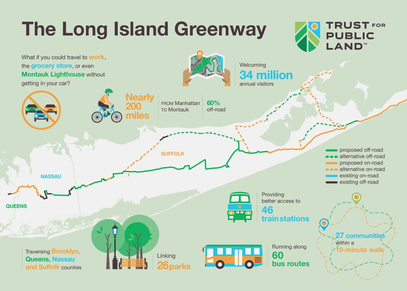
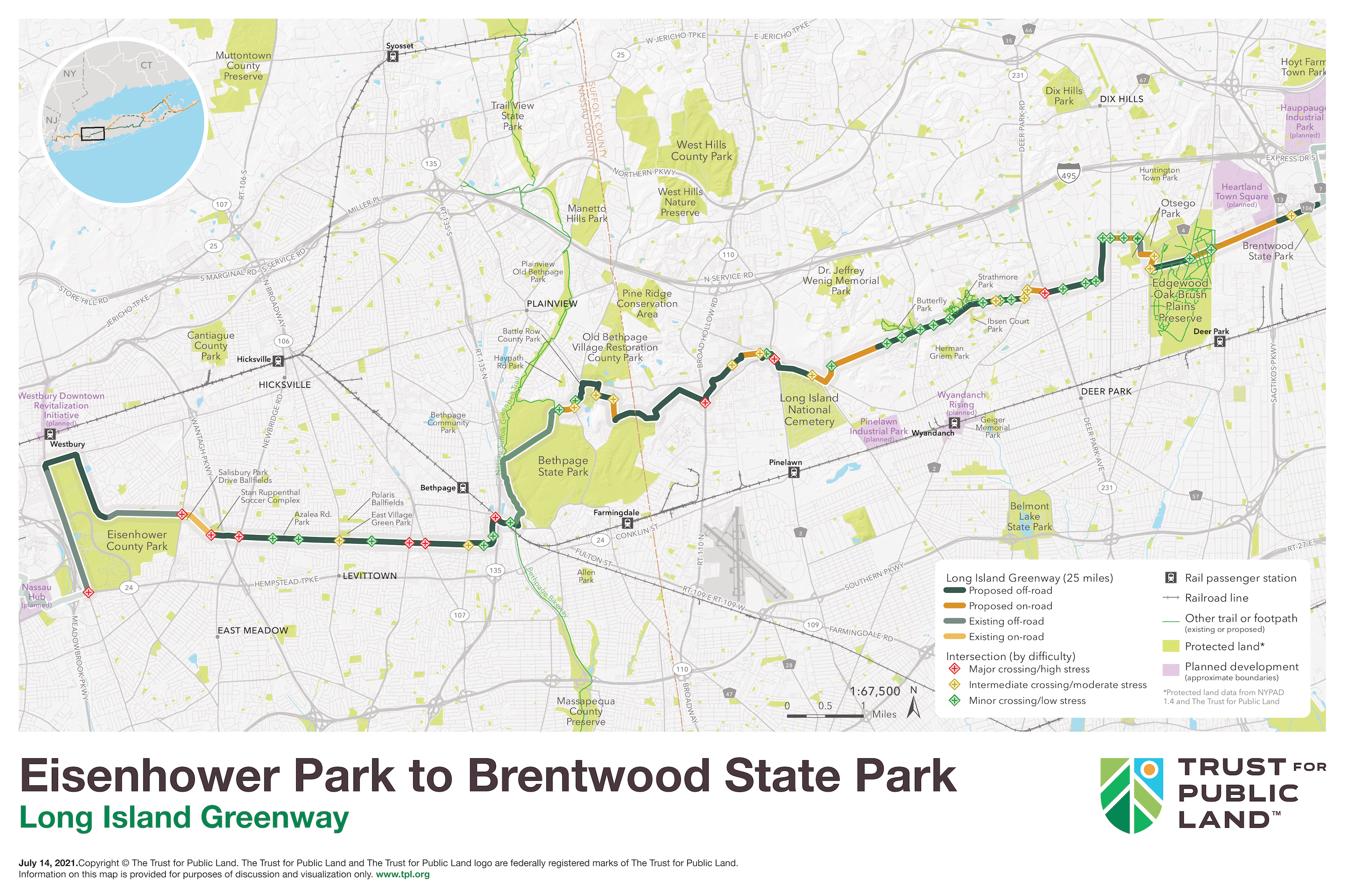
Construction for the first section from Eisenhower Park to Breantwood State Park will begin in 2026.
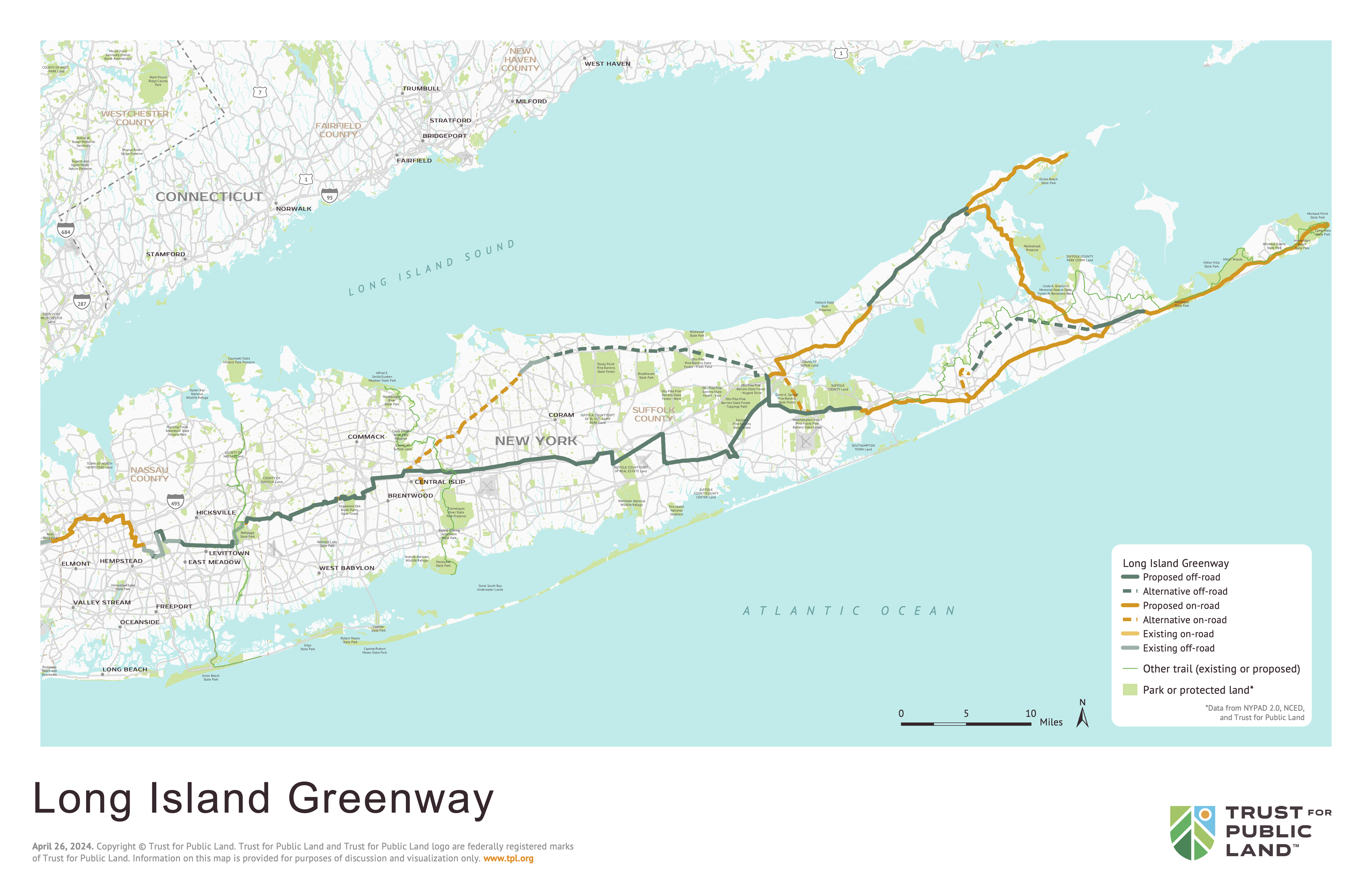
When finished this greenway will span the entirety of Long Island. The map was updated in April 2024.
We can hope. And contribute to it.

