
Delta 650 took off from runway 8R at Daniel K. Inouye International Airport due East at 5:15pm local time. Our pilot seemed to have made a point of banking the aircraft to trace the southern coast in the first 4 minutes of the flight to afford those seating on the left side a great aerial view of Sand Island, Honolulu downtown, Ala Moana, Waikiki, Kaimana, Diamond Head, Kahala, Hawaii Kai, Hanauma Bay, and Koko Head. Then the plane turned East again and flew towards the mainland.
Unlike the JFK arrival video I recorded, I was able to recognize all landmarks as I looked out of my window seat. This was largely due to my month-long research into Oahu before our trip to the island. But still, I figured I would write a post showing these famous Hawaiian landmarks. Here is the recorded video.
Here is a map showing the flight path as recorded in the clip. Open the map with Ctl-click or Cmd-click into a separate window to compare it to the video. You can also open the YouTube video in its own window.

Here are four inset maps showing key moments of the flight, with corresponding screenshots. The first map illustrates the takeoff flight path from the east-facing runway 8R. The plane was airborne shortly after it reached mid runway.

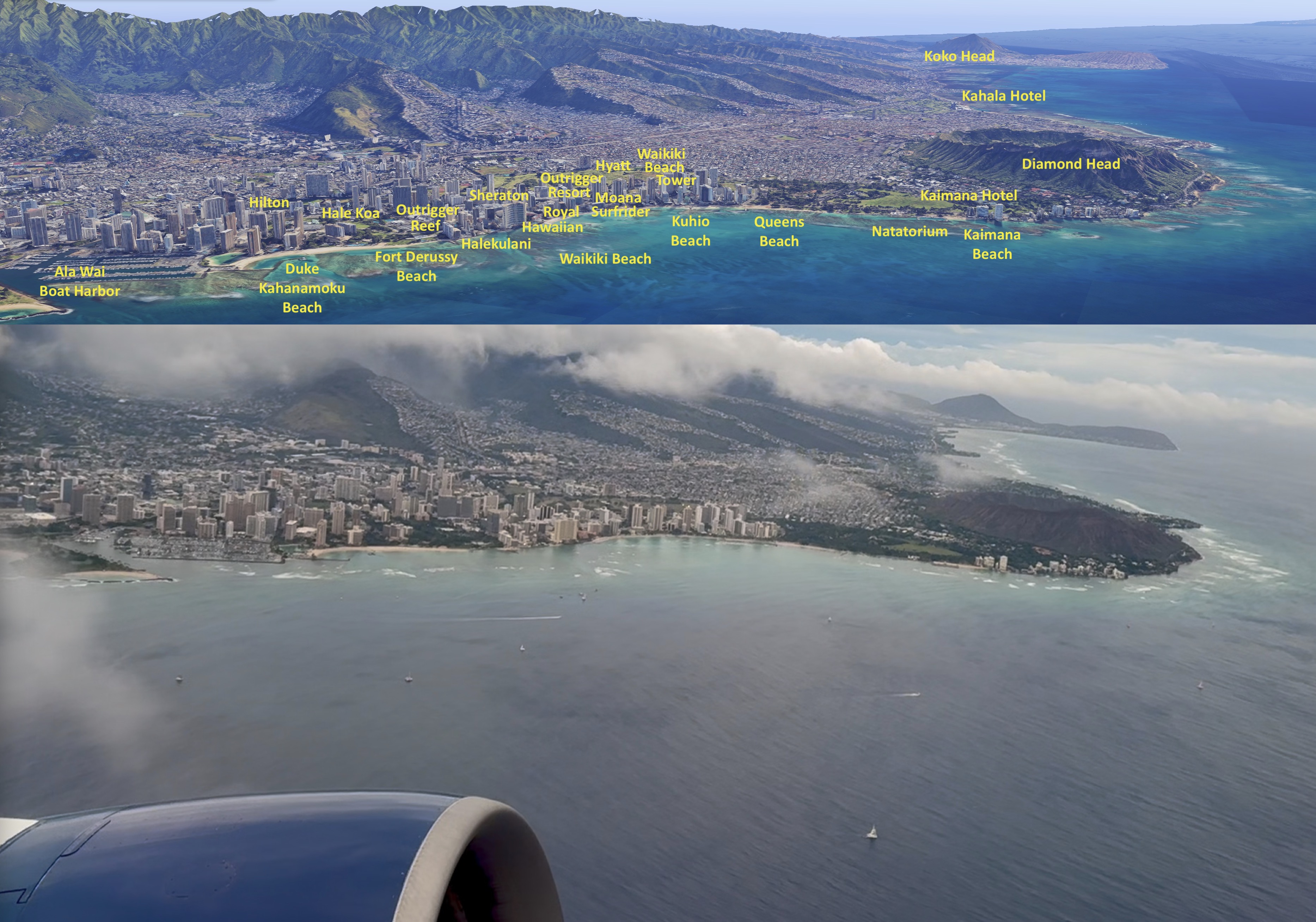
The pilot immediately banked right to fly away from shore, as the plane gained altitude. As the plane flew past Sand Island, the pilot returned to level flight and flew southeast, tracing the contour of the renowned Waikiki shoreline, including Ala Moana and Waikiki.

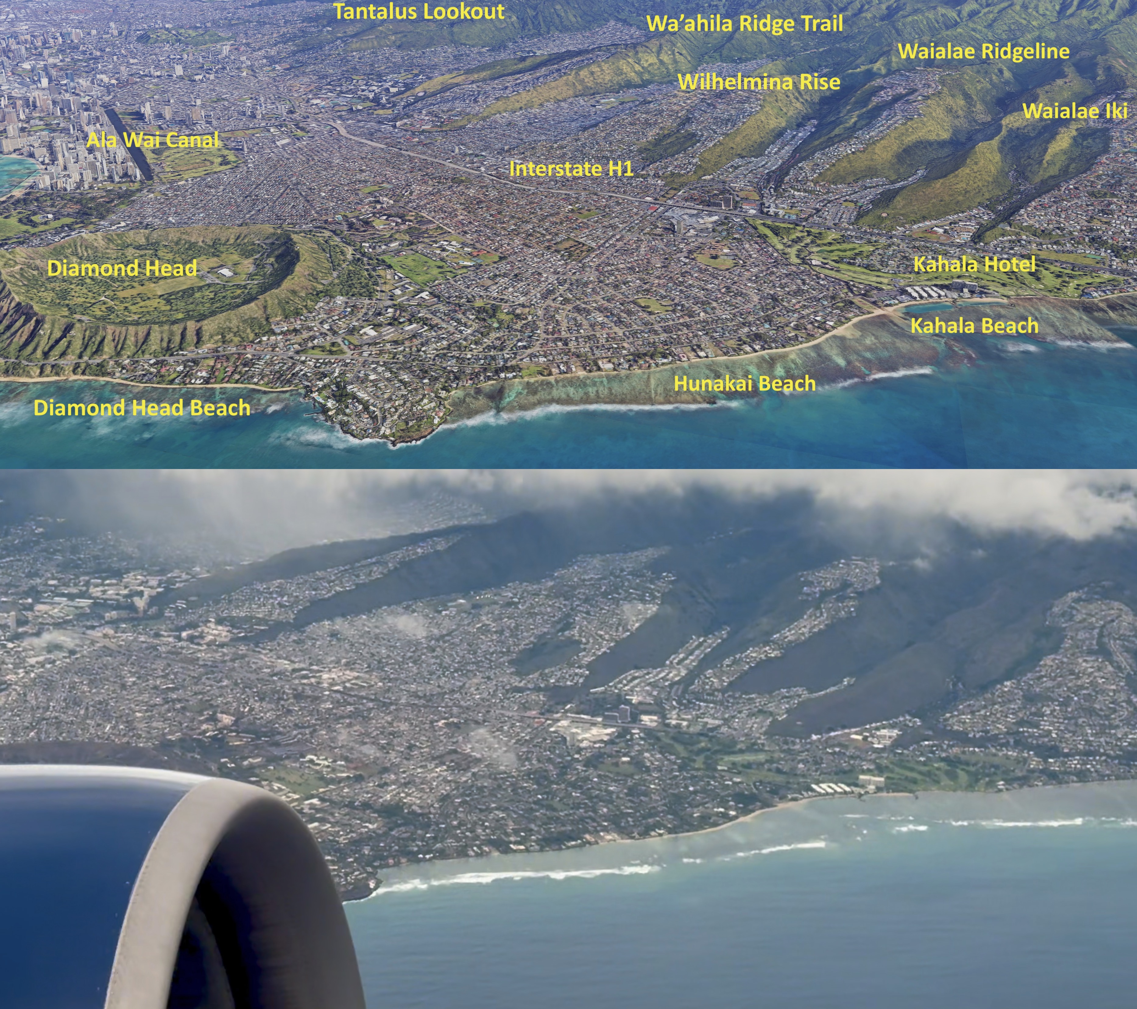
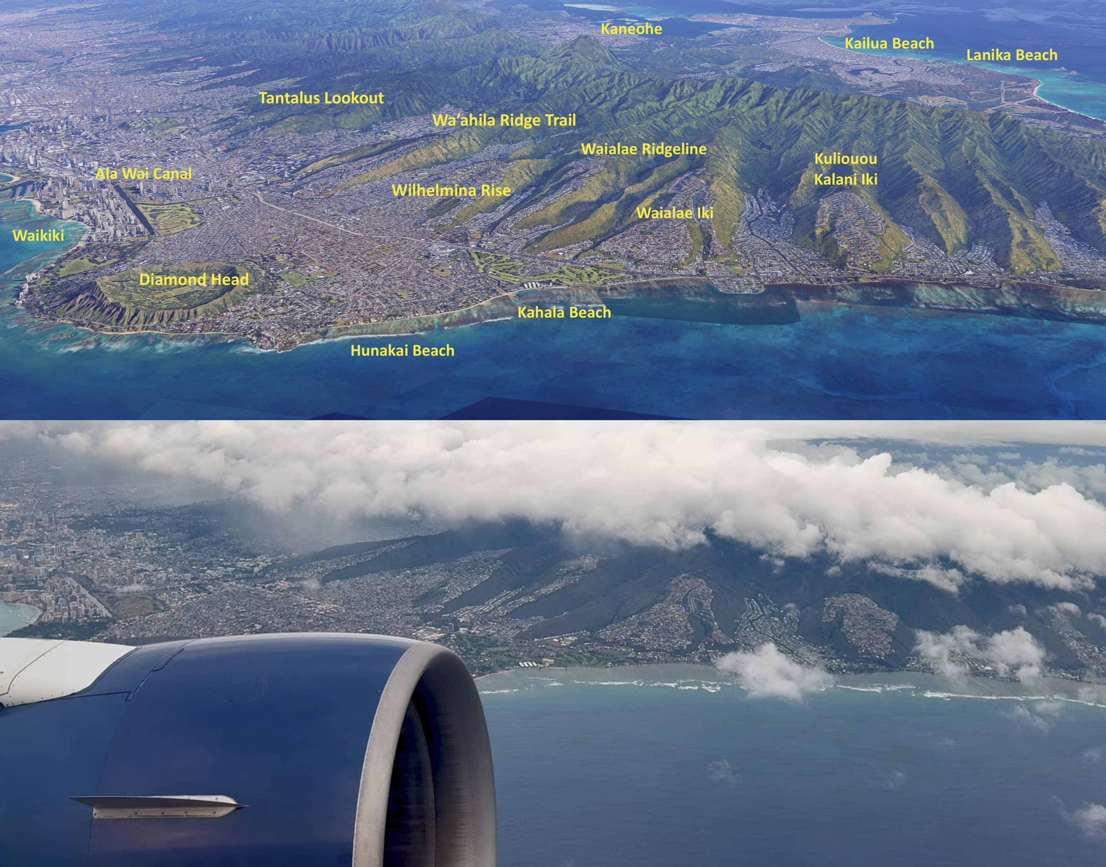
As the plane reached Diamond Head, the pilot banked left to keep following the shore at the same distance. The turn started roughly at Kaimana Beach and ended before reaching Kahala Beach.

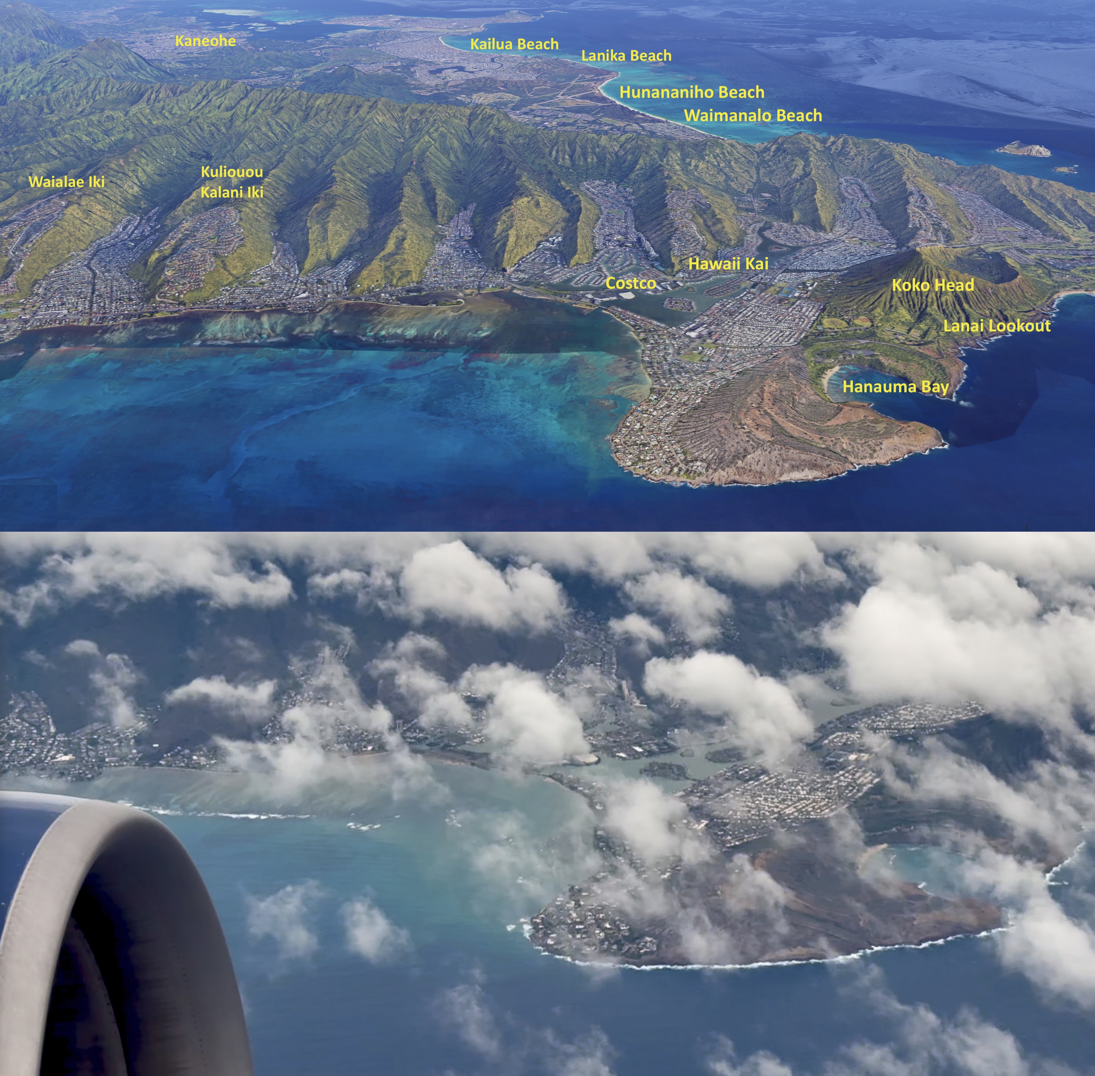
The pilot flew a straight line from Diamond Head to Hanauma Bay, then banked again to follow the shoreline around Koko Head. Once past Koko Head, the video ended. But the plane turned eastward to fly towards the mainland.

What follow are ten 3D maps showing the terrain as seen from the window seat. I fired up Google Maps with Globe View, and rotate the map for each capture, to match the window view as seen at each location. Key landmarks are labeled.


That’s it. Till next time.

